MyTopo
Calfpen Bay South Carolina US Topo Map
Couldn't load pickup availability
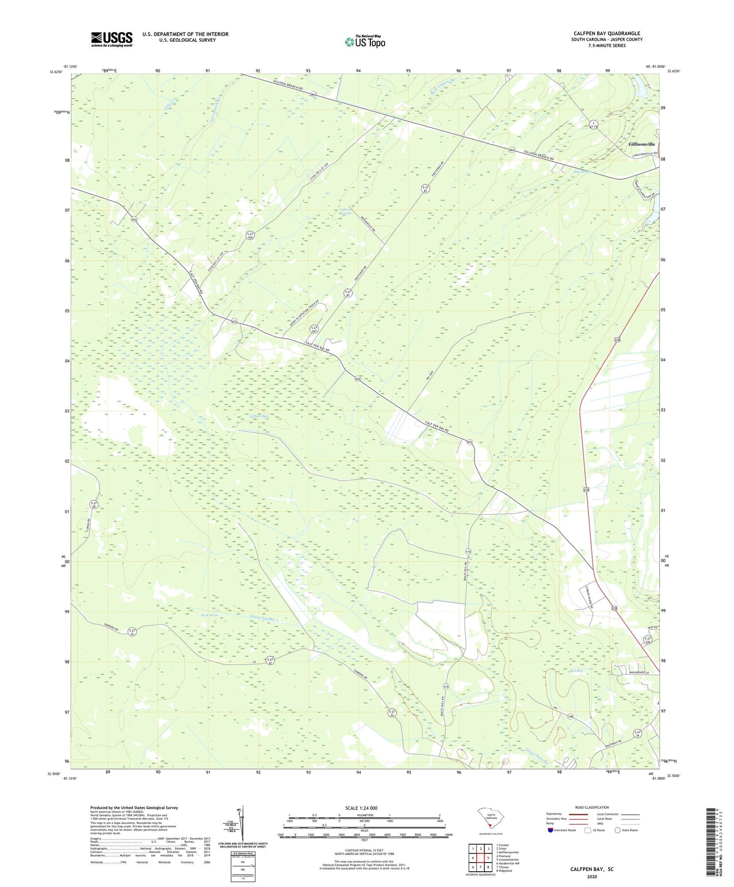
2024 topographic map quadrangle Calfpen Bay in the state of South Carolina. Scale: 1:24000. Based on the newly updated USGS 7.5' US Topo map series, this map is in the following counties: Jasper. The map contains contour data, water features, and other items you are used to seeing on USGS maps, but also has updated roads and other features. This is the next generation of topographic maps. Printed on high-quality waterproof paper with UV fade-resistant inks.
Quads adjacent to this one:
West: Pineland
Northwest: Furman
North: Grays
Northeast: McPhersonville
East: Coosawhatchie
Southeast: Ridgeland
South: Tillman
Southwest: Hardeeville NW
This map covers the same area as the classic USGS quad with code o32081e1.
Contains the following named places: Bay Swamp, Beaverdam Branch, Buck Drive, Calfpen Bay, Cypress Ridge Business Park, Cypress Woods Plantation Dam D-2582, Gillison Branch, Gillison Branch Baptist Church, Gillisonville, Gillisonville Census Designated Place, Grays-Tillman Division, Little Rock Church, Liveoak School, Nazarene Church, Nazarene School, Pilot Hunting Club, Pine Savannah Branch, Poli Bay, Savannah Branch, South Carolina Noname 27002 D-2585 Dam, South Carolina Noname 27003 D-2584 Dam, South Carolina Noname 27004 D-2583 Dam, Thompsons Pond Dam D-2586, ZIP Code: 29934