MyTopo
Wadmalaw Island South Carolina US Topo Map
Couldn't load pickup availability
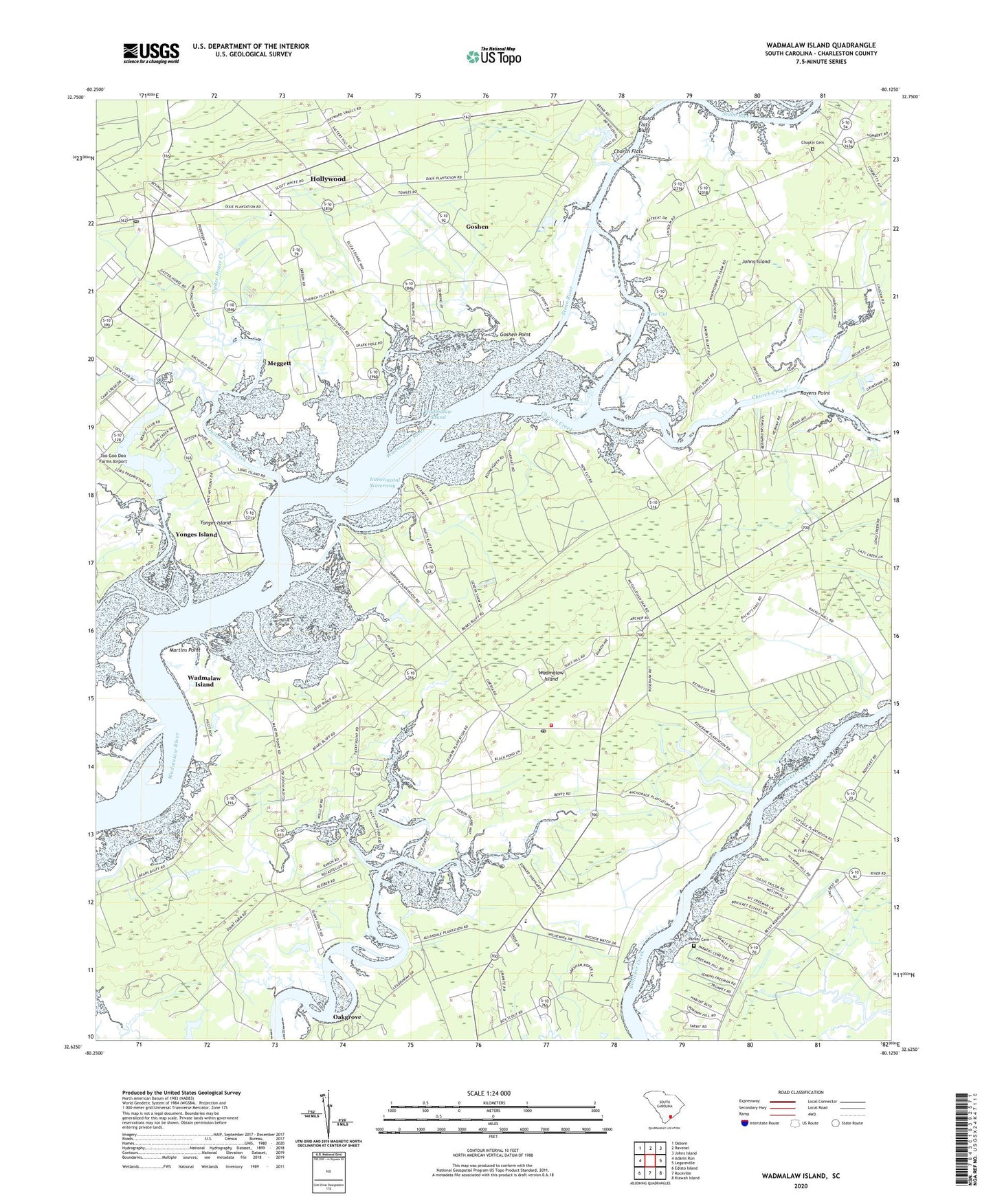
2020 topographic map quadrangle Wadmalaw Island in the state of South Carolina. Scale: 1:24000. Based on the newly updated USGS 7.5' US Topo map series, this map is in the following counties: Charleston. The map contains contour data, water features, and other items you are used to seeing on USGS maps, but also has updated roads and other features. This is the next generation of topographic maps. Printed on high-quality waterproof paper with UV fade-resistant inks.
Quads adjacent to this one:
West: Adams Run
Northwest: Osborn
North: Ravenel
Northeast: Johns Island
East: Legareville
Southeast: Kiawah Island
South: Rockville
Southwest: Edisto Island
Contains the following named places: Anchorage Plantation, Bears Bluff School, Bethlehem Church, Calvary Church, Chaplin Cemetery, Charleston County Public Library Saint Pauls Branch, Church Creek, Church Flats, Church Flats Bluff, Clementia, Cottage Plantation, Dixie Plantation, Edith L Frierson Elementary School, Goshen, Goshen Point, Hebron Church, Hollywood, Hollywood Post Office, Jerusalem Church, Martins Point, Meggett, Meggett School, New Cut, New Cut Landing, New Cut Plantation, Nine Mile Fork School, Oakgrove, Oyster House Creek, Parker Cemetery, Promised Land Church, Promised Land School, Ravens Point, Rivers, Saint James Bethel Church, Saint Johns Fire District Station 3, Saint Marys Church, Salem Church, Sellkirk Plantation, Town of Wadmalaw, Wadmalaw Island, Wadmalaw Island Division, Wadmalaw Island Post Office, Wadmalaw School, Wadmalaw Sound, Webster Church, Yonges Island, Yonges Island Airport, Yonges Island Post Office, ZIP Code: 29487