MyTopo
White Hall South Carolina US Topo Map
Couldn't load pickup availability
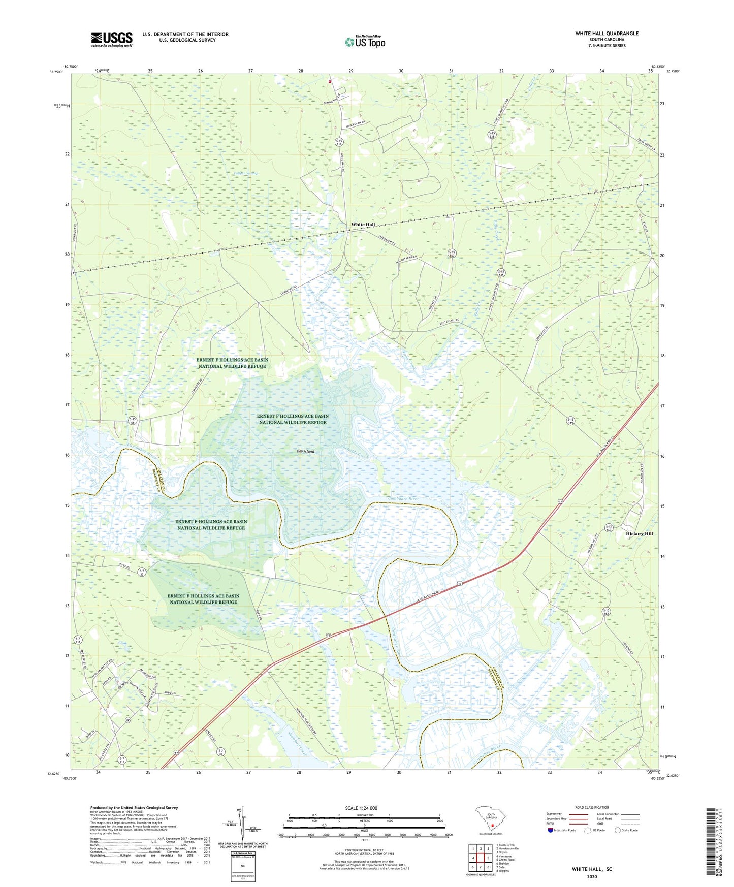
2020 topographic map quadrangle White Hall in the state of South Carolina. Scale: 1:24000. Based on the newly updated USGS 7.5' US Topo map series, this map is in the following counties: Colleton, Beaufort. The map contains contour data, water features, and other items you are used to seeing on USGS maps, but also has updated roads and other features. This is the next generation of topographic maps. Printed on high-quality waterproof paper with UV fade-resistant inks.
Quads adjacent to this one:
West: Yemassee
Northwest: Black Creek
North: Hendersonville
Northeast: Neyles
East: Green Pond
Southeast: Wiggins
South: Dale
Southwest: Sheldon
Contains the following named places: Bay Island, Bethel Church, Big State School, Blue House School, Bonny Hall Plantation, Bonny Hall School, Bosom Bottom Church, Calfpen Swamp, Cannan Church, Colleton Fire Department Station 25, Combahee Church, Combahee Ferry, Combahee Plantation, Cuckolds Creek, First African Church, Folly Creek, Heyward School, Hickory Hill, Hickory Hill Lake, Hickory Hill School, Hobnoy Plantation, Joshua Church, Laurel Springs Plantation, Longbrow Plantation, Mount Sinai Church, Myrtle Grove Plantation, New Port Plantation, Old Fort, Radnor, Rose Hill Plantation, Saint Marys Church, Snipe Bog Pond Dam D-2935, Trinity Church, White Hall, White Hall Church, White Hall Plantation, White Hall School, WJWJ-FM (Beaufort), WJWJ-TV (Beaufort)