MyTopo
Blythewood South Carolina US Topo Map
Couldn't load pickup availability
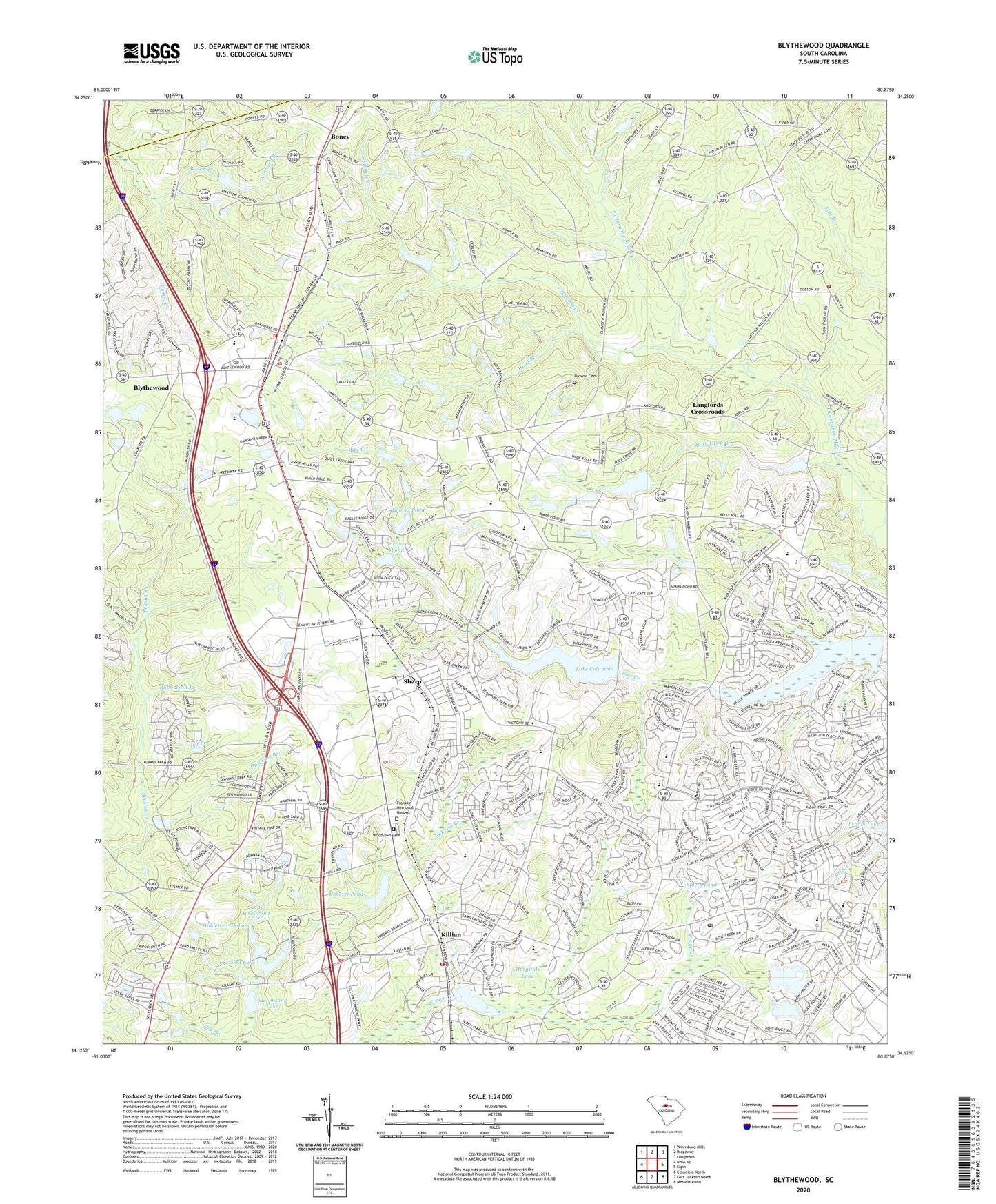
2024 topographic map quadrangle Blythewood in the state of South Carolina. Scale: 1:24000. Based on the newly updated USGS 7.5' US Topo map series, this map is in the following counties: Richland, Fairfield. The map contains contour data, water features, and other items you are used to seeing on USGS maps, but also has updated roads and other features. This is the next generation of topographic maps. Printed on high-quality waterproof paper with UV fade-resistant inks.
Quads adjacent to this one:
West: Irmo NE
Northwest: Winnsboro Mills
North: Ridgeway
Northeast: Longtown
East: Elgin
Southeast: Messers Pond
South: Fort Jackson North
Southwest: Columbia North
This map covers the same area as the classic USGS quad with code o34080b8.
Contains the following named places: Ashbury Branch, Barnnets Pond, Barnnets Pond D-0392 Dam, Bethel Church, Blythewood, Blythewood Division, Blythewood Elementary School, Blythewood Lookout Tower, Boney, Boney Creek, Browns Cemetery, Clarks Pond D-0411 Dam, Columbia - Richland Fire Station Bear Creek, Columbia Country Club, Columbia Richland Fire Department Killian, Columbia Richland Fire Station Blythewood, Covingtons Lake D-0545 Dam, Crane Creek Church, Crescent Lake, Duke School, Elders Pond, Epworth Pines D-0362 Dam, Flat Branch School, Franklin Memorial Garden, Free Hope Church, Free Hope School, Friendship Church, Fuller Pond Dam D-1592, Green Springs, Hanbury Junior High School, Hawkins Branch, Hidden Acres Pond, Holiness Church, Hood Branch, Hospitals Lake, Hospitals Lake D-0413 Dam, Killian, Killian School, Lake Ashley D-1590 Dam, Lake Columbia, Lake Columbia D-0549 Dam, Langfords Crossroads, Lot Branch, Mount Zion Church, North Crossing, North Pines, North Spring Lake, North Spring Lake D-0550 Dam, North Springs, North Springs Elementary School, Pine View Church, Progressive Church, Roberts Branch, Roberts Pond, Robertson Branch, Rose Creek, Round Top Branch, Round Top Church, Round Top School, Rymers Pond, Saint Marks Church, Saint Mary Church, Sand Level Church, Sand Level School, Sandfield Church, Sandhills Post Office, Shady Grove School, Sharp, Simmons Creek, Sorghum Branch, Stevensons Lake, Stevensons Lake D-0546 Dam, Sunny Acres Pond, Town of Blythewood, WNOK-FM (Columbia), Woodlawn Cemetery, ZIP Codes: 29016, 29229