MyTopo
Witherspoon Island South Carolina US Topo Map
Couldn't load pickup availability
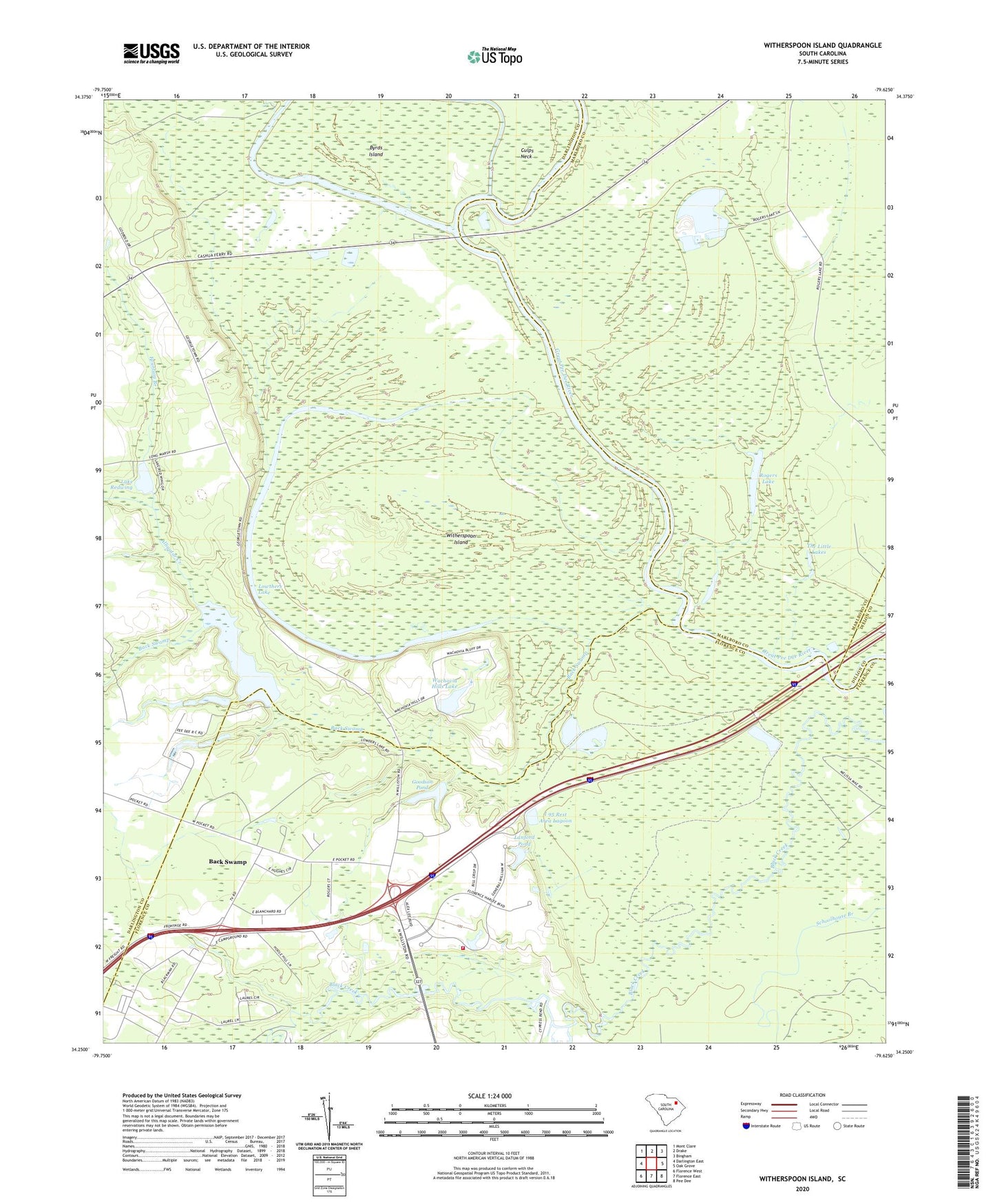
2024 topographic map quadrangle Witherspoon Island in the state of South Carolina. Scale: 1:24000. Based on the newly updated USGS 7.5' US Topo map series, this map is in the following counties: Darlington, Florence, Marlboro, Dillon. The map contains contour data, water features, and other items you are used to seeing on USGS maps, but also has updated roads and other features. This is the next generation of topographic maps. Printed on high-quality waterproof paper with UV fade-resistant inks.
Quads adjacent to this one:
West: Darlington East
Northwest: Mont Clare
North: Drake
Northeast: Bingham
East: Oak Grove
Southeast: Pee Dee
South: Florence East
Southwest: Florence West
This map covers the same area as the classic USGS quad with code o34079c6.
Contains the following named places: Alligator Creek, Annarate Church, Back Swamp, Black Swamp School, Byrds Island, Cashua Ferry, Cashua Neck, Central Baptist Church, Church of Jesus Christ, Community Freewill Baptist Church, Experiment Station Pond Dam D-3554, Fountain Branch, Goodson Pond, Goodson Pond Dam D-3558, Hurricane Branch, I 95 Rest Area Lagoon, I 95 Rest Area Lagoon Dam D-3560, Lake Redwing, Lanford Pond, Lanford Pond Dam D-3559, Lowthers Lake, McCalls Crossroads, Pee Dee Touchstone Energy Center, Polk Swamp Creek, Rogers Lake, Saint Paul Church, Saint Paul School, South Carolina Noname 16001 D-3553 Dam, South Carolina Noname 16034 D-3552 Dam, South Carolina Noname 160626 D-3551 Dam, The Little Lakes, Wachovia Hills, Wachovia Hills Lake, Windy Hill Fire Department Station 3, Witherspoon Island, WJPM-TV (Florence)