MyTopo
Alcester South Dakota US Topo Map
Couldn't load pickup availability
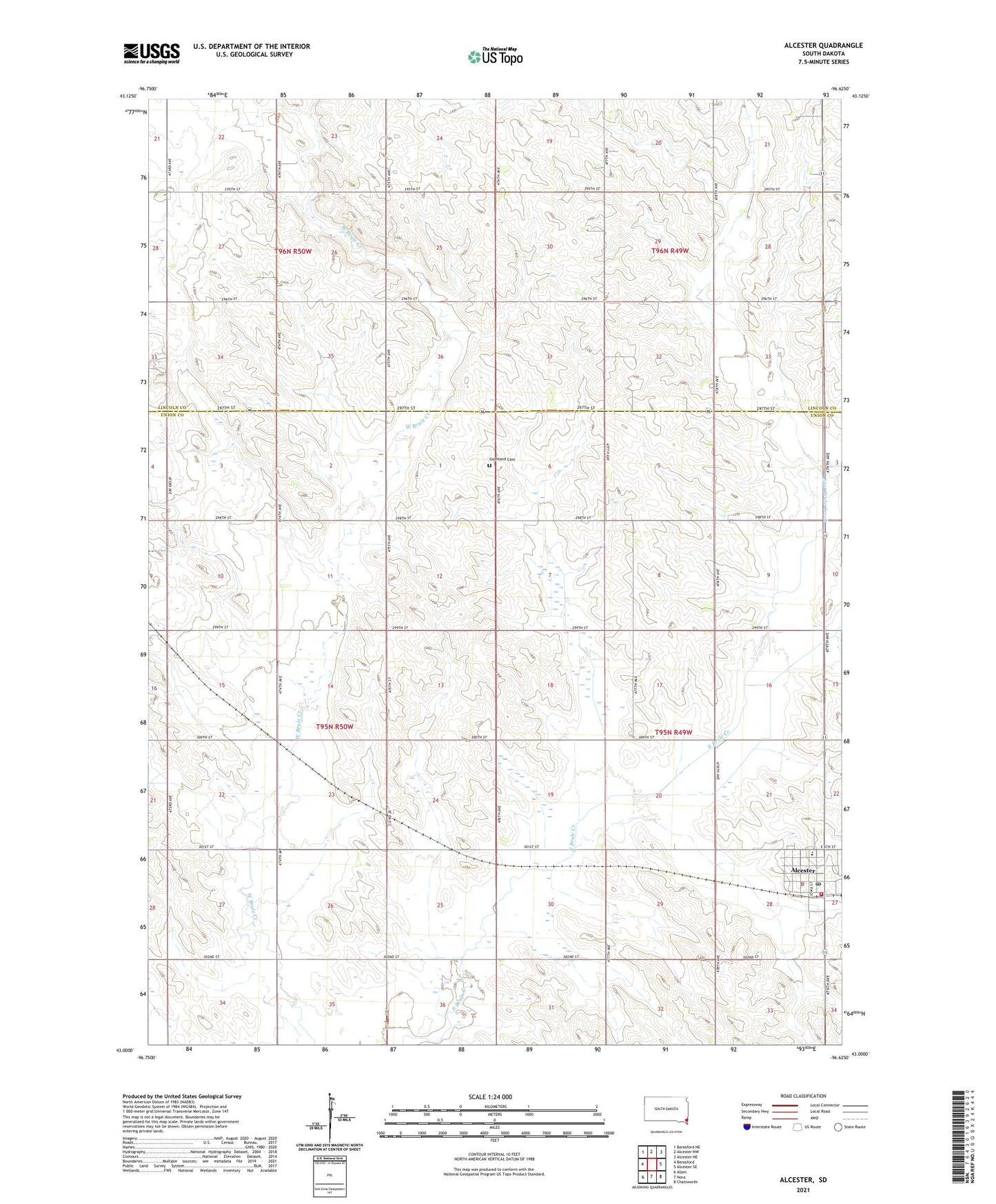
2021 topographic map quadrangle Alcester in the state of South Dakota. Scale: 1:24000. Based on the newly updated USGS 7.5' US Topo map series, this map is in the following counties: Union, Lincoln. The map contains contour data, water features, and other items you are used to seeing on USGS maps, but also has updated roads and other features. This is the next generation of topographic maps. Printed on high-quality waterproof paper with UV fade-resistant inks.
Quads adjacent to this one:
West: Beresford
Northwest: Beresford NE
North: Alcester NW
Northeast: Alcester NE
East: Alcester SE
South: Nora
Southwest: Alsen
Contains the following named places: Alcester, Alcester City Hall, Alcester Emergency Medical Service, Alcester Police Department, Alcester Post Office, Alcester Public Library, Alcester Volunteer Fire Department, Alcester-Hudson High School, Alcester-Hudson Junior High School, City of Alcester, Elmwood School, Gothland Cemetery, Gothland School, Pleasant Hill School, School Number 10, School Number 51, School Number 52, School Number 57, Silver Lake School, Sunnyside, Township of Alcester, Township of Prairie