MyTopo
Alcester SE South Dakota US Topo Map
Couldn't load pickup availability
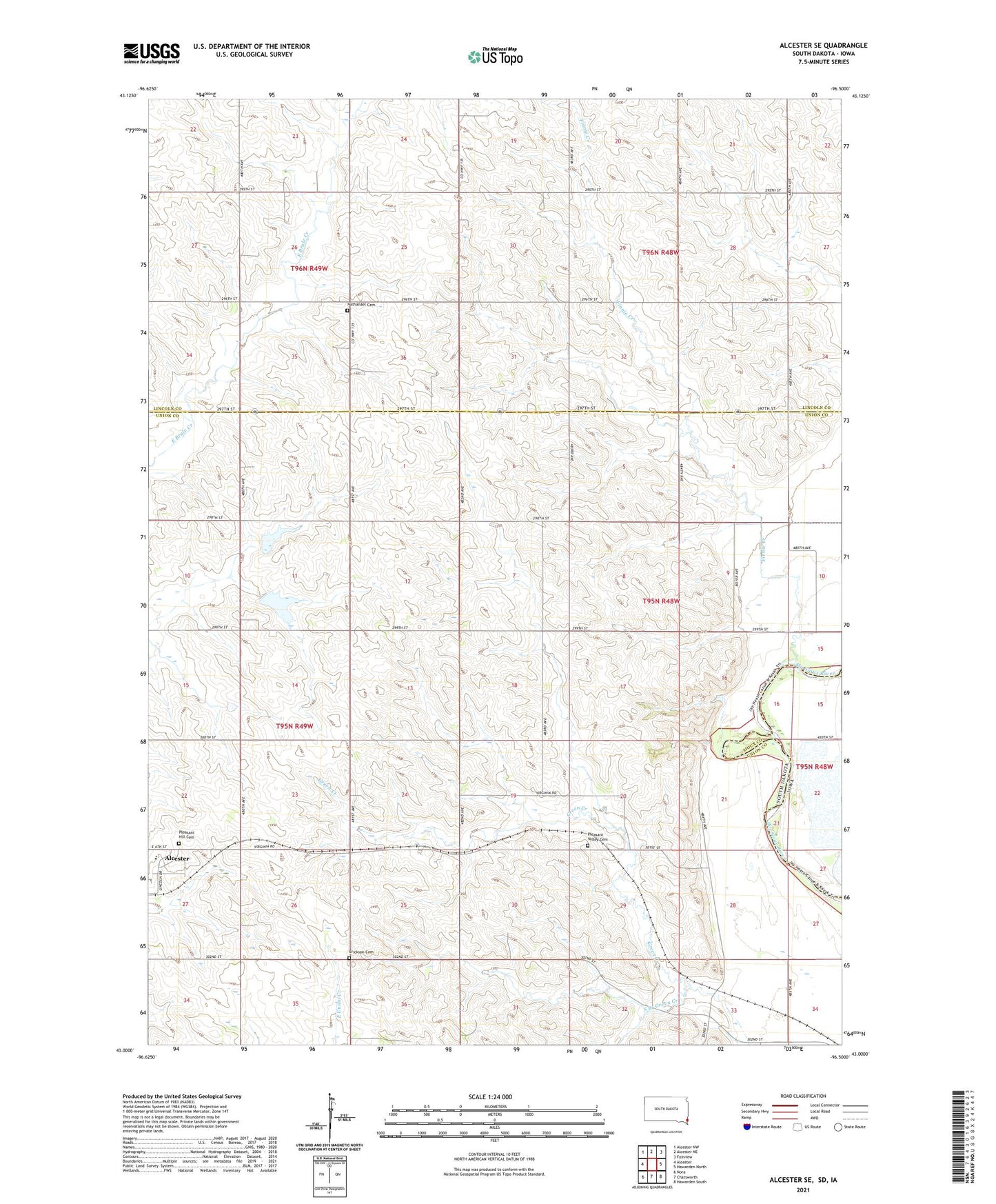
2021 topographic map quadrangle Alcester SE in the state of South Dakota. Scale: 1:24000. Based on the newly updated USGS 7.5' US Topo map series, this map is in the following counties: Union, Lincoln, Sioux. The map contains contour data, water features, and other items you are used to seeing on USGS maps, but also has updated roads and other features. This is the next generation of topographic maps. Printed on high-quality waterproof paper with UV fade-resistant inks.
Quads adjacent to this one:
West: Alcester
Northwest: Alcester NW
North: Alcester NE
Northeast: Fairview
East: Hawarden North
Southeast: Hawarden South
Southwest: Nora
This map covers the same area as the classic USGS quad with code o43096a5.
Contains the following named places: Alcester-Hudson Elementary School, East View School, Edwards School, Erickson Cemetery, Finnie Creek, Linden, McVay School, Nathanael Cemetery, Pleasant Hill Cemetery, Pleasant Valley Cemetery, School Number 54, School Number 60, South Branch Green Creek, Spring Creek Farms, Township of Virginia, ZIP Code: 57034