MyTopo
Allen South Dakota US Topo Map
Couldn't load pickup availability
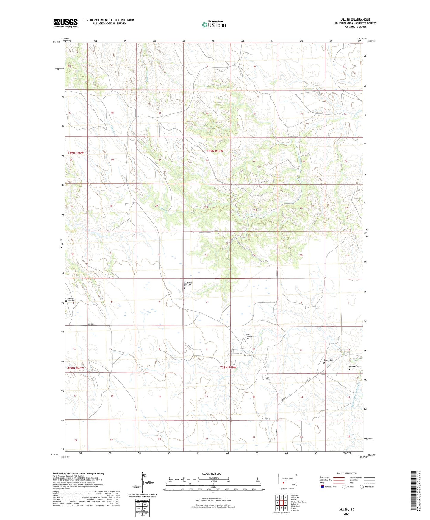
2021 topographic map quadrangle Allen in the state of South Dakota. Scale: 1:24000. Based on the newly updated USGS 7.5' US Topo map series, this map is in the following counties: Bennett. The map contains contour data, water features, and other items you are used to seeing on USGS maps, but also has updated roads and other features. This is the next generation of topographic maps. Printed on high-quality waterproof paper with UV fade-resistant inks.
Quads adjacent to this one:
West: Yellow Bear Camp
Northwest: Kyle NE
North: Hisle NW
Northeast: Hisle
East: Allen SE
Southeast: Swett NE
South: Swett
Southwest: Batesland
This map covers the same area as the classic USGS quad with code k43101c7.
Contains the following named places: Allen, Allen Census Designated Place, Allen Community Cemetery, Allen Post Office, America Horse School, American Horse Middle School, Inestimable Gift Cemetery, Peyote Cemetery, Pleasant Hill Cemetery, Red Bear Cemetery, ZIP Code: 57714