MyTopo
Antelope Butte South Dakota US Topo Map
Couldn't load pickup availability
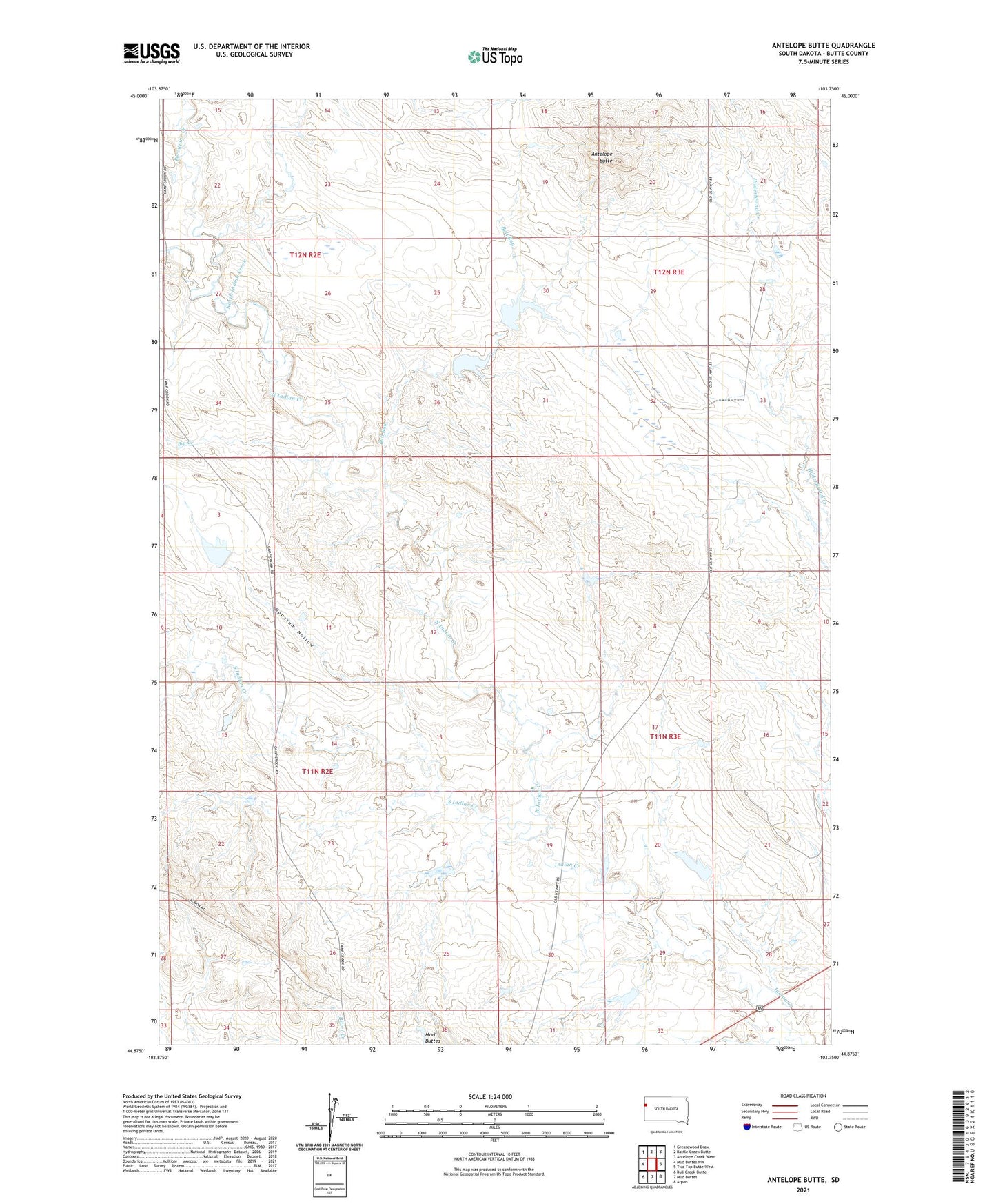
2021 topographic map quadrangle Antelope Butte in the state of South Dakota. Scale: 1:24000. Based on the newly updated USGS 7.5' US Topo map series, this map is in the following counties: Butte. The map contains contour data, water features, and other items you are used to seeing on USGS maps, but also has updated roads and other features. This is the next generation of topographic maps. Printed on high-quality waterproof paper with UV fade-resistant inks.
Quads adjacent to this one:
West: Mud Buttes NW
Northwest: Greasewood Draw
North: Battle Creek Butte
Northeast: Antelope Creek West
East: Two Top Butte West
Southeast: Arpan
South: Mud Buttes
Southwest: Bull Creek Butte
This map covers the same area as the classic USGS quad with code o44103h7.
Contains the following named places: Antelope Butte, Big Creek, Bull Run, Center of Nation Roadside Park, Davis Ranch, Davis Ranch Number 1 Dam, Delzer Number 1 Dam, Delzer Number 2 Dam, Delzer Number 3 Dam, H G Horman Dam Number 1, Hoeye Ranch, Horman Ranch, North Indian Creek, Opossum Hollow, Porcupine Creek, School Land Dam, South Indian Creek, Township of Eflle Fourche