MyTopo
Arpan South Dakota US Topo Map
Couldn't load pickup availability
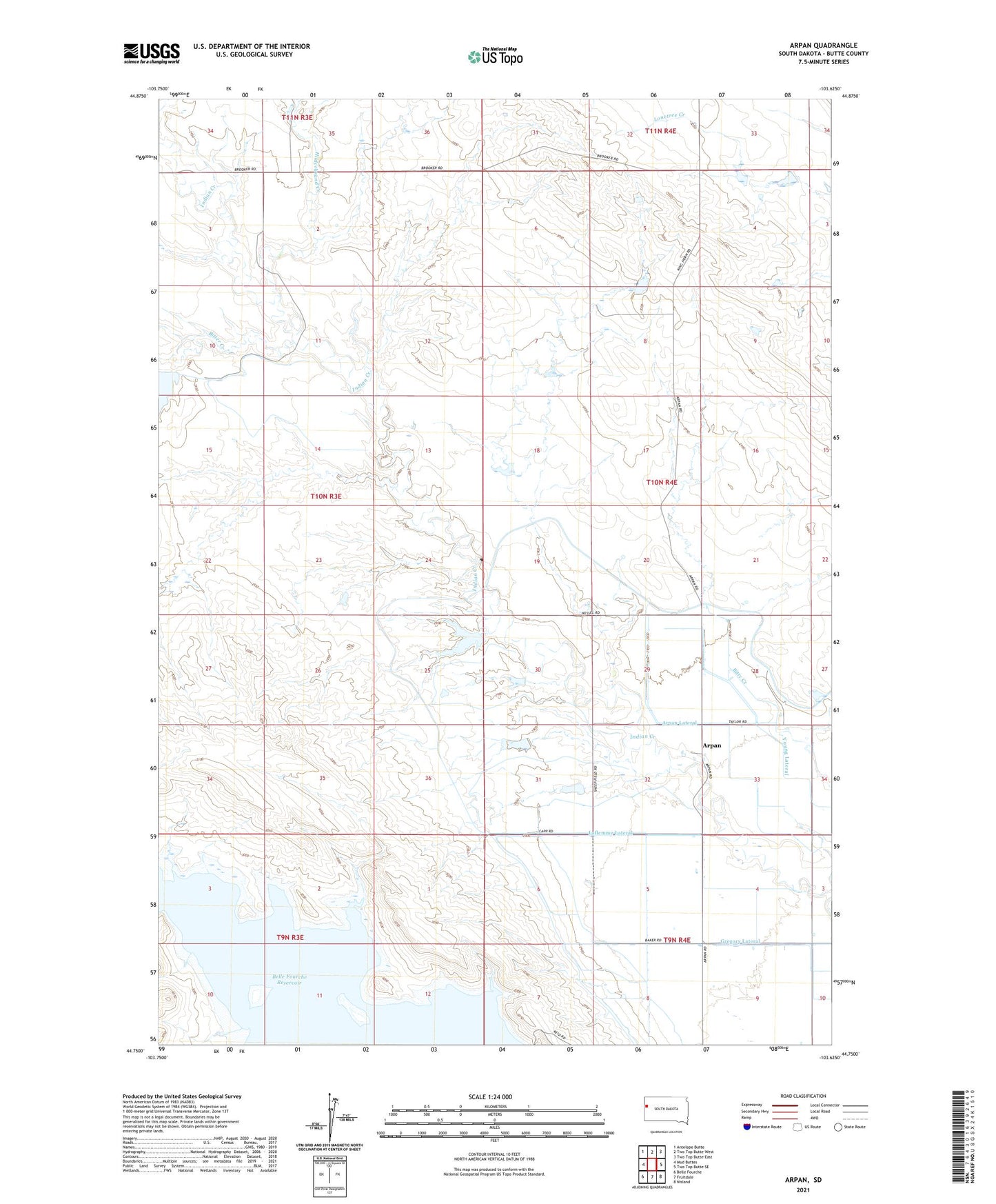
2021 topographic map quadrangle Arpan in the state of South Dakota. Scale: 1:24000. Based on the newly updated USGS 7.5' US Topo map series, this map is in the following counties: Butte. The map contains contour data, water features, and other items you are used to seeing on USGS maps, but also has updated roads and other features. This is the next generation of topographic maps. Printed on high-quality waterproof paper with UV fade-resistant inks.
Quads adjacent to this one:
West: Mud Buttes
Northwest: Antelope Butte
North: Two Top Butte West
Northeast: Two Top Butte East
East: Two Top Butte SE
Southeast: Nisland
South: Fruitdale
Southwest: Belle Fourche
This map covers the same area as the classic USGS quad with code o44103g6.
Contains the following named places: Arpan, Arpan Lateral, Barker School, Bitter Creek, Gregory Lateral, Guidinger Dam, Hilderbrand Creek, Laflemme Lateral, R L Cundy Dam Number 1, Royal McKnight Dam Number 1, Royal McKnight Dam Number 2, Woodworth Ranch, Young Lateral