MyTopo
Beresford NE South Dakota US Topo Map
Couldn't load pickup availability
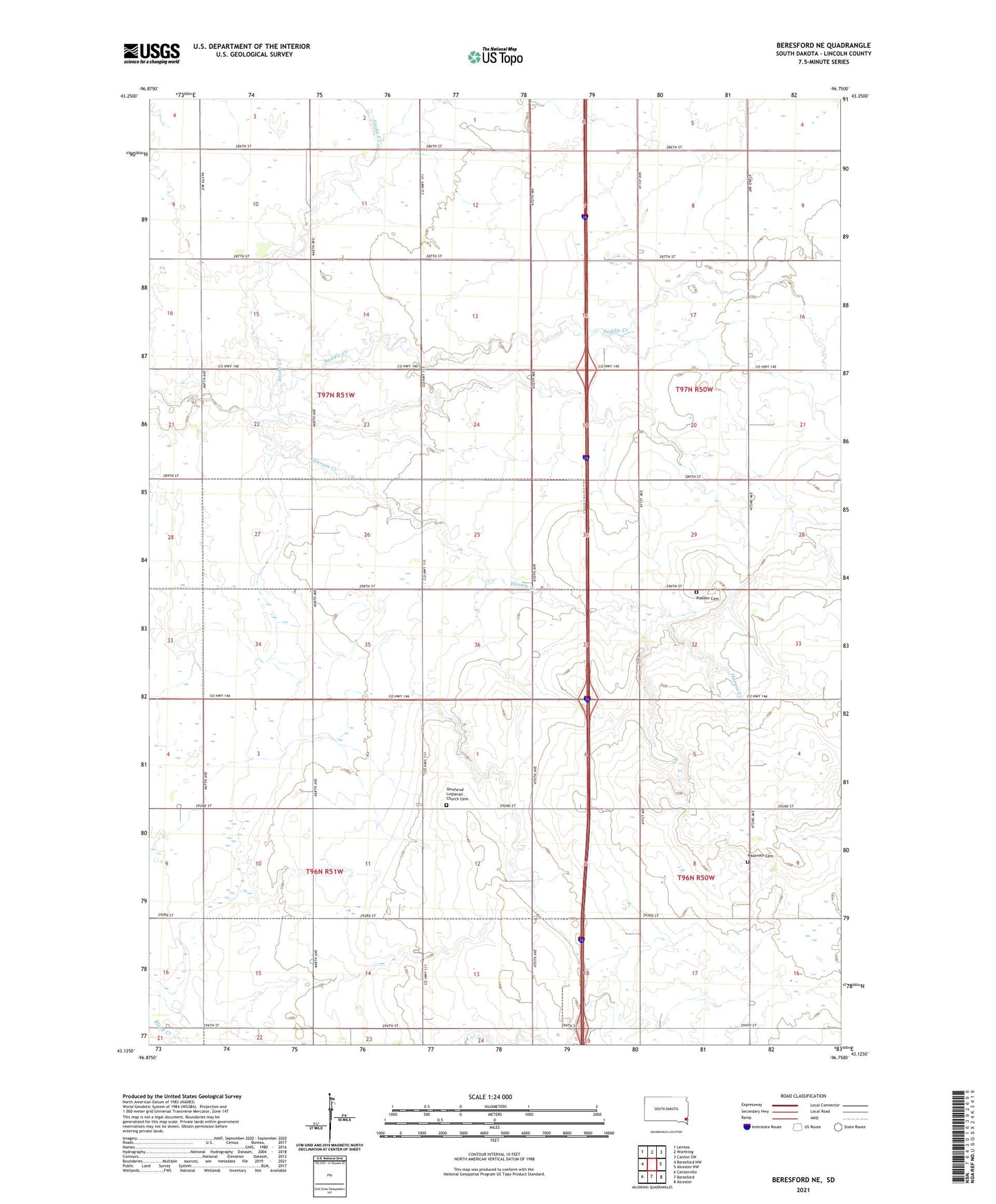
2021 topographic map quadrangle Beresford NE in the state of South Dakota. Scale: 1:24000. Based on the newly updated USGS 7.5' US Topo map series, this map is in the following counties: Lincoln. The map contains contour data, water features, and other items you are used to seeing on USGS maps, but also has updated roads and other features. This is the next generation of topographic maps. Printed on high-quality waterproof paper with UV fade-resistant inks.
Quads adjacent to this one:
West: Beresford NW
Northwest: Lennox
North: Worthing
Northeast: Canton SW
East: Alcester NW
Southeast: Alcester
South: Beresford
Southwest: Centerville
Contains the following named places: Burney School, Haram, Haram Creek, Leeville, Lincoln Center School, Lincoln Centre, Mount Hope School, Nazareth Cemetery, North Star School, Pioneer Cemetery, Pioneer School, Pleasant View School, Skrefsrud Lutheran Church Cemetery, Skresfrud Church, Snake Creek, Township of Brooklyn, Township of Delaware