MyTopo
Lennox South Dakota US Topo Map
Couldn't load pickup availability
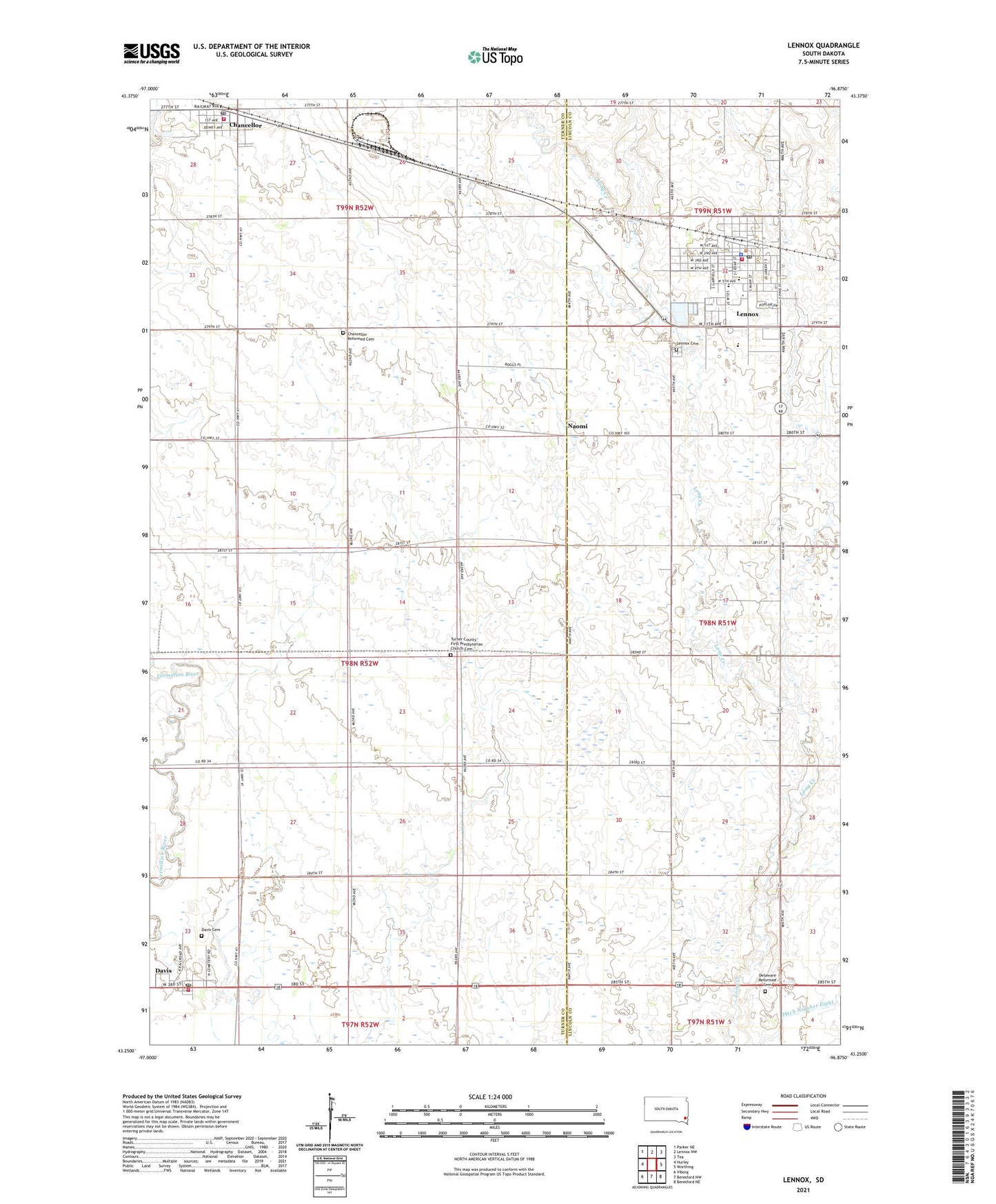
2021 topographic map quadrangle Lennox in the state of South Dakota. Scale: 1:24000. Based on the newly updated USGS 7.5' US Topo map series, this map is in the following counties: Turner, Lincoln. The map contains contour data, water features, and other items you are used to seeing on USGS maps, but also has updated roads and other features. This is the next generation of topographic maps. Printed on high-quality waterproof paper with UV fade-resistant inks.
Quads adjacent to this one:
West: Hurley
Northwest: Parker NE
North: Lennox NW
Northeast: Tea
East: Worthing
Southeast: Beresford NE
South: Beresford NW
Southwest: Viborg
This map covers the same area as the classic USGS quad with code o43096c8.
Contains the following named places: Burma School, Chancellor, Chancellor Reformed Cemetery, Chancellor Volunteer Fire Department, City of Lennox, Davis, Davis Cemetery, Davis Fire Department, Davis Post Office, Delaware Church, Delaware Reformed Cemetery, Lennox, Lennox Area Ambulance, Lennox Area Historical Society Museum, Lennox Cemetery, Lennox City Hall, Lennox Community Library, Lennox Elementary School, Lennox Fire Department, Lennox High School, Lennox Middle School, Lennox Police Department, Lennox Post Office, Naomi, School Number 19, School Number 23, School Number 24, School Number 89, Sunny Side School, Town of Chancellor, Town of Davis, Township of Middleton, Turner County First Presbyterian Church Cemetery, Vietor School, ZIP Code: 57021