MyTopo
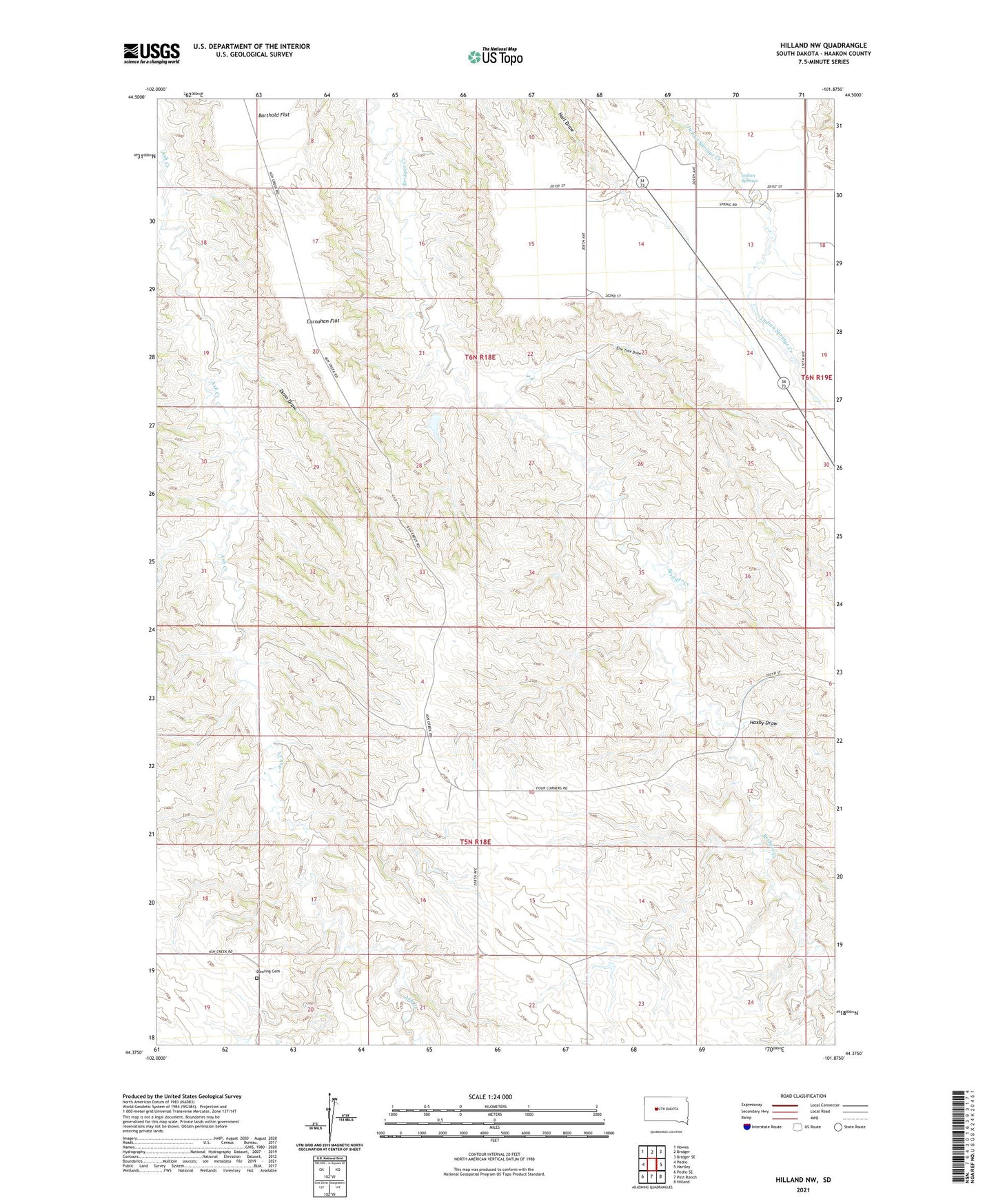
Hilland NW South Dakota US Topo Map
Couldn't load pickup availability
2021 topographic map quadrangle Hilland NW in the state of South Dakota. Scale: 1:24000. Based on the newly updated USGS 7.5' US Topo map series, this map is in the following counties: Haakon. The map contains contour data, water features, and other items you are used to seeing on USGS maps, but also has updated roads and other features. This is the next generation of topographic maps. Printed on high-quality waterproof paper with UV fade-resistant inks.
Quads adjacent to this one:
West: Pedro
Northwest: Howes
North: Bridger
Northeast: Bridger SE
East: Hartley
Southeast: Hilland
South: Post Ranch
Southwest: Pedro SE
This map covers the same area as the classic USGS quad with code o44101d8.
Contains the following named places: Barthold Flat, Blan Ranch, Carnahan Flat, Charles Price Ranch, Dowling Cemetery, Dreis Brothers Dam, Dunn Draw, Elm Tree Draw, Hanson Ranch, Hanson School, Hartley, Haxby Draw, Indian Springs, Indian Springs School, Joe Price Ranch, Olson Ranch, Peterson Ranch, Ramey School, Townley Ranch, Township of Dowling