MyTopo
Carlock South Dakota US Topo Map
Couldn't load pickup availability
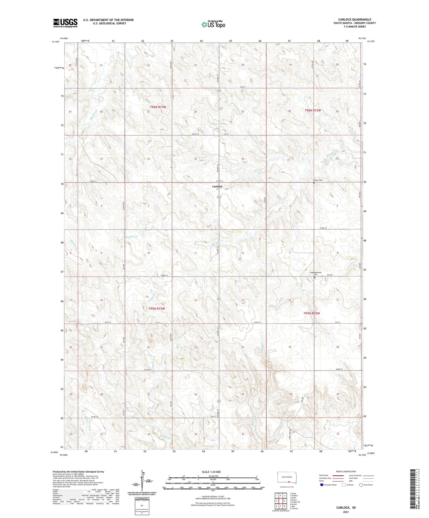
2021 topographic map quadrangle Carlock in the state of South Dakota. Scale: 1:24000. Based on the newly updated USGS 7.5' US Topo map series, this map is in the following counties: Gregory. The map contains contour data, water features, and other items you are used to seeing on USGS maps, but also has updated roads and other features. This is the next generation of topographic maps. Printed on high-quality waterproof paper with UV fade-resistant inks.
Quads adjacent to this one:
West: Paxton
Northwest: Dallas
North: Gregory
Northeast: Burke
East: Gregory SE
Southeast: Jamison
South: Mills
Southwest: Burton
Contains the following named places: Carlock, Congregational Cemetery, Fairmont Church, German Congregation Cemetery, Jeppeson School, Kaupp Hereford Ranch Number 1 Dam, Peace Cemetery, Peace Church, Pleasant Hill School, Pleasant View School, Ramis School, School Number 33, Township of Carlock, Township of Dickens