MyTopo
Burke South Dakota US Topo Map
Couldn't load pickup availability
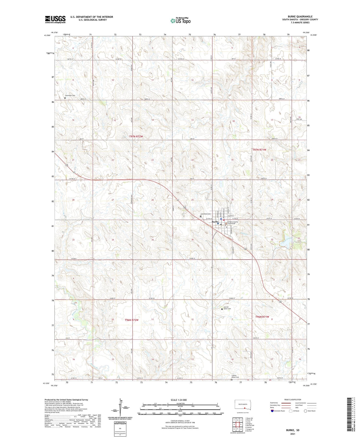
2021 topographic map quadrangle Burke in the state of South Dakota. Scale: 1:24000. Based on the newly updated USGS 7.5' US Topo map series, this map is in the following counties: Gregory. The map contains contour data, water features, and other items you are used to seeing on USGS maps, but also has updated roads and other features. This is the next generation of topographic maps. Printed on high-quality waterproof paper with UV fade-resistant inks.
Quads adjacent to this one:
West: Gregory
Northwest: Dixon SW
North: Dixon SE
Northeast: Lucas
East: Herrick NW
Southeast: Herrick
South: Gregory SE
Southwest: Carlock
This map covers the same area as the classic USGS quad with code o43099b3.
Contains the following named places: Burke, Burke Ambulance Service, Burke Dam, Burke Elementary School, Burke High School, Burke Middle School, Burke Municipal Airport, Burke Police Department, Burke Post Office, Burke Public Library, Burke Volunteer Fire Department, City of Burke, Community Memorial Hospital, County Home Cemetery, Cournoyer Cemetery, Graceland Cemetery, Gregory County Courthouse, Gregory County Sheriff's Office, Lake Burke, Rambrandt School, Sacred Heart Cemetery, School Number 1, Township of Jones, Township of Rhoades