MyTopo
Clayton South Dakota US Topo Map
Couldn't load pickup availability
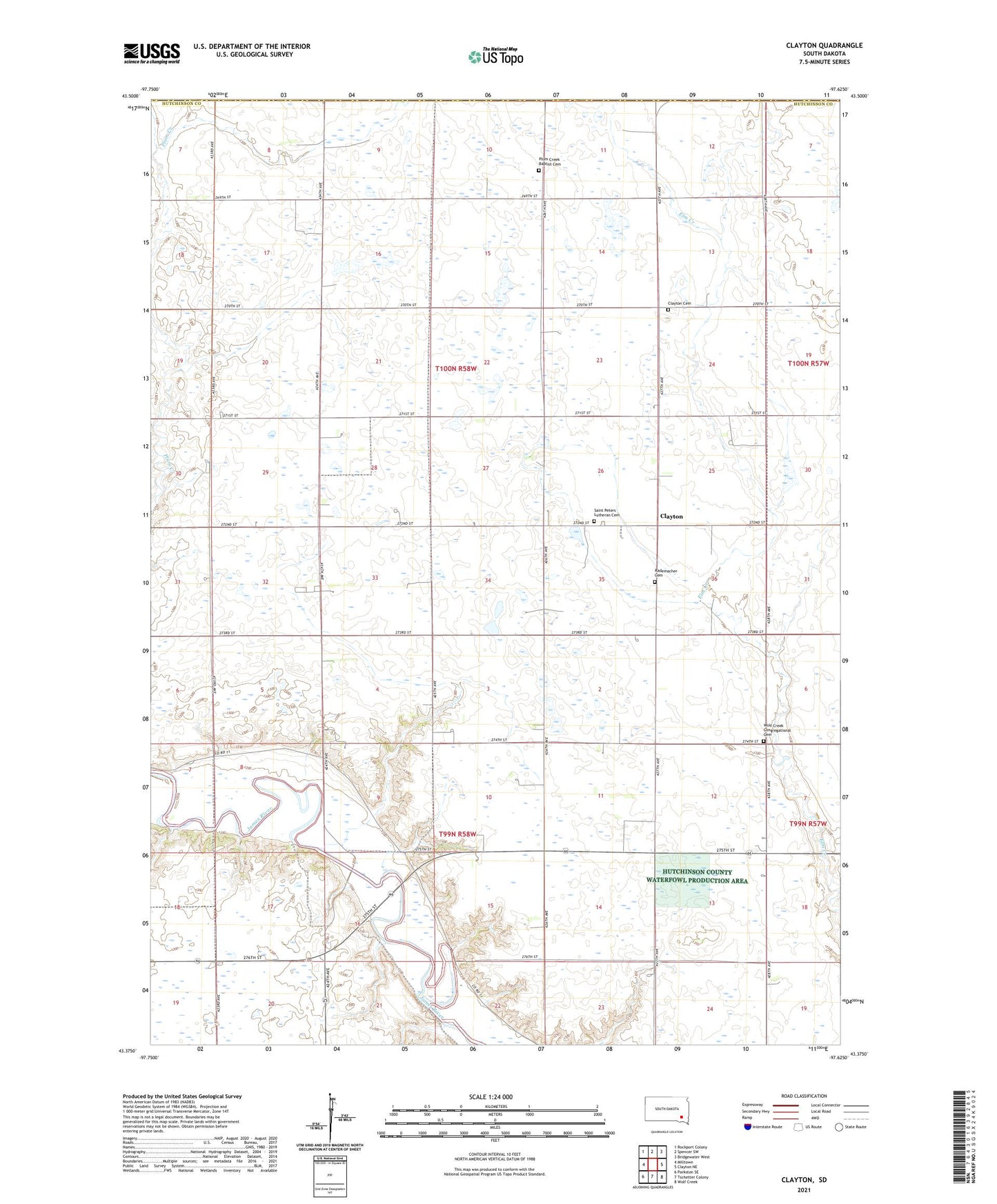
2021 topographic map quadrangle Clayton in the state of South Dakota. Scale: 1:24000. Based on the newly updated USGS 7.5' US Topo map series, this map is in the following counties: Hutchinson, Hanson. The map contains contour data, water features, and other items you are used to seeing on USGS maps, but also has updated roads and other features. This is the next generation of topographic maps. Printed on high-quality waterproof paper with UV fade-resistant inks.
Quads adjacent to this one:
West: Milltown
Northwest: Rockport Colony
North: Spencer SW
Northeast: Bridgewater West
East: Clayton NE
Southeast: Wolf Creek
South: Tschetter Colony
Southwest: Parkston SE
Contains the following named places: Clayton, Clayton Cemetery, Clayton School, Guericke Dam, Highland School, Kapsch School, Menno Colony, Mensch Dam, Plum Creek Baptist Cemetery, Plum Creek Church, Rademacher Cemetery, Reiswig School, Saint Peters Lutheran Cemetery, School Number 50, School Number 52, Township of Clayton, Werning School, Wolf Creek Congregational Cemetery