MyTopo
Parkston SE South Dakota US Topo Map
Couldn't load pickup availability
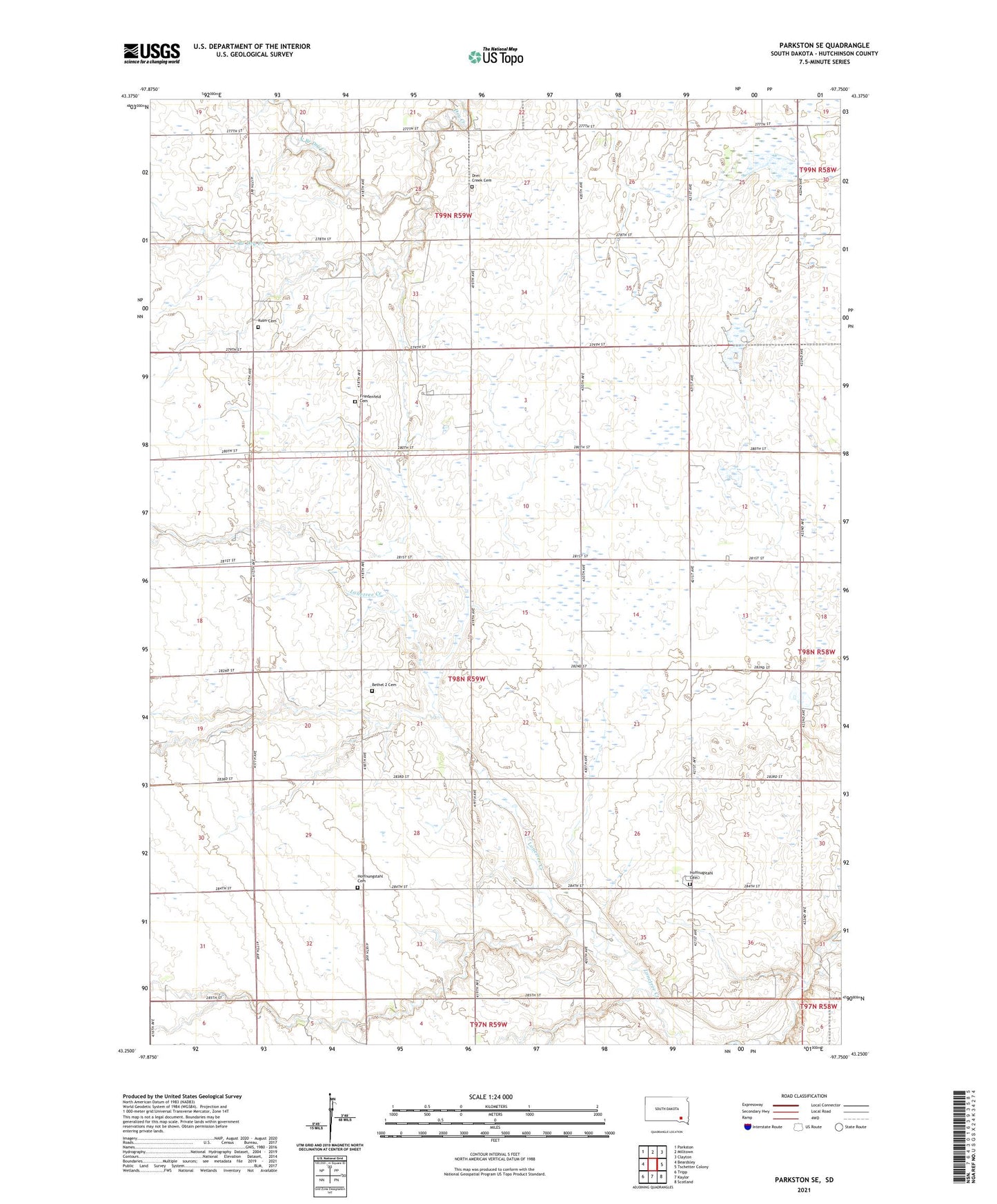
2021 topographic map quadrangle Parkston SE in the state of South Dakota. Scale: 1:24000. Based on the newly updated USGS 7.5' US Topo map series, this map is in the following counties: Hutchinson. The map contains contour data, water features, and other items you are used to seeing on USGS maps, but also has updated roads and other features. This is the next generation of topographic maps. Printed on high-quality waterproof paper with UV fade-resistant inks.
Quads adjacent to this one:
West: Beardsley
Northwest: Parkston
North: Milltown
Northeast: Clayton
East: Tschetter Colony
Southeast: Scotland
South: Kaylor
Southwest: Tripp
This map covers the same area as the classic USGS quad with code o43097c7.
Contains the following named places: Bethel 2 Cemetery, Drei Creek Cemetery, Friedenfeld Cemetery, Hoffnugstahl Cemetery, Hoffnungstahl Cemetery, Hutchinson County, Kulm Cemetery, Kulm School, Mogck Slough State Public Shooting Area, North Branch Dry Creek, South Branch Dry Creek, Township of Sharon, Weiger Slough State Public Shooting Area