MyTopo
Milltown South Dakota US Topo Map
Couldn't load pickup availability
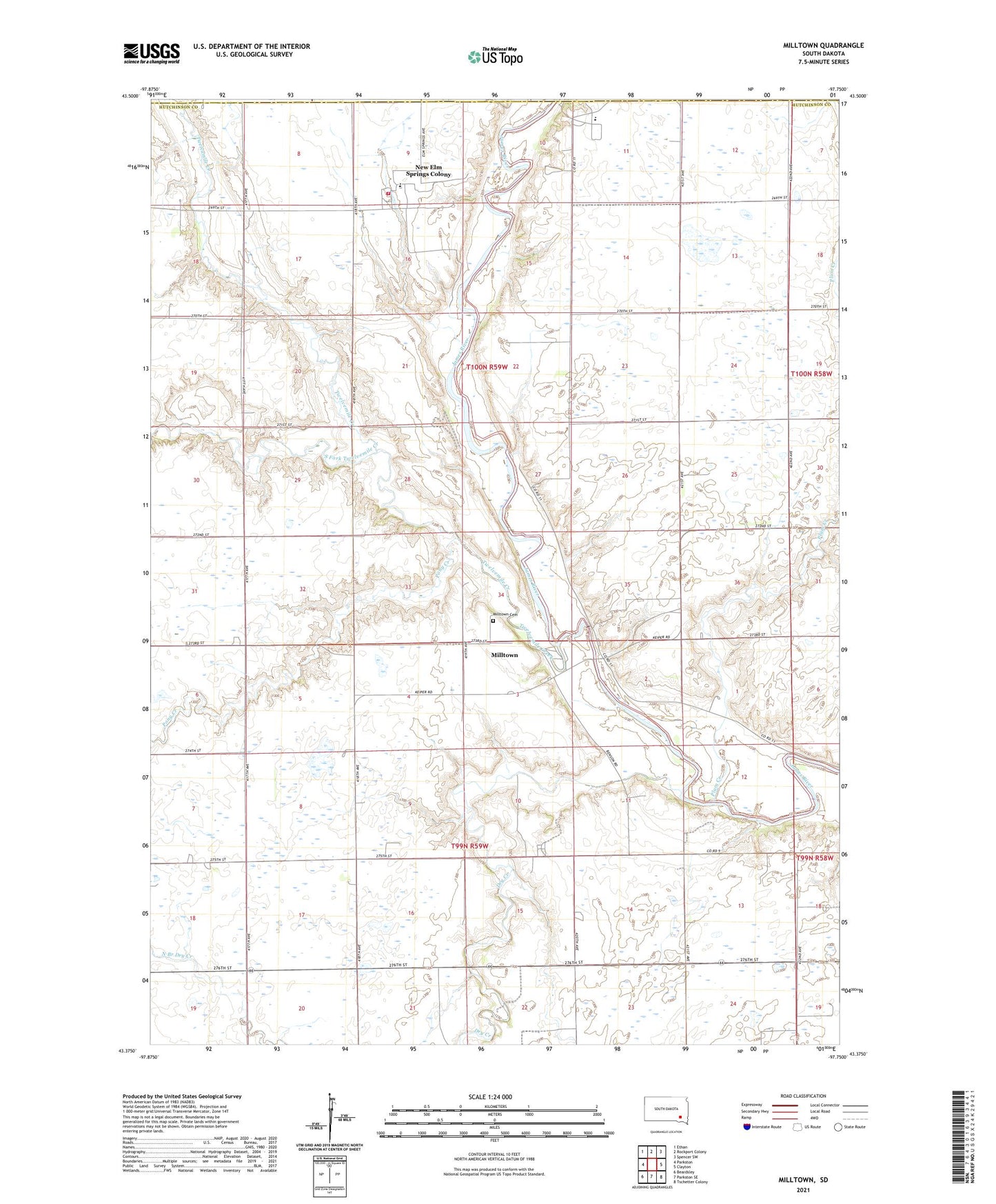
2021 topographic map quadrangle Milltown in the state of South Dakota. Scale: 1:24000. Based on the newly updated USGS 7.5' US Topo map series, this map is in the following counties: Hutchinson, Hanson. The map contains contour data, water features, and other items you are used to seeing on USGS maps, but also has updated roads and other features. This is the next generation of topographic maps. Printed on high-quality waterproof paper with UV fade-resistant inks.
Quads adjacent to this one:
West: Parkston
Northwest: Ethan
North: Rockport Colony
Northeast: Spencer SW
East: Clayton
Southeast: Tschetter Colony
South: Parkston SE
Southwest: Beardsley
This map covers the same area as the classic USGS quad with code o43097d7.
Contains the following named places: Colony of Mercy Home for the Aged, Dry Creek, Foster School, Milltown, Milltown Cemetery, Milltown Census Designated Place, Milltown Colony, New Elm Spring Colony Census Designated Place, New Elm Spring Colony Elementary School, New Elm Springs Colony, New Elm Springs Volunteer Fire Department, Old Elm Spring Colony, Old Elm Spring Colony Census Designated Place, Old Elm Spring Colony Elementary School, Pleasant View School, Plum Creek, Pony Creek, South Fork Twelvemile Creek, Stirling School, Township of Foster, Township of Milltown, Twelvemile Creek