MyTopo
Clear Lake North South Dakota US Topo Map
Couldn't load pickup availability
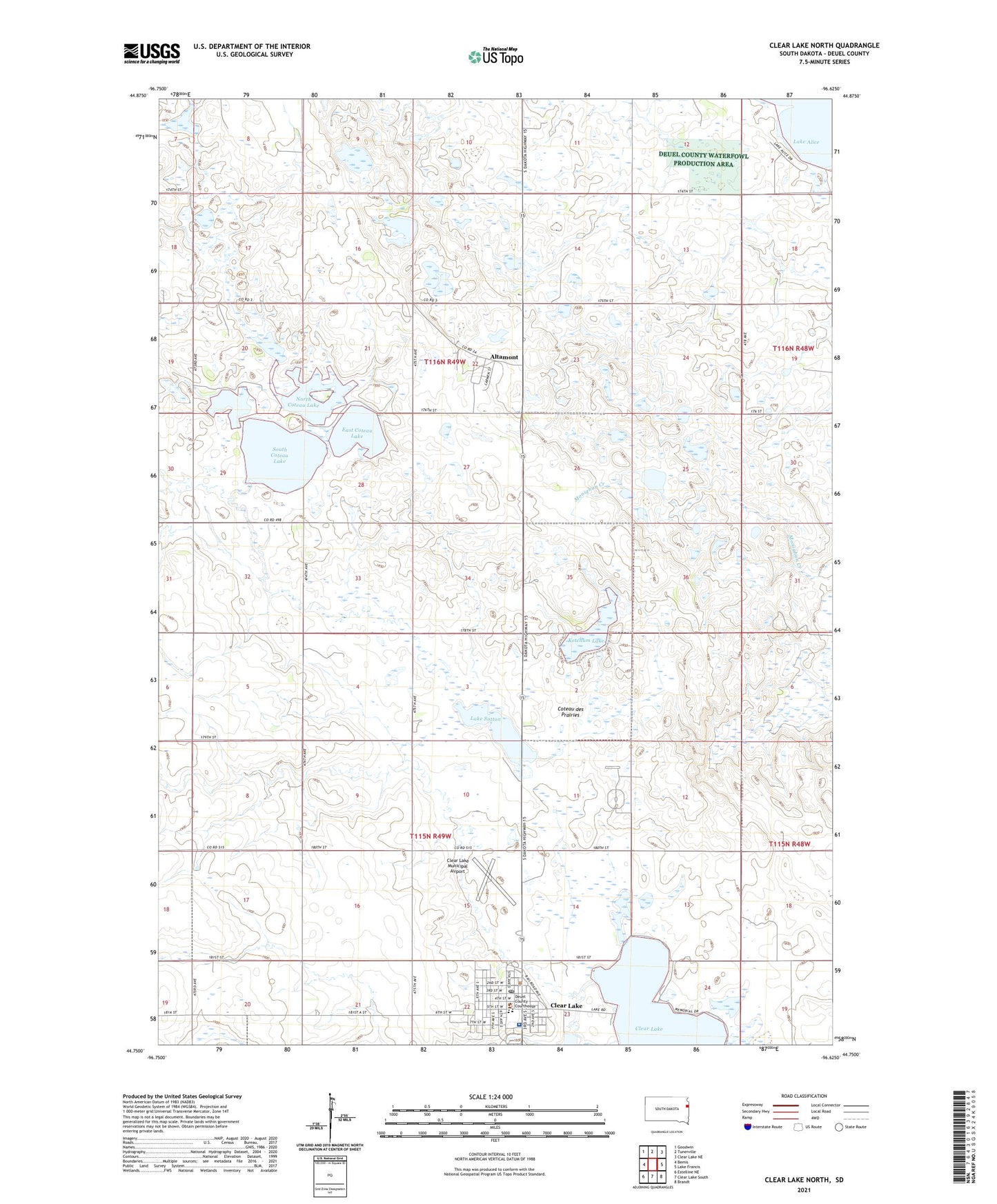
2021 topographic map quadrangle Clear Lake North in the state of South Dakota. Scale: 1:24000. Based on the newly updated USGS 7.5' US Topo map series, this map is in the following counties: Deuel. The map contains contour data, water features, and other items you are used to seeing on USGS maps, but also has updated roads and other features. This is the next generation of topographic maps. Printed on high-quality waterproof paper with UV fade-resistant inks.
Quads adjacent to this one:
West: Bemis
Northwest: Goodwin
North: Tunerville
Northeast: Clear Lake NE
East: Lake Francis
Southeast: Brandt
South: Clear Lake South
Southwest: Estelline NE
Contains the following named places: Altamont, Altamont State Public Shooting Areas, City of Clear Lake, Clear Lake, Clear Lake City Library, Clear Lake Elementary School, Clear Lake Middle School, Clear Lake Municipal Airport, Clear Lake Municipal Building, Clear Lake Post Office, Coteau Island State Public Shooting Area, Crystal Springs State Public Shooting Area, Deuel County, Deuel County Ambulance, Deuel County Courthouse, Deuel County Sheriff, Deuel High School, East Coteau Lake, Ketchum Lake, Ketchum Lake State Public Shooting Area, Lake Sutton, Lake Sutton State Public Shooting Areas, North Coteau Lake, Sanford Deuel County Medical Center, South Coteau Lake, Town of Altamont, Township of Altamont, Ulen Park, ZIP Code: 57226