MyTopo
Goodwin South Dakota US Topo Map
Couldn't load pickup availability
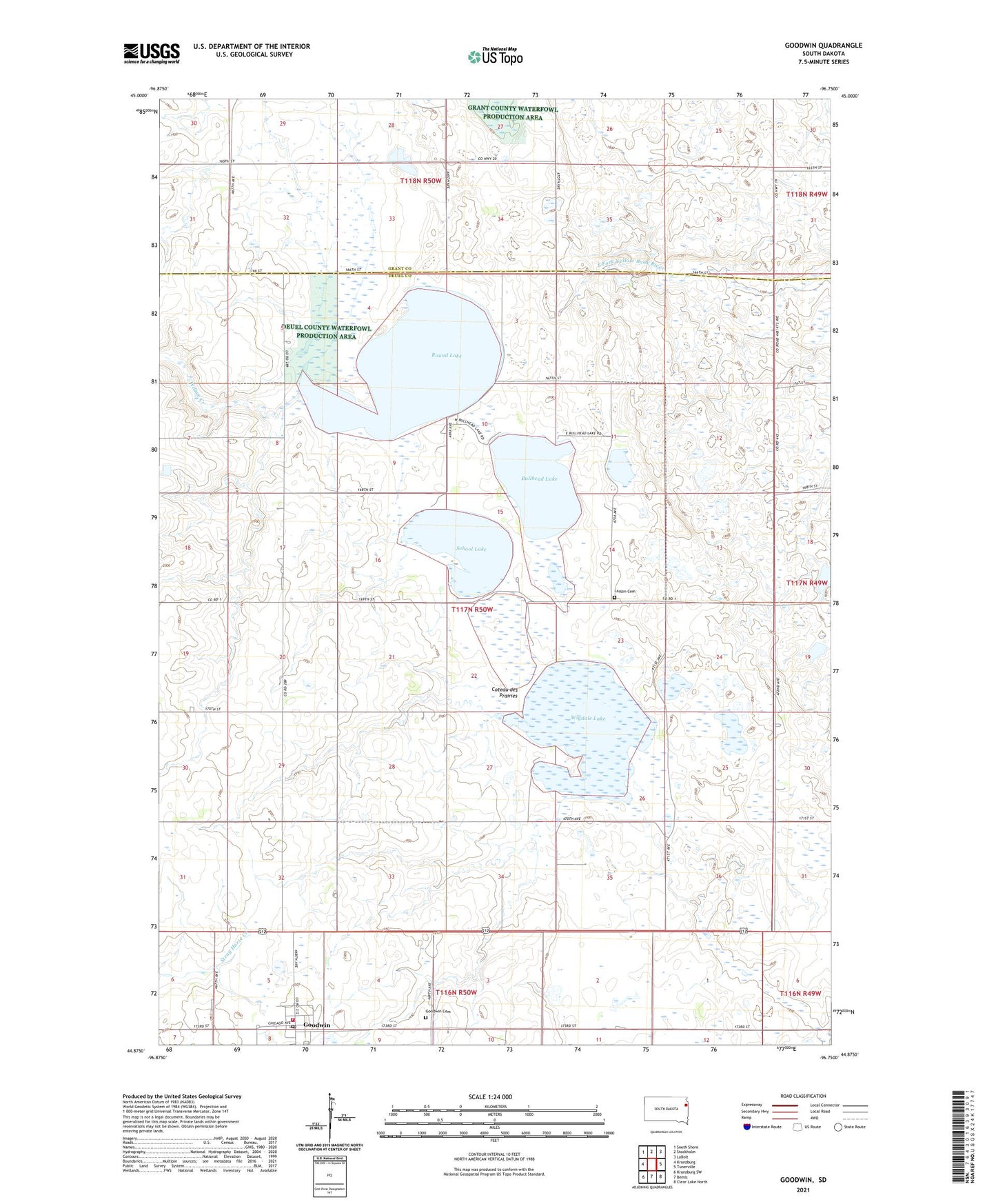
2021 topographic map quadrangle Goodwin in the state of South Dakota. Scale: 1:24000. Based on the newly updated USGS 7.5' US Topo map series, this map is in the following counties: Deuel, Grant. The map contains contour data, water features, and other items you are used to seeing on USGS maps, but also has updated roads and other features. This is the next generation of topographic maps. Printed on high-quality waterproof paper with UV fade-resistant inks.
Quads adjacent to this one:
West: Kranzburg
Northwest: South Shore
North: Stockholm
Northeast: LaBolt
East: Tunerville
Southeast: Clear Lake North
South: Bemis
Southwest: Kranzburg SW
This map covers the same area as the classic USGS quad with code o44096h7.
Contains the following named places: Brens Corner, Bullhead Lake, Goodwin, Goodwin Cemetery, Goodwin Fire Department, Goodwin Post Office, Larson Cemetery, Pleasant Valley School, Rome State Wildlife Management Area, Round Lake, Round Lake State Wildlife Management Area, School Lake, Town of Goodwin, Township of Rome, Wigdale Lake, ZIP Code: 57265