MyTopo
Bemis South Dakota US Topo Map
Couldn't load pickup availability
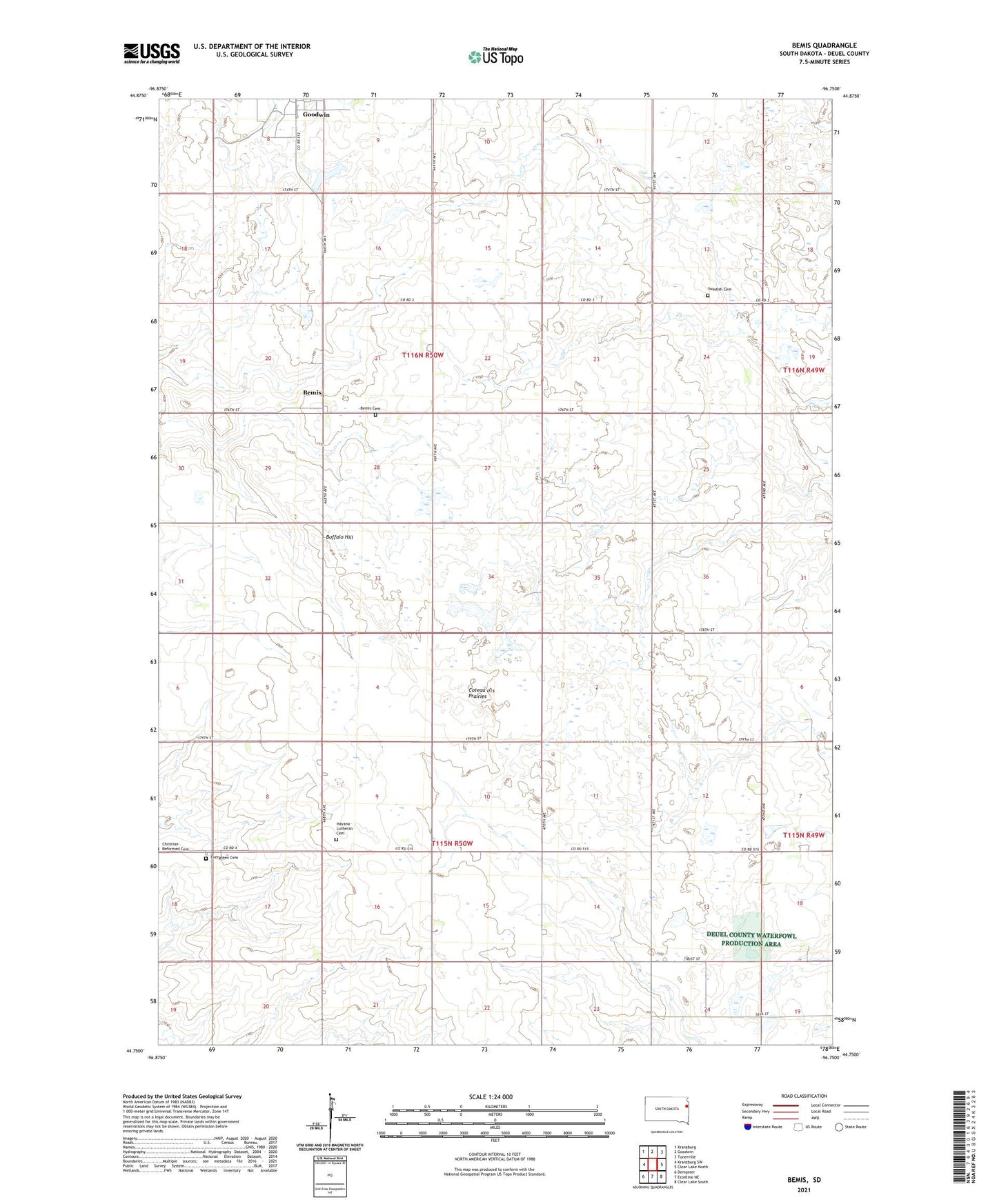
2021 topographic map quadrangle Bemis in the state of South Dakota. Scale: 1:24000. Based on the newly updated USGS 7.5' US Topo map series, this map is in the following counties: Deuel. The map contains contour data, water features, and other items you are used to seeing on USGS maps, but also has updated roads and other features. This is the next generation of topographic maps. Printed on high-quality waterproof paper with UV fade-resistant inks.
Quads adjacent to this one:
West: Kranzburg SW
Northwest: Kranzburg
North: Goodwin
Northeast: Tunerville
East: Clear Lake North
Southeast: Clear Lake South
South: Estelline NE
Southwest: Dempster
This map covers the same area as the classic USGS quad with code o44096g7.
Contains the following named places: Bemis, Bemis Cemetery, Bemis Church, Buffalo Hill, Evangelical Lutheran Church, Evergreen Cemetery, Havana Lutheran Cemetery, Hilltop School, Nelson State Wildlife Management Area, Reformed Church, Swedish Cemetery, Township of Goodwin, Township of Havana, ZIP Code: 57238