MyTopo
Colman South Dakota US Topo Map
Couldn't load pickup availability
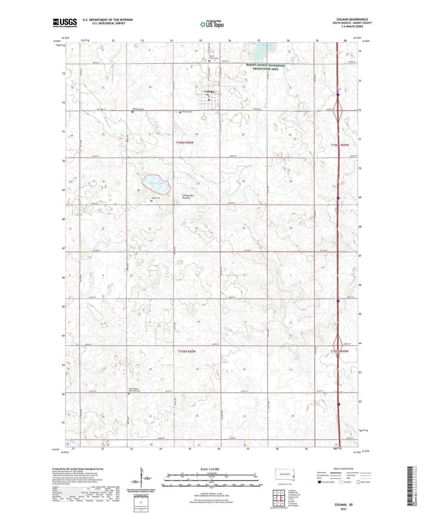
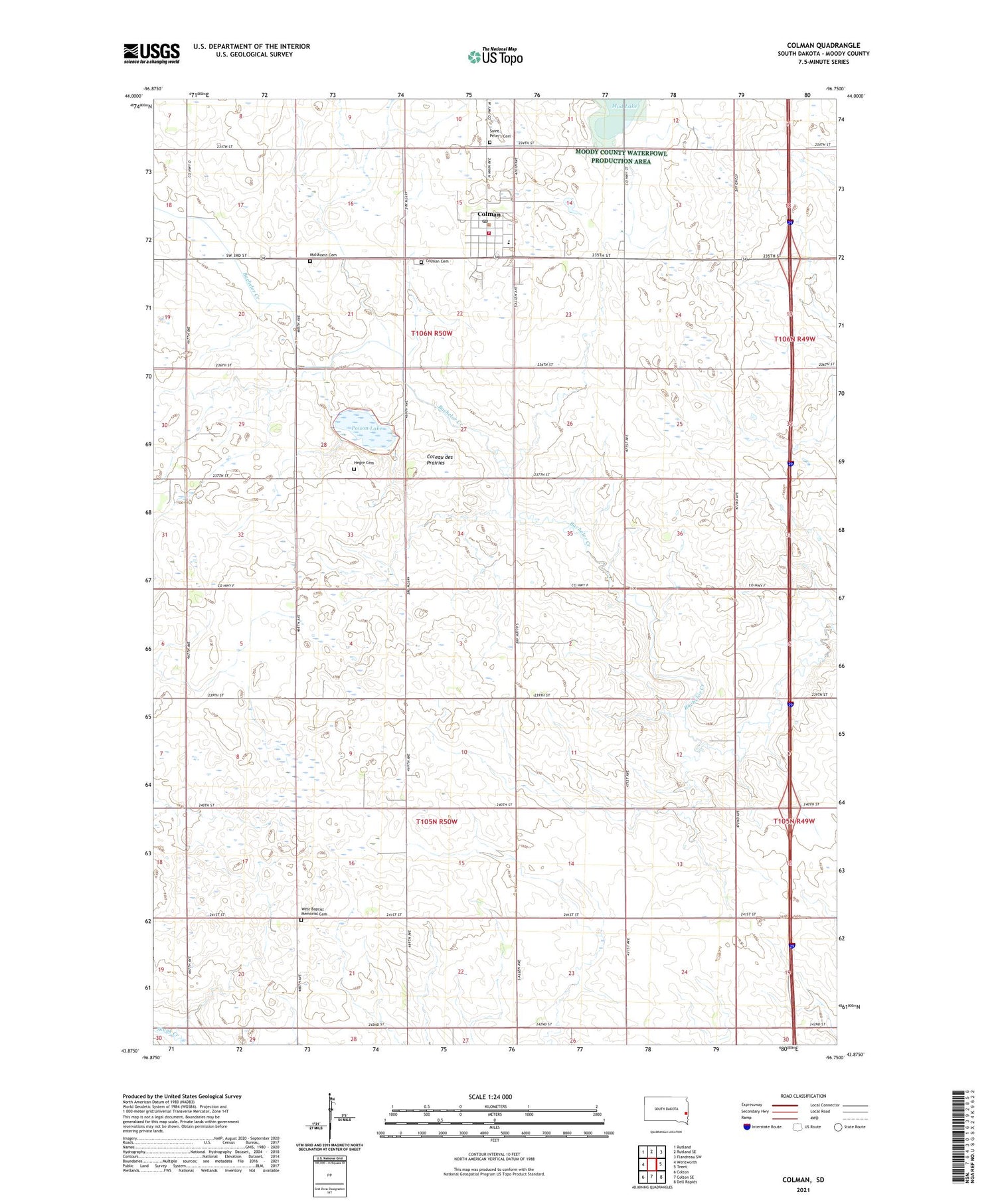
2021 topographic map quadrangle Colman in the state of South Dakota. Scale: 1:24000. Based on the newly updated USGS 7.5' US Topo map series, this map is in the following counties: Moody. The map contains contour data, water features, and other items you are used to seeing on USGS maps, but also has updated roads and other features. This is the next generation of topographic maps. Printed on high-quality waterproof paper with UV fade-resistant inks.
Quads adjacent to this one:
West: Wentworth
Northwest: Rutland
North: Rutland SE
Northeast: Flandreau SW
East: Trent
Southeast: Dell Rapids
South: Colton SE
Southwest: Colton
Contains the following named places: City of Colman, Colman, Colman Branch Library, Colman Cemetery, Colman City Hall, Colman Elementary School, Colman Fire Department, Colman Police Department, Colman Post Office, Colman-Egan High School, Colman-Egan Junior High School, Devaney School, Hegre Cemetery, Molskness Cemetery, Mud Lake, Norwegian Lutheran Church, Poison Lake, Saint Peter's Cemetery, Sioux Valley Landing Strip, Township of Colman, Township of Lynn, West Baptist Memorial Cemetery, West Church