MyTopo
Dell Rapids South Dakota US Topo Map
Couldn't load pickup availability
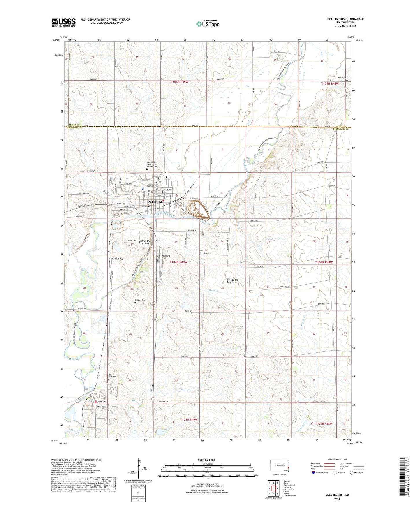
2021 topographic map quadrangle Dell Rapids in the state of South Dakota. Scale: 1:24000. Based on the newly updated USGS 7.5' US Topo map series, this map is in the following counties: Minnehaha, Moody. The map contains contour data, water features, and other items you are used to seeing on USGS maps, but also has updated roads and other features. This is the next generation of topographic maps. Printed on high-quality waterproof paper with UV fade-resistant inks.
Quads adjacent to this one:
West: Colton SE
Northwest: Colman
North: Trent
Northeast: Dell Rapids NE
East: Dell Rapids SE
Southeast: Garretson West
South: Renner
Southwest: Crooks
This map covers the same area as the classic USGS quad with code o43096g6.
Contains the following named places: Avera Dells Area Hospital, Baltic, Baltic Branch Library, Baltic City Hall, Baltic Elementary School, Baltic High School, Baltic Middle School, Baltic Post Office, Baltic Volunteer Fire Department, City of Baltic, City of Dell Rapids, Corothers School Number 36, Dell Rapids, Dell Rapids - Saint Mary's Catholic Cemetery, Dell Rapids Carnegie Public Library, Dell Rapids City Hall, Dell Rapids Community Ambulance Service, Dell Rapids Elementary School, Dell Rapids Fire Department, Dell Rapids High School, Dell Rapids Middle School, Dell Rapids Post Office, Dells Island, Dells of the Sioux River, Nelson Cemetery, Saint Mary's Elementary School, Saint Mary's High School, Saint Mary's Junior High School, Saint Olaf Cemetery, Sioux Valley Church, Stordahl Cemetery, Township of Dell Rapids, Weelborg Airport, ZIP Code: 57022