MyTopo
Colton SE South Dakota US Topo Map
Couldn't load pickup availability
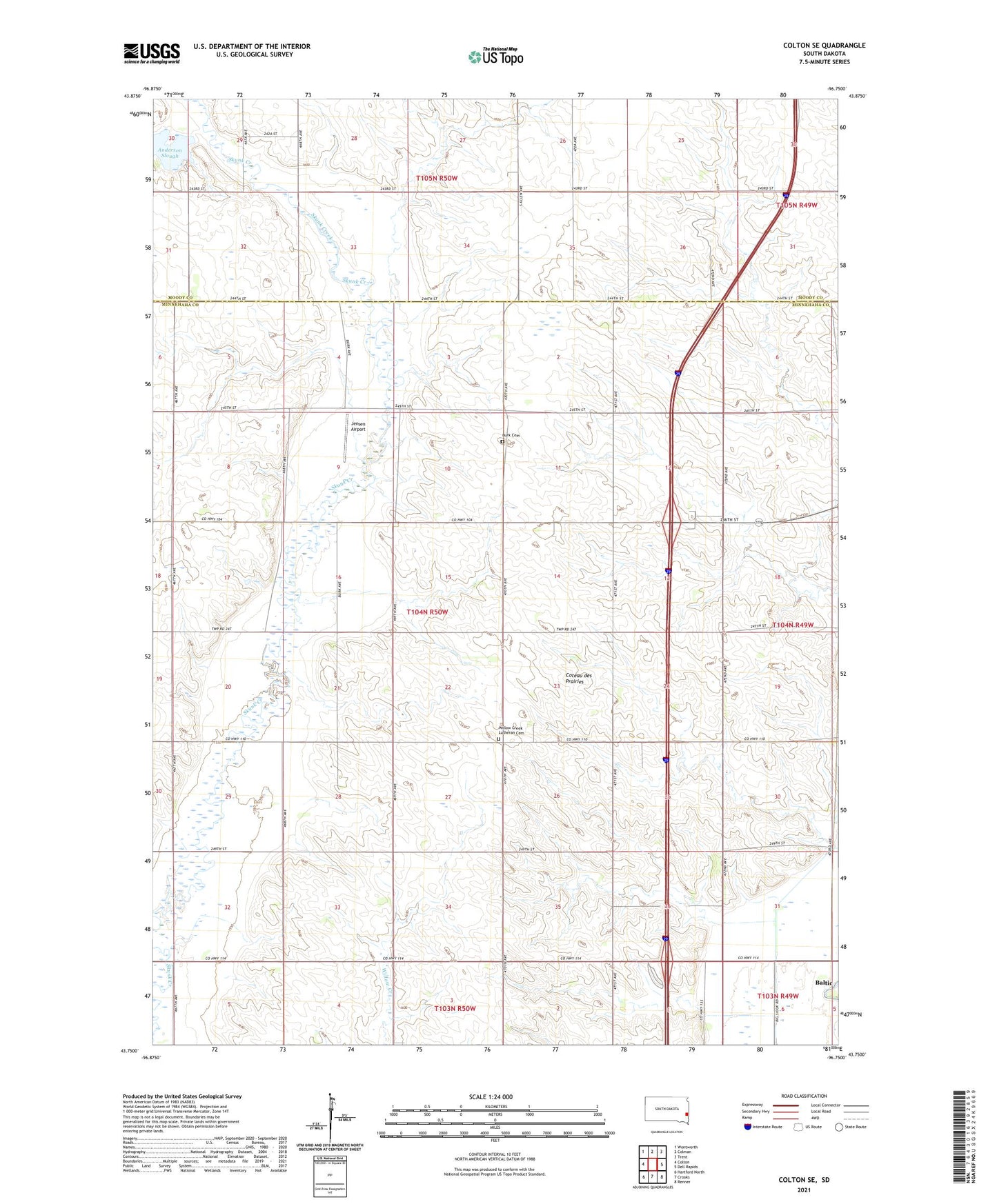
2021 topographic map quadrangle Colton SE in the state of South Dakota. Scale: 1:24000. Based on the newly updated USGS 7.5' US Topo map series, this map is in the following counties: Minnehaha, Moody. The map contains contour data, water features, and other items you are used to seeing on USGS maps, but also has updated roads and other features. This is the next generation of topographic maps. Printed on high-quality waterproof paper with UV fade-resistant inks.
Quads adjacent to this one:
West: Colton
Northwest: Wentworth
North: Colman
Northeast: Trent
East: Dell Rapids
Southeast: Renner
South: Crooks
Southwest: Hartford North
This map covers the same area as the classic USGS quad with code o43096g7.
Contains the following named places: Anderson Slough, Burk Cemetery, Fleetwood, Jensen Airport, Lookout, Park Ridge Shopping Center, Township of Burk, Willow Creek Church, Willow Creek Lutheran Cemetery