MyTopo
Colome South Dakota US Topo Map
Couldn't load pickup availability
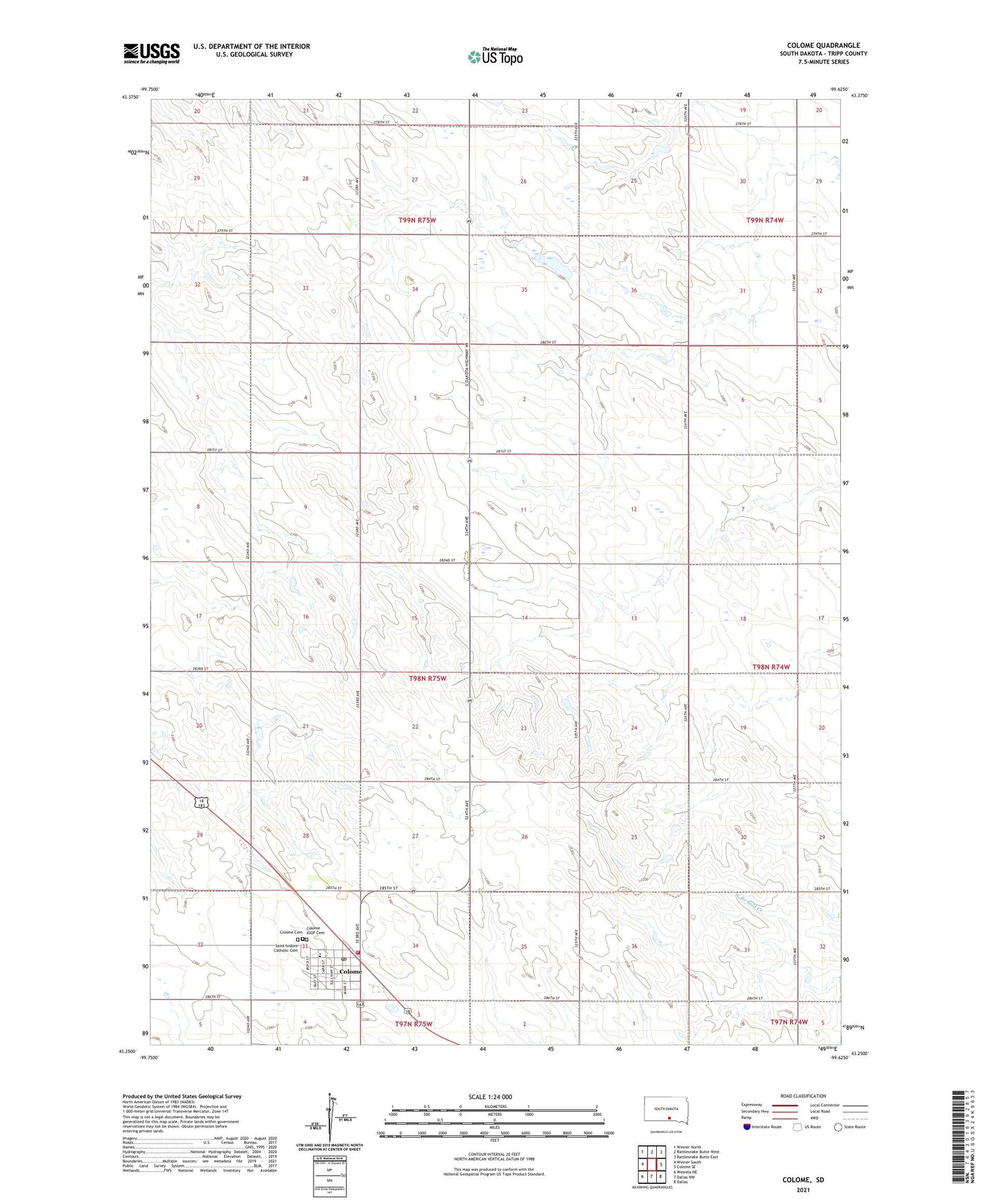
2021 topographic map quadrangle Colome in the state of South Dakota. Scale: 1:24000. Based on the newly updated USGS 7.5' US Topo map series, this map is in the following counties: Tripp. The map contains contour data, water features, and other items you are used to seeing on USGS maps, but also has updated roads and other features. This is the next generation of topographic maps. Printed on high-quality waterproof paper with UV fade-resistant inks.
Quads adjacent to this one:
West: Winner South
Northwest: Winner North
North: Rattlesnake Butte West
Northeast: Rattlesnake Butte East
East: Colome SE
Southeast: Dallas
South: Dallas NW
Southwest: Wewela NE
This map covers the same area as the classic USGS quad with code o43099c6.
Contains the following named places: City of Colome, Colome, Colome Branch Library, Colome Cemetery, Colome Elementary School, Colome Fire Department, Colome High School, Colome IOOF Cemetery, Colome Junior High School, Colome Post Office, Saint Isidore Catholic Cemetery, Township of Colome