MyTopo
Winner South South Dakota US Topo Map
Couldn't load pickup availability
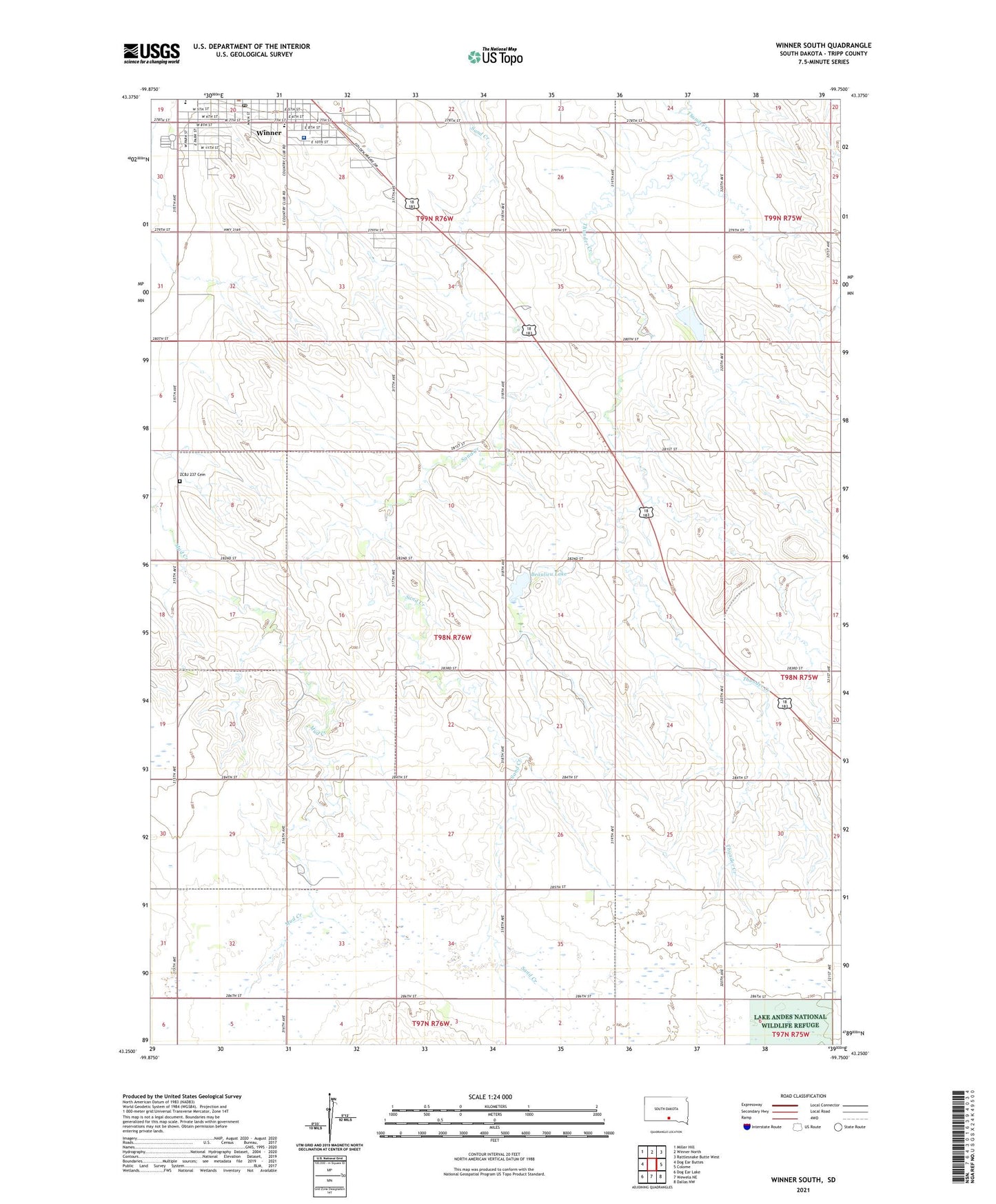
2021 topographic map quadrangle Winner South in the state of South Dakota. Scale: 1:24000. Based on the newly updated USGS 7.5' US Topo map series, this map is in the following counties: Tripp. The map contains contour data, water features, and other items you are used to seeing on USGS maps, but also has updated roads and other features. This is the next generation of topographic maps. Printed on high-quality waterproof paper with UV fade-resistant inks.
Quads adjacent to this one:
West: Dog Ear Buttes
Northwest: Miller Hill
North: Winner North
Northeast: Rattlesnake Butte West
East: Colome
Southeast: Dallas NW
South: Wewela NE
Southwest: Dog Ear Lake
This map covers the same area as the classic USGS quad with code o43099c7.
Contains the following named places: Beaulieu Dam, Beaulieu Lake, Beaulieu Lake State Game Production Area, KWYR-FM (Winner), McLaughlin Dam State Game Production Area, Novantny Brothers Number 1 Dam, Reilly School, Township of Wilson, Tripp County Fair Grounds, Tripp County Library, Winner City Hall, Winner Drive-In, Winner High School, Winner Middle School, Winner Post Office, Winner Regional Hospital, ZCBJ 237 Cemetery