MyTopo
Ditch Creek South Dakota US Topo Map
Couldn't load pickup availability
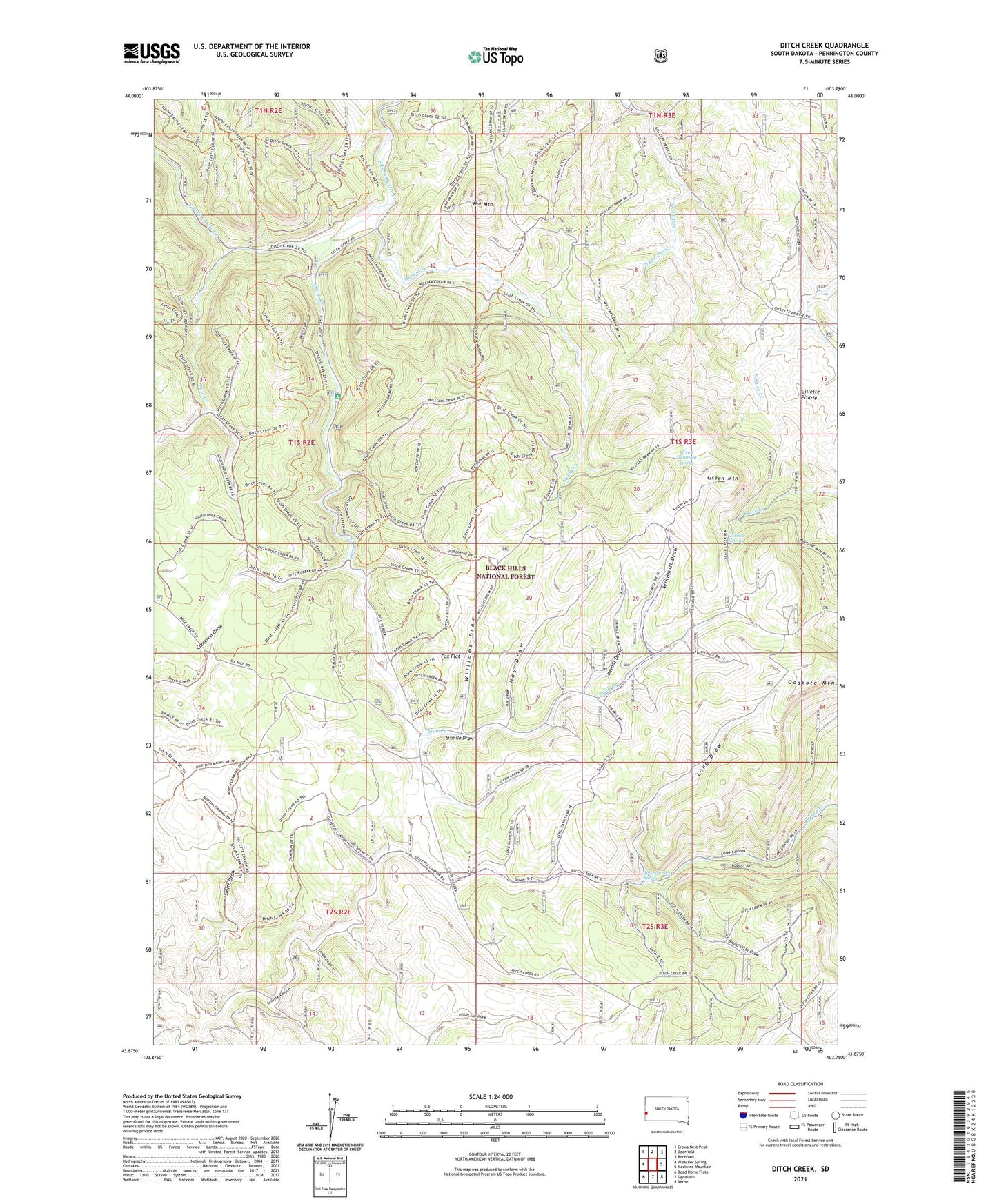
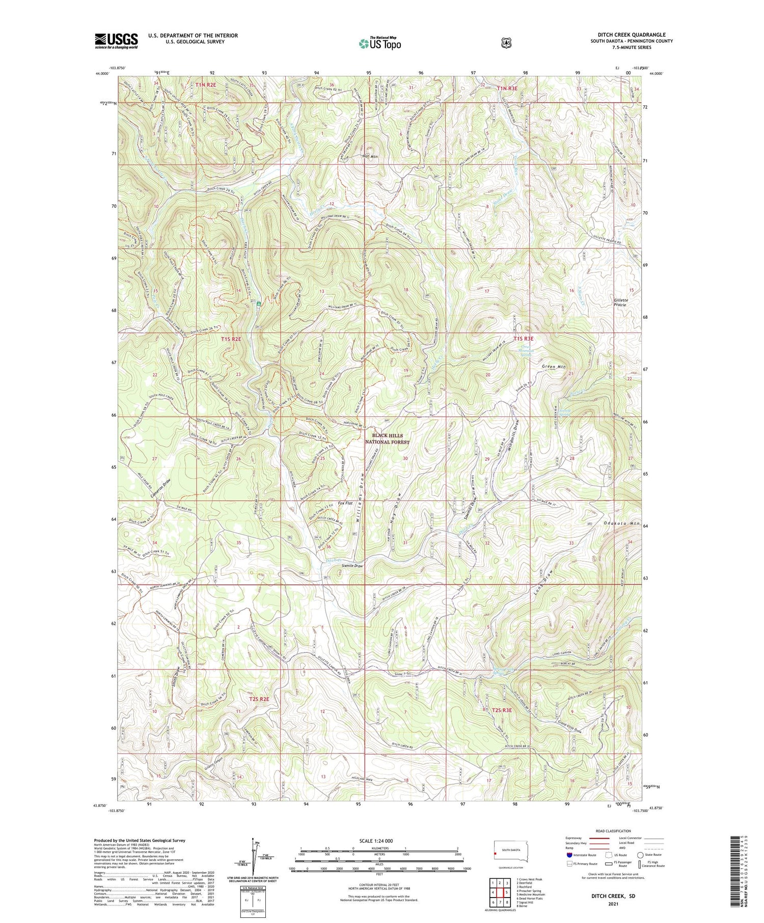
2021 topographic map quadrangle Ditch Creek in the state of South Dakota. Scale: 1:24000. Based on the newly updated USGS 7.5' US Topo map series, this map is in the following counties: Pennington. The map contains contour data, water features, and other items you are used to seeing on USGS maps, but also has updated roads and other features. This is the next generation of topographic maps. Printed on high-quality waterproof paper with UV fade-resistant inks.
Quads adjacent to this one:
West: Preacher Spring
Northwest: Crows Nest Peak
North: Deerfield
Northeast: Rochford
East: Medicine Mountain
Southeast: Berne
South: Signal Hill
Southwest: Dead Horse Flats
Contains the following named places: Accidental Mine, Copper Mountain Gravel Pit, Ditch Creek, Ditch Creek Gampground, Four Corners Well, Fox Flat, Gillette Well, Grand Vista Draw, Green Mountain, Green Mountain Spring, Hat Mountain, Hay Draw, Heely Creek, Herman Matt Ranch, Hoar Ranch, Kimballs Ranch, Long Draw, Miller Camp, Montezuma, Odakota Mountain, Pole Creek, Sawmill Draw, Sears Ranch, Silica Sand Mine, Sixmile Draw, Sixmile Spring, Smith Draw, Spring Creek Spring, Stan-Penn Lodge Mine, Stone Draw, Tony Matt Ranch, Unorganized Territory of West Pennington, Williams Draw, Windmill Draw