MyTopo
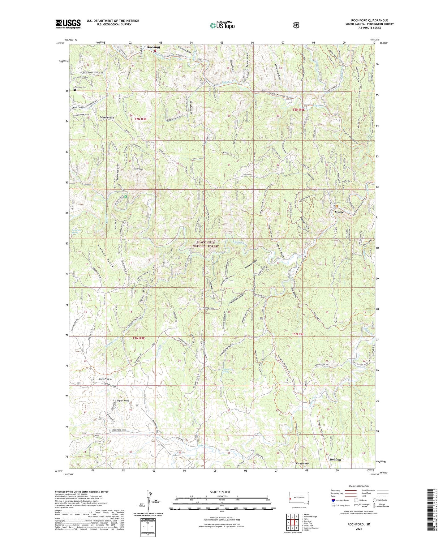
Rochford South Dakota US Topo Map
Couldn't load pickup availability
Also explore the Rochford Forest Service Topo of this same quad for updated USFS data
2021 topographic map quadrangle Rochford in the state of South Dakota. Scale: 1:24000. Based on the newly updated USGS 7.5' US Topo map series, this map is in the following counties: Pennington. The map contains contour data, water features, and other items you are used to seeing on USGS maps, but also has updated roads and other features. This is the next generation of topographic maps. Printed on high-quality waterproof paper with UV fade-resistant inks.
Quads adjacent to this one:
West: Deerfield
Northwest: Nahant
North: Minnesota Ridge
Northeast: Nemo
East: Silver City
Southeast: Hill City
South: Medicine Mountain
Southwest: Ditch Creek
This map covers the same area as the classic USGS quad with code o44103a6.
Contains the following named places: Bearcat Gulch, Benner Gulch, Bittersweet Creek, Blind Gulch, Bloody Gulch, Bobcat Gulch, Brown Jug Draw, Castle Peak, Castle Peak Campground, Castleton, Cluder Gulch, Crooked Creek, Cuttys Ark Mine, Dougherty Gulch, Dougherty Spring, East Gimlet Creek, Fairview, Fish and Hunter Siding, Gimlet Creek, Hoodoo Gulch, Irish Gulch, Lind Gulch, Lookout Mill, Lost Park Spring, Minnesota Gulch, Moonshine Gulch, Myersville, Mystic, North Fork Castle Creek, Pony Gulch, Poverty Gulch, Redfern, Redfern Mountain, Rimmer Ridge, Rochford, Rochford Cemetery, Rochford Volunteer Fire Department, Rockford Forest Service Facility, Signal Knob, Silver Creek, Slate Prairie, Slate Prairie Church, Slate Prairie School, Smith Gulch, Standby Mine, Township of Rochford, Wheeler Gulch, Whitetail Gulch