MyTopo
Drywood Lakes South Dakota US Topo Map
Couldn't load pickup availability
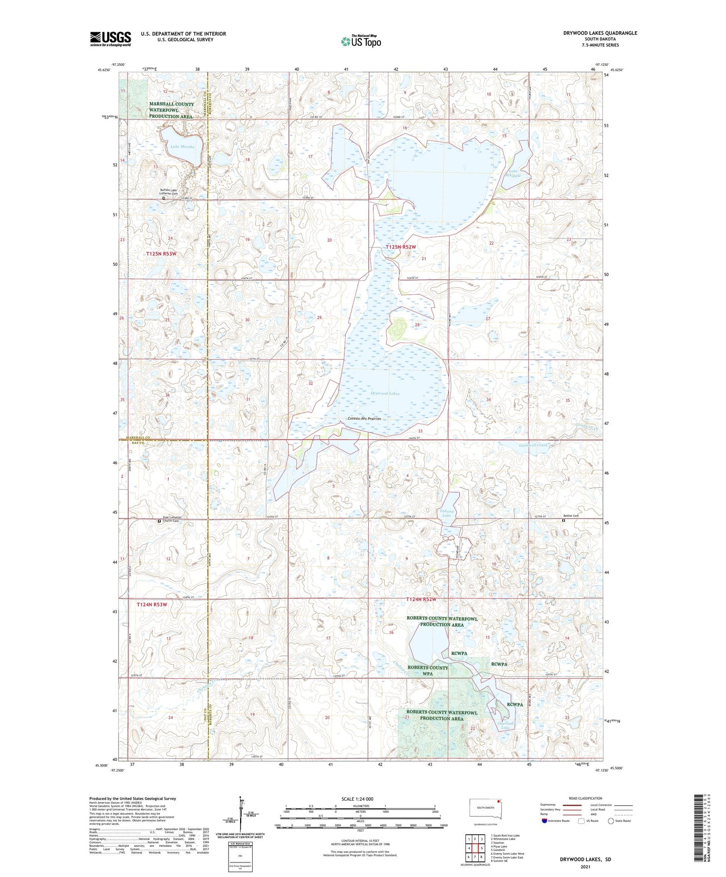
2021 topographic map quadrangle Drywood Lakes in the state of South Dakota. Scale: 1:24000. Based on the newly updated USGS 7.5' US Topo map series, this map is in the following counties: Roberts, Marshall, Day. The map contains contour data, water features, and other items you are used to seeing on USGS maps, but also has updated roads and other features. This is the next generation of topographic maps. Printed on high-quality waterproof paper with UV fade-resistant inks.
Quads adjacent to this one:
West: Piyas Lake
Northwest: South Red Iron Lake
North: Whitestone Lake
Northeast: Sisseton
East: Goodwill
Southeast: Summit NE
South: Enemy Swim Lake East
Southwest: Enemy Swim Lake West
This map covers the same area as the classic USGS quad with code o45097e2.
Contains the following named places: Bethel Cemetery, Buffalo Lake Lutheran Cemetery, Drywood Lakes, Lake Martha, Lake View Farm, Lake Whipple, One Road School, Oneroad Bethel Church, Oneroad Lake, Roberts County Waterfowl Production Area, Tahana Lake, Township of Dry Wood Lake, Township of One Road, Zoar Lutheran Church Cemetery, Zoark Church