MyTopo
Feinstein Lake South Dakota US Topo Map
Couldn't load pickup availability
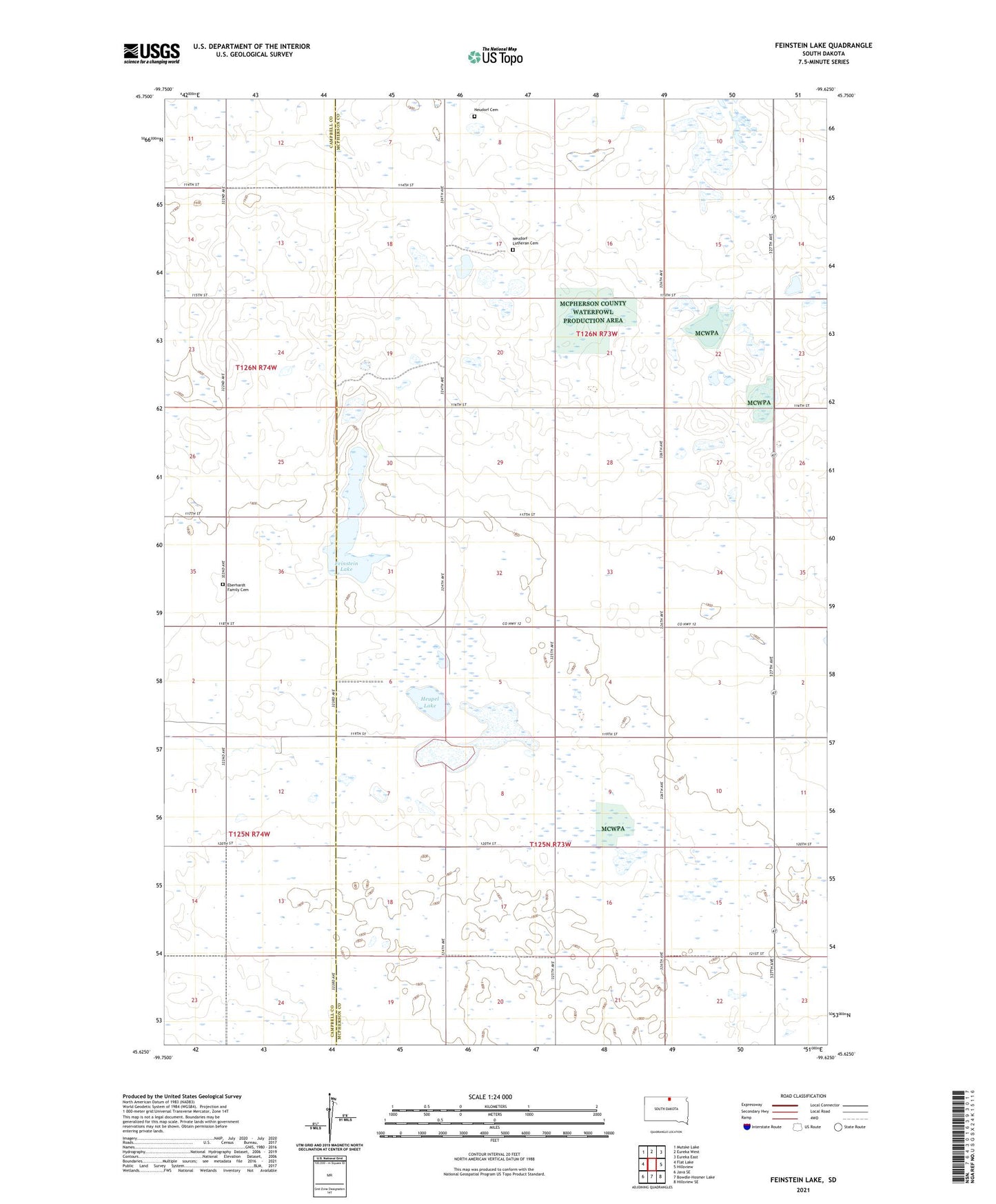
2021 topographic map quadrangle Feinstein Lake in the state of South Dakota. Scale: 1:24000. Based on the newly updated USGS 7.5' US Topo map series, this map is in the following counties: McPherson, Campbell. The map contains contour data, water features, and other items you are used to seeing on USGS maps, but also has updated roads and other features. This is the next generation of topographic maps. Printed on high-quality waterproof paper with UV fade-resistant inks.
Quads adjacent to this one:
West: Flat Lake
Northwest: Mutske Lake
North: Eureka West
Northeast: Eureka East
East: Hillsview
Southeast: Hillsview SE
South: Bowdle-Hosmer Lake
Southwest: Java SE
This map covers the same area as the classic USGS quad with code o45099f6.
Contains the following named places: Eberhardt Family Cemetery, Feinstein Lake, Heupel Lake, Neudorf Cemetery, Neudorf Lutheran Cemetery, North Jackson State Public Shooting Area, Township of Bauer, Township of Jackson