MyTopo
Faith South Dakota US Topo Map
Couldn't load pickup availability
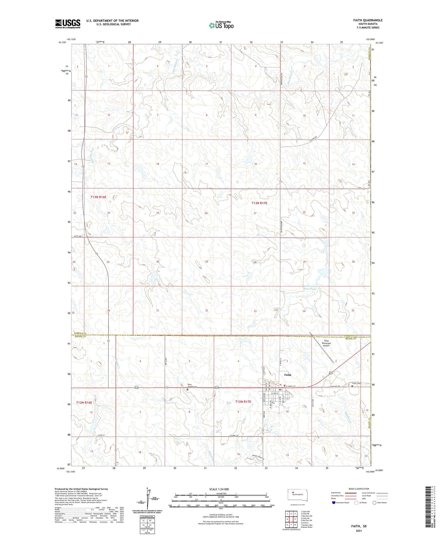
2021 topographic map quadrangle Faith in the state of South Dakota. Scale: 1:24000. Based on the newly updated USGS 7.5' US Topo map series, this map is in the following counties: Perkins, Meade, Ziebach. The map contains contour data, water features, and other items you are used to seeing on USGS maps, but also has updated roads and other features. This is the next generation of topographic maps. Printed on high-quality waterproof paper with UV fade-resistant inks.
Quads adjacent to this one:
West: Faith SW
Northwest: Faith NW
North: Faith NE
Northeast: Red Elm NW
East: Red Elm SW
Southeast: Bessie Butte
South: Durkee Lake
Southwest: Avance
This map covers the same area as the classic USGS quad with code o45102a1.
Contains the following named places: Arrow Head School, City of Faith, D Ulrich Dam, Faith, Faith Ambulance Service, Faith Cemetery, Faith City Police Department, Faith Community Center, Faith Community Center - City Hall, Faith Elementary School, Faith Fire Department, Faith High School, Faith Junior High School, Faith Municipal Airport, Faith Post Office, Faith Public/School Library, Prairie Oasis Mall, Rattlesnake Petes Pond, S Baxter Number 1 Dam, Saint Joseph Cemetery, Township of Flint Rock, Unorganized Territory of Flint Rock, V Anders Dam, W Reedy Dam, William Baxter Dam, Z Drum Dam