MyTopo
Fourmile South Dakota US Topo Map
Couldn't load pickup availability
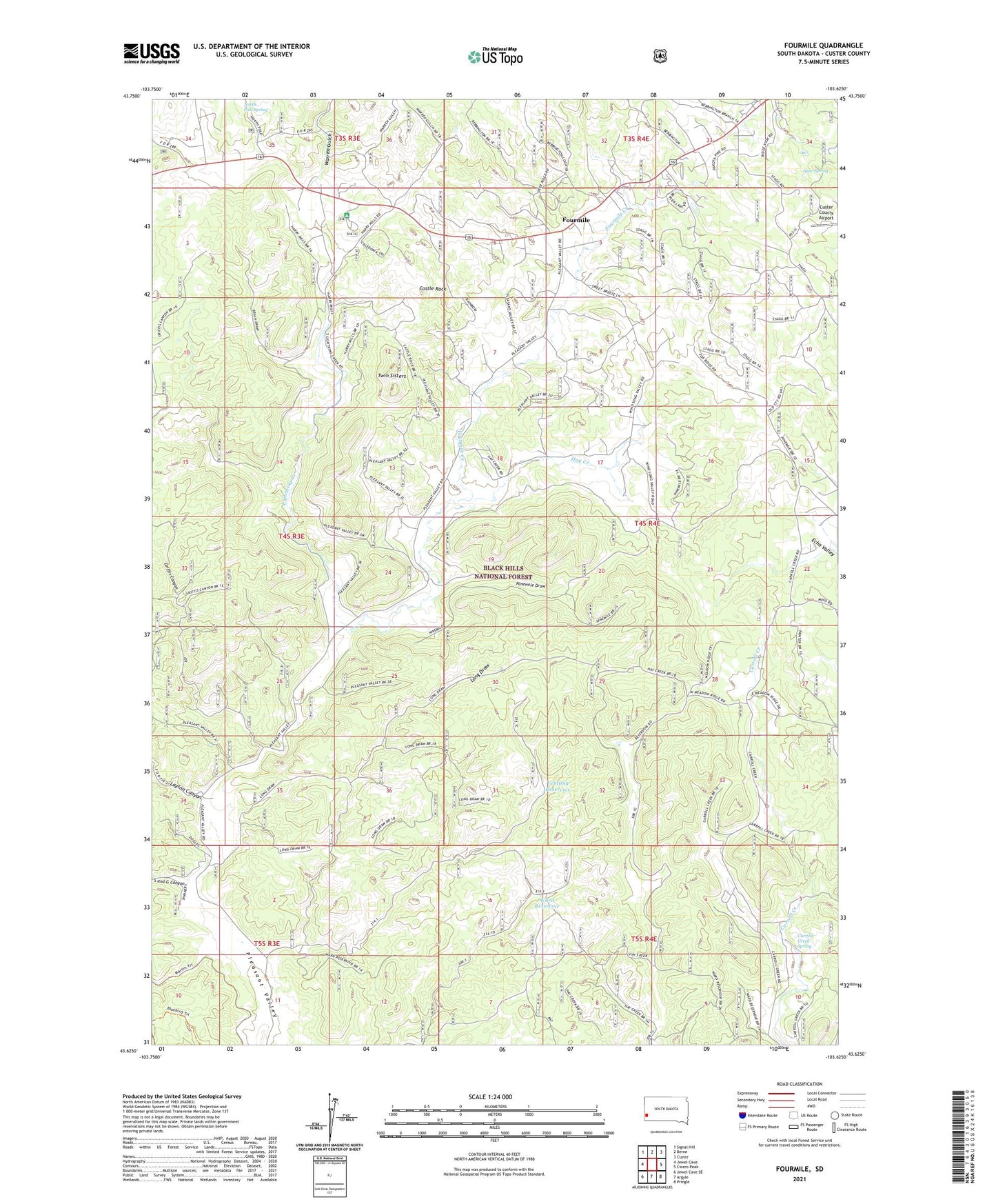
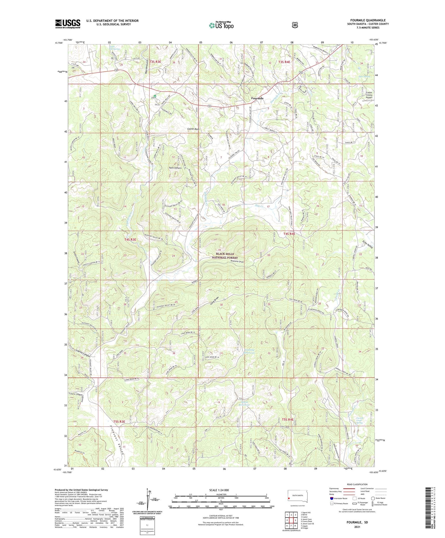
2021 topographic map quadrangle Fourmile in the state of South Dakota. Scale: 1:24000. Based on the newly updated USGS 7.5' US Topo map series, this map is in the following counties: Custer. The map contains contour data, water features, and other items you are used to seeing on USGS maps, but also has updated roads and other features. This is the next generation of topographic maps. Printed on high-quality waterproof paper with UV fade-resistant inks.
Quads adjacent to this one:
West: Jewel Cave
Northwest: Signal Hill
North: Berne
Northeast: Custer
East: Cicero Peak
Southeast: Pringle
South: Argyle
Southwest: Jewel Cave SE
Contains the following named places: Bebington Group Mine, Carroll Creek Spring, Castle Rock, Comanche Park Campground, Dubuque Claim, Fourmile, Fourmile Creek, Fourmile School, Griffis Canyon, Griffis Well, Harrymill Picnic Area, Hay Creek, Helen Beryl Mine, Keystone Lode Mine, Layton Canyon, Lightning Creek, Long Draw, McClure Dam, New York Mine, Nine Mile Ranch, Ninemile Draw, Pleasant Valley Station, Rafferty Ranch, Rainbow Number Four Mine, Red Spar Mine, Rocky Ridge Mine, Royal Flush Claim Mine, S and G Canyon, Sevenmile School, Spar Spring, Spring on the Right, Sutherland Ranch, Tin Mountain Mine, Tiptop Mine, Twelve Mile Ranch, Twin Sisters, Ventling Reservoir, Ward Reservoir, Warren Draw Mine, Warren Gulch, White Spar Mine, Woods Ranch, ZIP Code: 57730