MyTopo
Jewel Cave SE South Dakota US Topo Map
Couldn't load pickup availability
Also explore the Jewel Cave SE Forest Service Topo of this same quad for updated USFS data
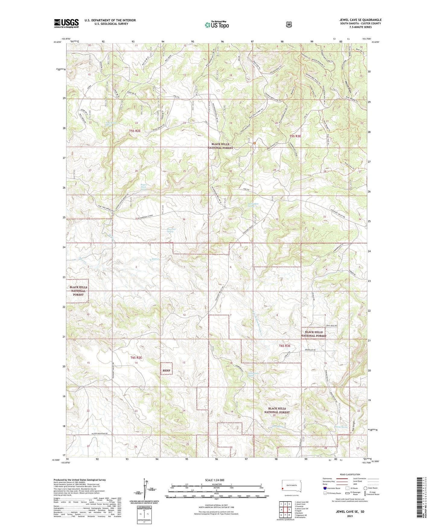
2021 topographic map quadrangle Jewel Cave SE in the state of South Dakota. Scale: 1:24000. Based on the newly updated USGS 7.5' US Topo map series, this map is in the following counties: Custer. The map contains contour data, water features, and other items you are used to seeing on USGS maps, but also has updated roads and other features. This is the next generation of topographic maps. Printed on high-quality waterproof paper with UV fade-resistant inks.
Quads adjacent to this one:
West: Jewel Cave SW
Northwest: Jewel Cave NW
North: Jewel Cave
Northeast: Fourmile
East: Argyle
Southeast: Minnekahta
South: Edgemont NE
Southwest: Burdock
This map covers the same area as the classic USGS quad with code o43103e7.
Contains the following named places: Cedar Ranch, East Pass Creek, Issue Wood Spring, Lindseys Ranch, McClelland School, Metz Spring, Nitche Spring, Pine Tree Spring, Richardson Spring, Richardson Well, Rogers Shack Spring, Sutherland Spring, West Pass Creek