MyTopo
Frederick South Dakota US Topo Map
Couldn't load pickup availability
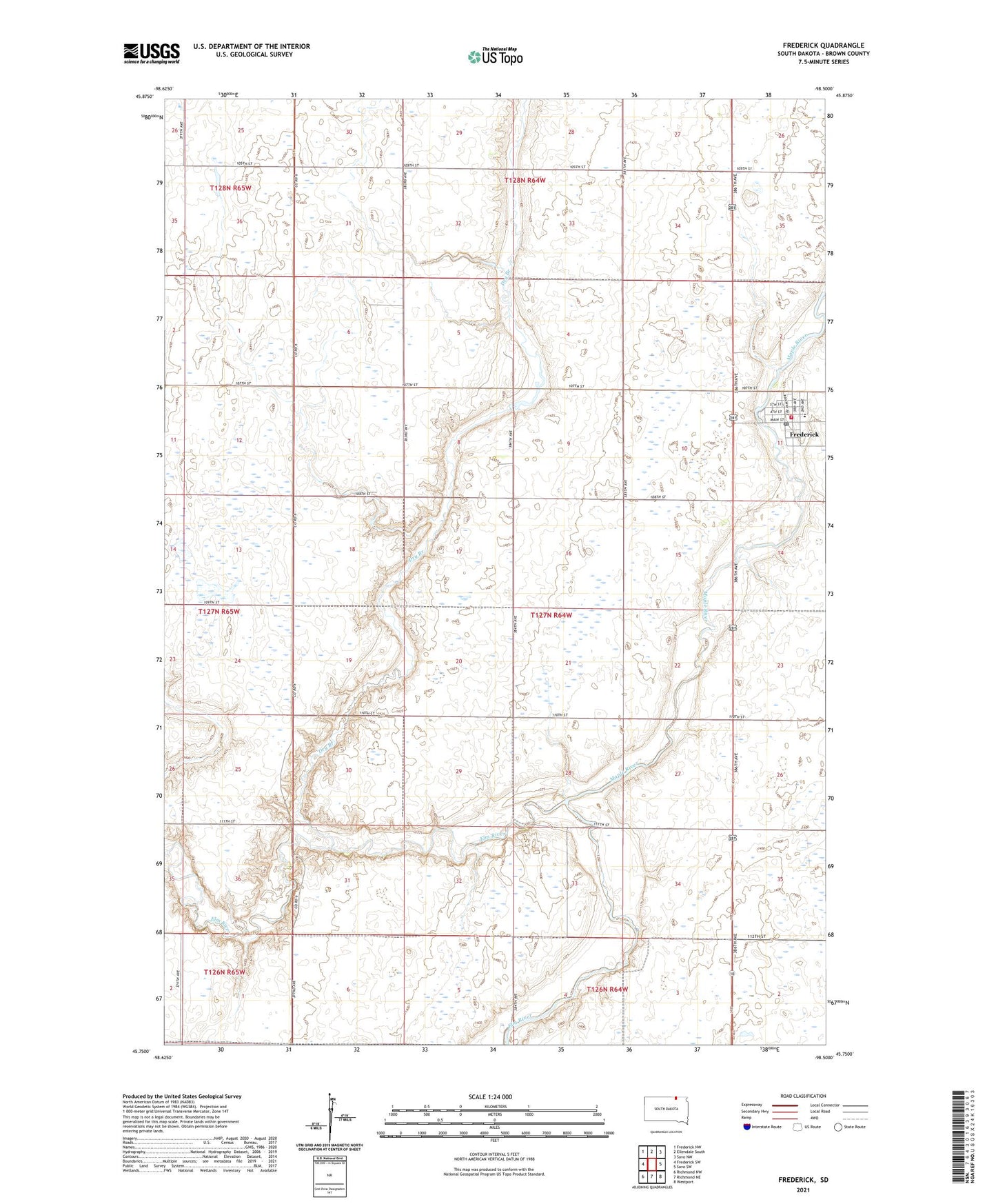
2021 topographic map quadrangle Frederick in the state of South Dakota. Scale: 1:24000. Based on the newly updated USGS 7.5' US Topo map series, this map is in the following counties: Brown. The map contains contour data, water features, and other items you are used to seeing on USGS maps, but also has updated roads and other features. This is the next generation of topographic maps. Printed on high-quality waterproof paper with UV fade-resistant inks.
Quads adjacent to this one:
West: Frederick SW
North: Ellendale South
East: Savo SW
Southeast: Westport
South: Richmond NE
Southwest: Richmond NW
This map covers the same area as the classic USGS quad with code o45098g5.
Contains the following named places: Dry Branch, Emma Burnham Public Library, Frederick, Frederick Area Ambulance Service, Frederick City Hall, Frederick Dam, Frederick Elementary School, Frederick Fire Department, Frederick HIgh School, Frederick Junior High School, Frederick Lake, Frederick Post Office, Frederick Township Hall, Hudson Bay Trading Post, Maple River, School Number 1, School Number 10, School Number 2, Town of Frederick, Township of Frederick, Township of Oneota, ZIP Code: 57441