MyTopo
Richmond NW South Dakota US Topo Map
Couldn't load pickup availability
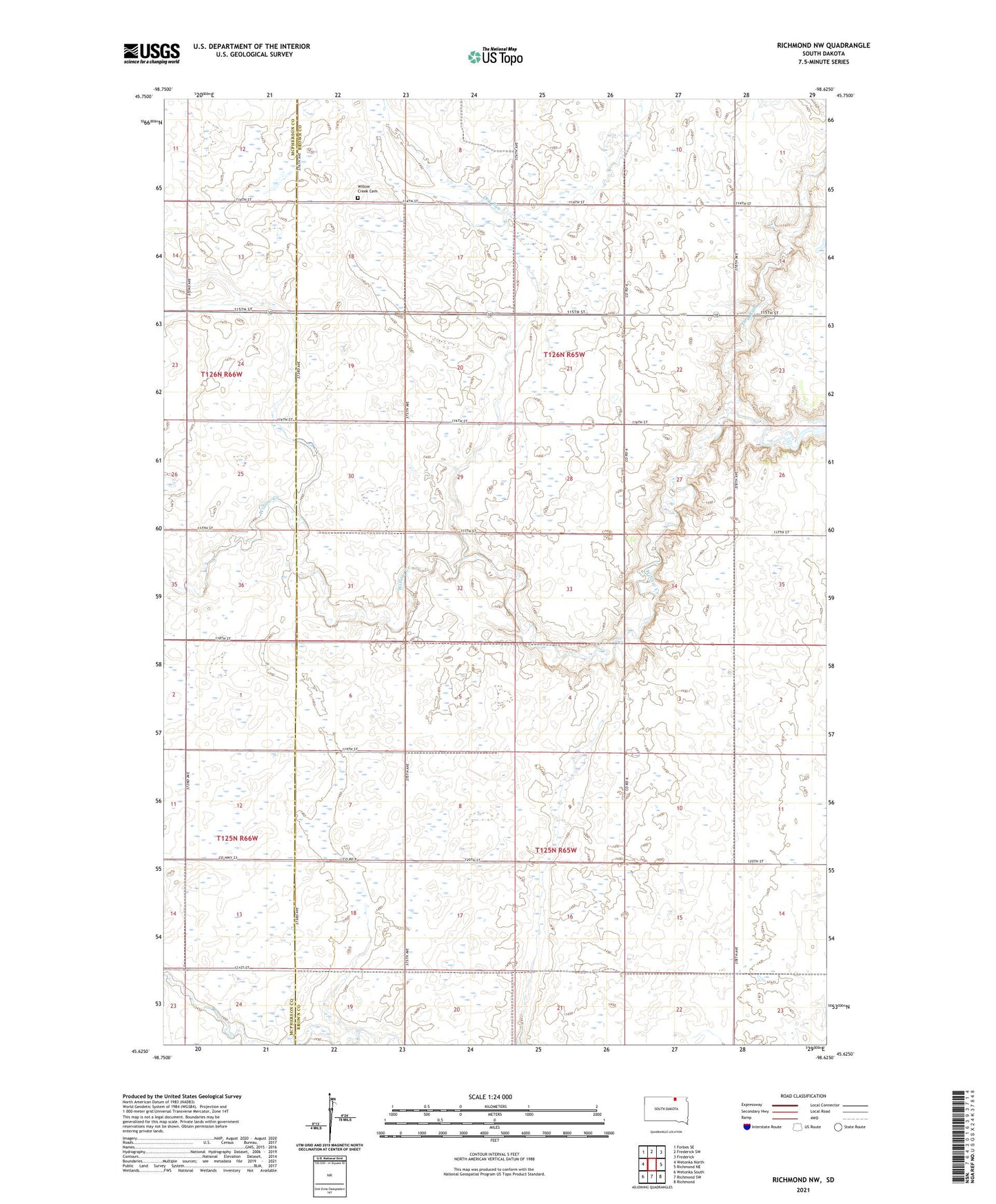
2021 topographic map quadrangle Richmond NW in the state of South Dakota. Scale: 1:24000. Based on the newly updated USGS 7.5' US Topo map series, this map is in the following counties: Brown, McPherson. The map contains contour data, water features, and other items you are used to seeing on USGS maps, but also has updated roads and other features. This is the next generation of topographic maps. Printed on high-quality waterproof paper with UV fade-resistant inks.
Quads adjacent to this one:
West: Wetonka North
Northwest: Forbes SE
North: Frederick SW
Northeast: Frederick
East: Richmond NE
Southeast: Richmond
South: Richmond SW
Southwest: Wetonka South
This map covers the same area as the classic USGS quad with code o45098f6.
Contains the following named places: Altison Ranch, Bern Post Office, Carlisle Township Hall, Delhi Post Office, Dry Run, Franklin Township Hall, Township of Carlisle, Township of Franklyn, Willow Creek Cemetery, ZIP Code: 57481