MyTopo
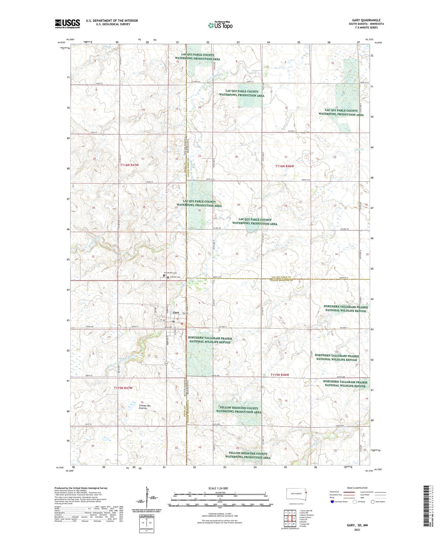
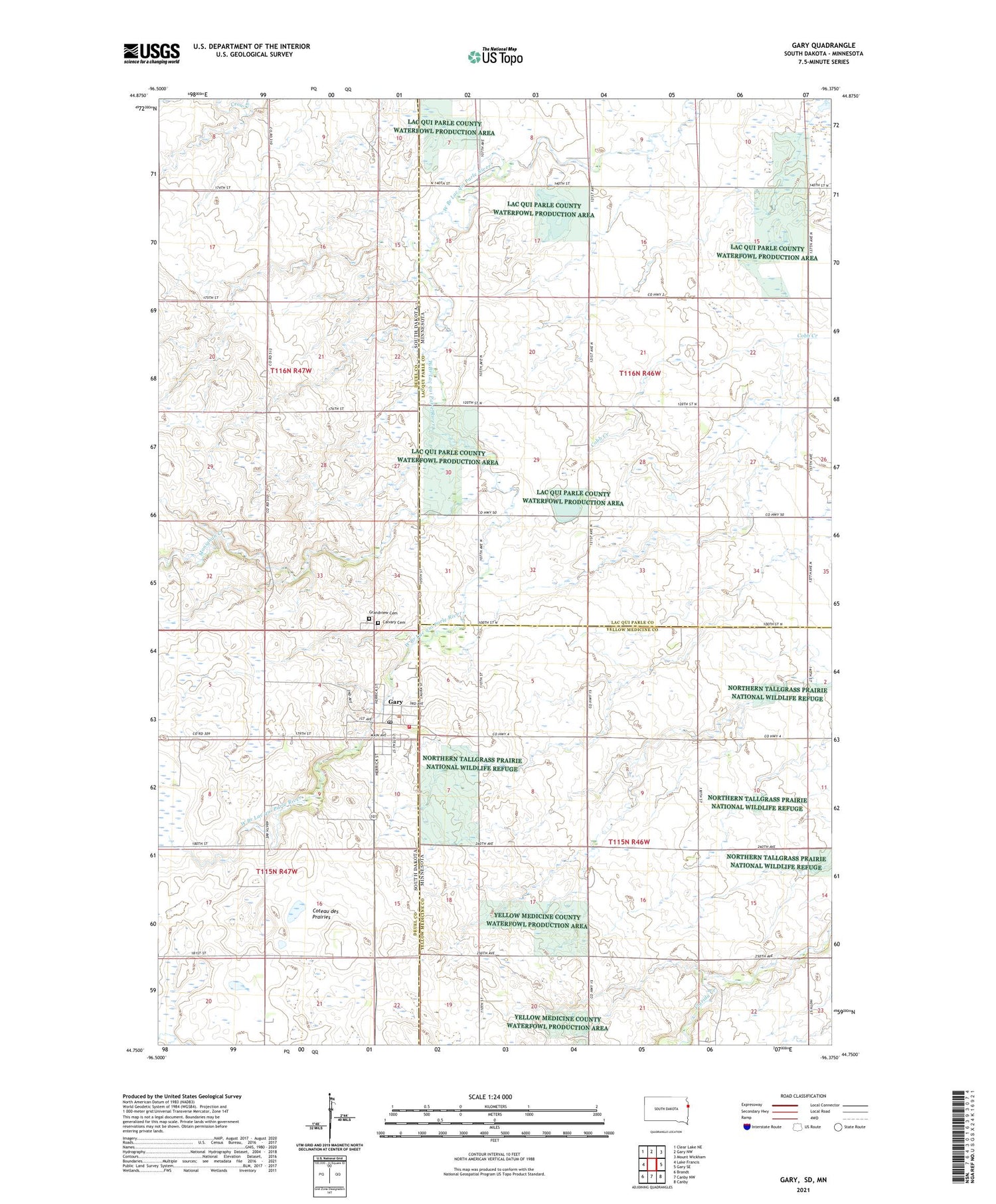
Gary South Dakota US Topo Map
Couldn't load pickup availability
2021 topographic map quadrangle Gary in the states of Minnesota, South Dakota. Scale: 1:24000. Based on the newly updated USGS 7.5' US Topo map series, this map is in the following counties: Deuel, Lac qui Parle, Yellow Medicine. The map contains contour data, water features, and other items you are used to seeing on USGS maps, but also has updated roads and other features. This is the next generation of topographic maps. Printed on high-quality waterproof paper with UV fade-resistant inks.
Quads adjacent to this one:
West: Lake Francis
Northwest: Clear Lake NE
North: Gary NW
Northeast: Mount Wickham
East: Gary SE
Southeast: Canby
South: Canby NW
Southwest: Brandt
Contains the following named places: Calvary Cemetery, City of Gary, De vorak State Wildlife Management Area, Gary, Gary City Hall, Gary Fire Department, Gary Post Office, Gary Public Library, Grandview Cemetery, Lytle School, Monighan Creek, Plantation State Wildlife Management Area, Saint Peters Church, Township of Florida, Township of Manfred, William Webber Dam