MyTopo
Gayville NE South Dakota US Topo Map
Couldn't load pickup availability
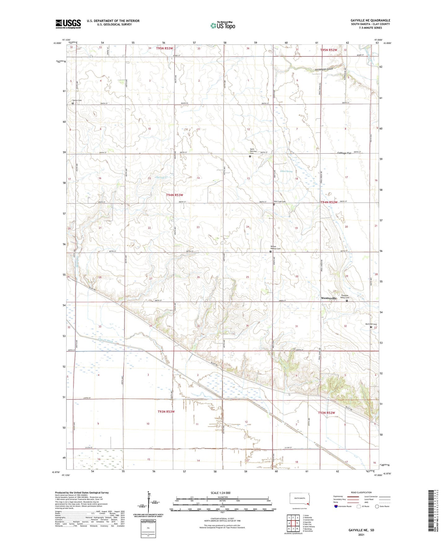
2021 topographic map quadrangle Gayville NE in the state of South Dakota. Scale: 1:24000. Based on the newly updated USGS 7.5' US Topo map series, this map is in the following counties: Clay. The map contains contour data, water features, and other items you are used to seeing on USGS maps, but also has updated roads and other features. This is the next generation of topographic maps. Printed on high-quality waterproof paper with UV fade-resistant inks.
Quads adjacent to this one:
West: Gayville
Northwest: Irene
North: Wakonda
Northeast: Centerville
East: Hub City
Southeast: Vermillion
South: Meckling
Southwest: Saint Helena
Contains the following named places: Bethel Baptist Cemetery, Bethel Scandinavian Baptist Church, Bethel School, Bluff Center, Bluff Center Cemetery, Bolton Post Office, Clay Creek Ditch, Devine School Number 24, Dillon Spring, Ellingson Spring, Methodist Episcopal Church, Mortvedt Cemetery, New Lodi Cemetery, Norwegian Gulch, Pleasant Valley Cemetery, Saint Patricks Catholic Church, Saint Patricks Cemetery, Spring Creek, Spring Hill School, Township of Bethel, Union Cemetery, Westerville School, Westreville