MyTopo
Saint Helena Nebraska US Topo Map
Couldn't load pickup availability
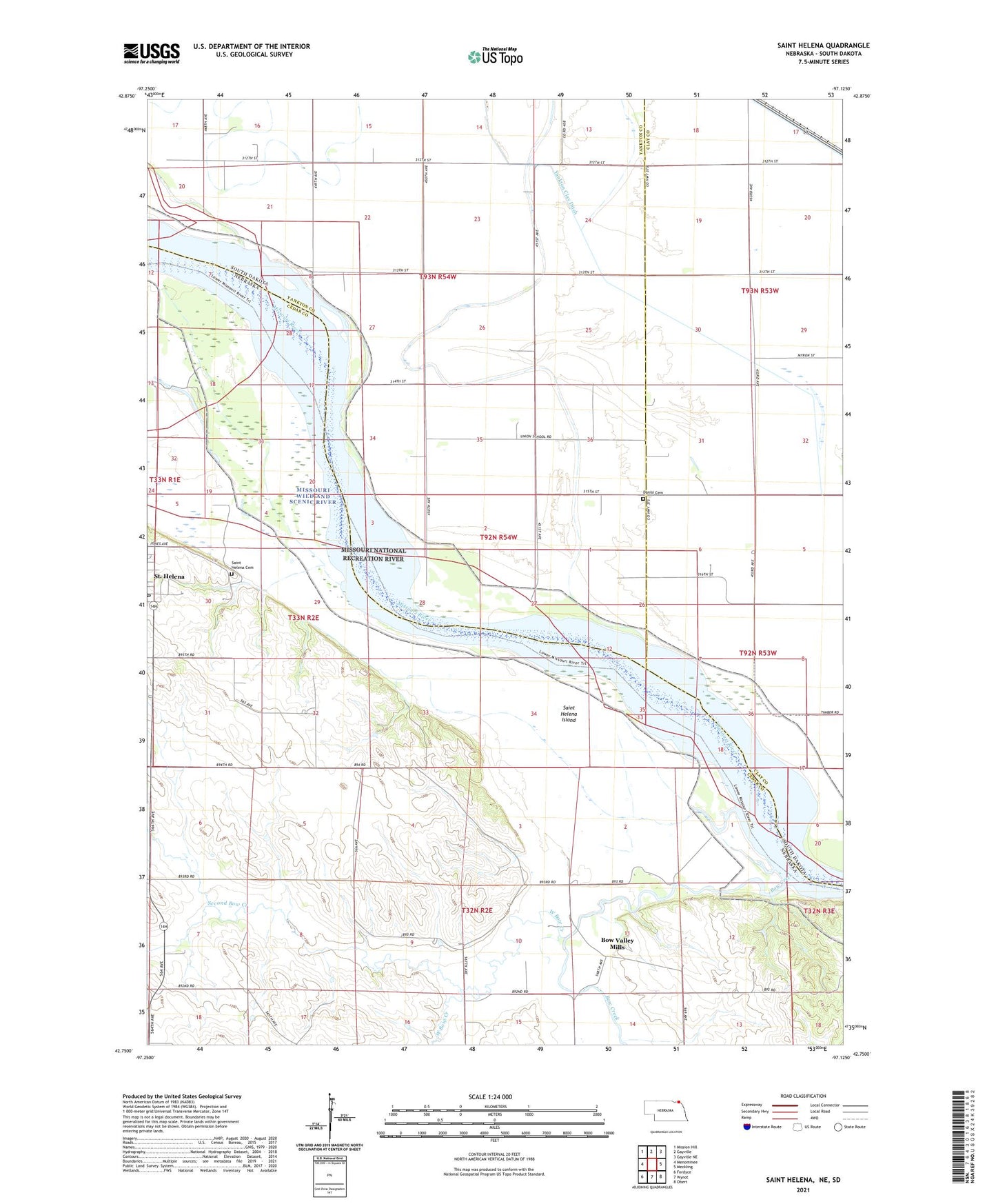
2021 topographic map quadrangle Saint Helena in the states of Nebraska, South Dakota. Scale: 1:24000. Based on the newly updated USGS 7.5' US Topo map series, this map is in the following counties: Cedar, Yankton, Clay. The map contains contour data, water features, and other items you are used to seeing on USGS maps, but also has updated roads and other features. This is the next generation of topographic maps. Printed on high-quality waterproof paper with UV fade-resistant inks.
Quads adjacent to this one:
West: Menominee
Northwest: Mission Hill
North: Gayville
Northeast: Gayville NE
East: Meckling
Southeast: Obert
South: Wynot
Southwest: Fordyce
Contains the following named places: Bow Creek, Bow Valley Mills, Danisi Cemetery, Immaculate Conception Catholic Church, Lake Fargo, Lincoln School, New Homewood Park Campgrounds, Saint Helena, Saint Helena Cemetery, Saint Helena Island, Saint Helena Post Office, Saint Marys School, Second Bow Creek, Sunny Side School, The Chute, Township of Gayville, Trinity Church, Village of Saint Helena, West Bow Creek