MyTopo
Meckling South Dakota US Topo Map
Couldn't load pickup availability
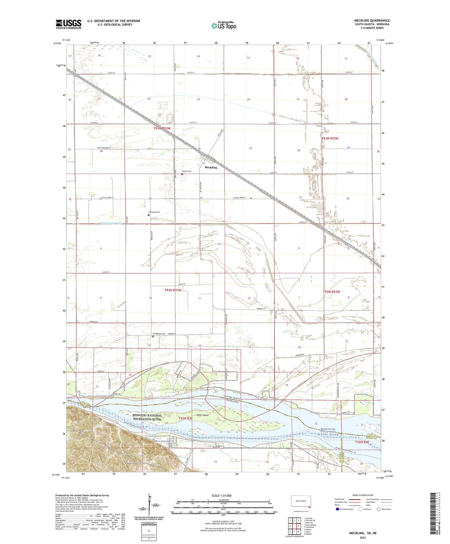
2021 topographic map quadrangle Meckling in the states of South Dakota, Nebraska. Scale: 1:24000. Based on the newly updated USGS 7.5' US Topo map series, this map is in the following counties: Clay, Cedar, Dixon. The map contains contour data, water features, and other items you are used to seeing on USGS maps, but also has updated roads and other features. This is the next generation of topographic maps. Printed on high-quality waterproof paper with UV fade-resistant inks.
Quads adjacent to this one:
West: Saint Helena
Northwest: Gayville
North: Gayville NE
Northeast: Hub City
East: Vermillion
Southeast: Maskell
South: Obert
Southwest: Wynot
This map covers the same area as the classic USGS quad with code o42097g1.
Contains the following named places: Bergen Church, Elmwood School, Evergreen Cemetery, Goat Island, Harmony School, KVRA-AM (Vermillion), KVRF-FM (Vermillion), Meckling, Meckling Cemetery, Meckling Census Designated Place, Missouri National Recreation River, Norway School, Taylor Cemetery, Township of Meckling, Township of Norway, Wiseman State Wildlife Management Area, Yankton Clay Ditch