MyTopo
Gayville South Dakota US Topo Map
Couldn't load pickup availability
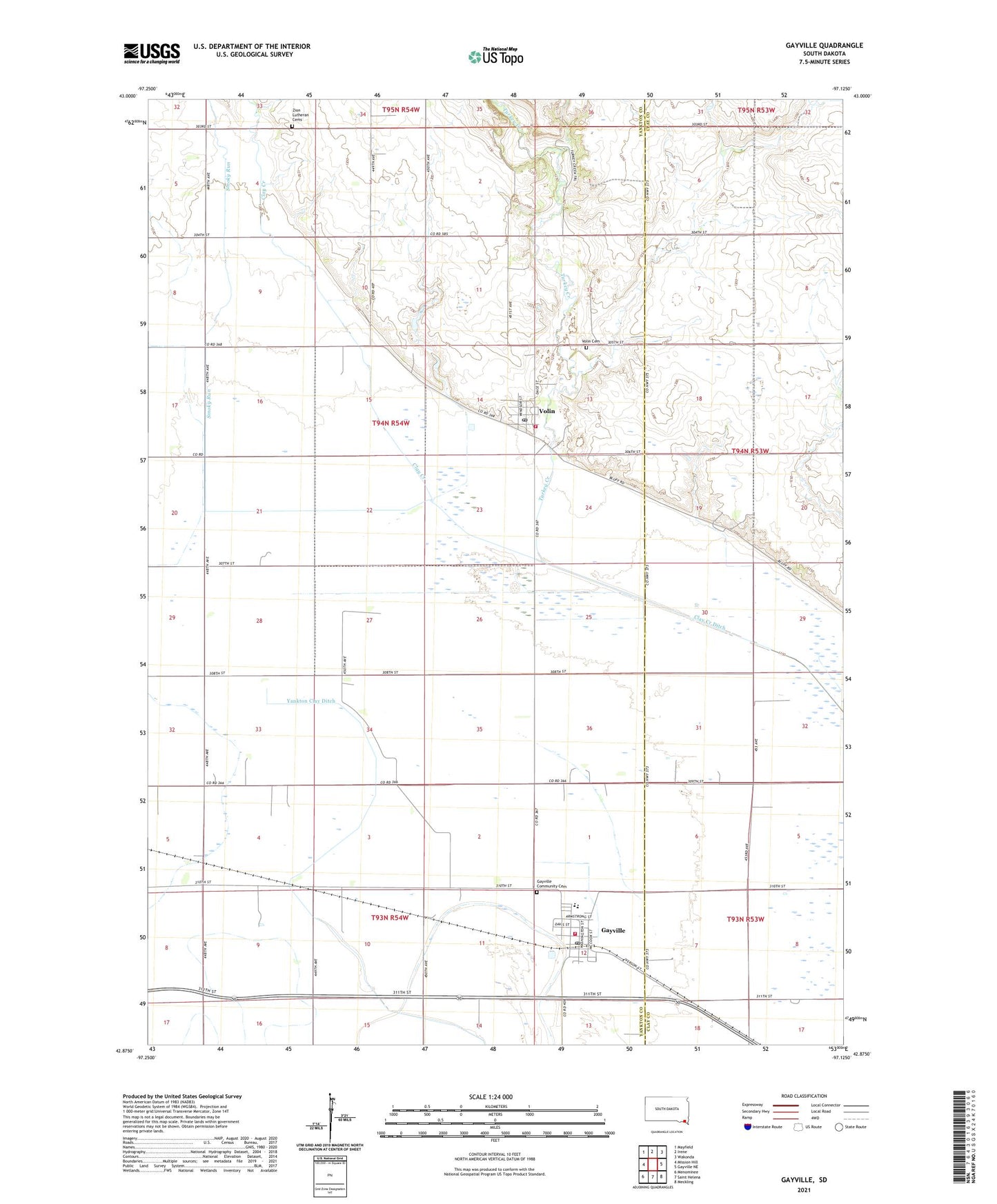
2021 topographic map quadrangle Gayville in the state of South Dakota. Scale: 1:24000. Based on the newly updated USGS 7.5' US Topo map series, this map is in the following counties: Yankton, Clay. The map contains contour data, water features, and other items you are used to seeing on USGS maps, but also has updated roads and other features. This is the next generation of topographic maps. Printed on high-quality waterproof paper with UV fade-resistant inks.
Quads adjacent to this one:
West: Mission Hill
Northwest: Mayfield
North: Irene
Northeast: Wakonda
East: Gayville NE
Southeast: Meckling
South: Saint Helena
Southwest: Menominee
Contains the following named places: Berkley School, Circle Grove School, Clay Creek, Gayville, Gayville Community Cemetery, Gayville Community Fire Department, Gayville Post Office, Gayville-Volin Elementary School, Gayville-Volin High School, Gayville-Volin Middle School, Inch School, Oakdale School, Pleasant Valley School, Saybrook, Saybrook School, Smoky Run, Town of Gayville, Town of Volin, Township of Volin, Turkey Creek, Volin, Volin Cemetery, Volin Fire Department, Volin Post Office, Zion Church, Zion Lutheran Cemetery, ZIP Codes: 57031, 57072