MyTopo
Heinne Creek South Dakota US Topo Map
Couldn't load pickup availability
Also explore the Heinne Creek Forest Service Topo of this same quad for updated USFS data
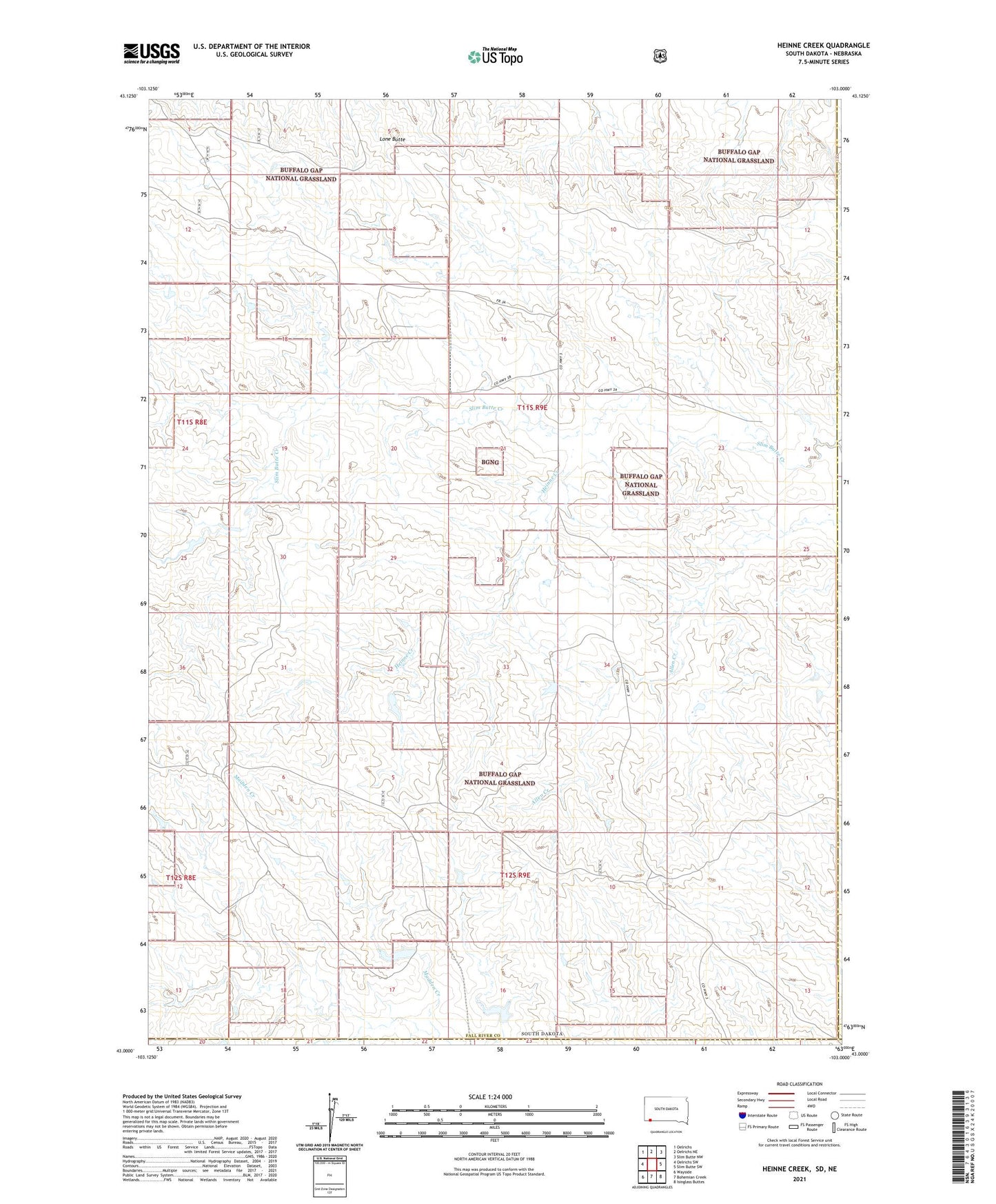
2021 topographic map quadrangle Heinne Creek in the state of South Dakota. Scale: 1:24000. Based on the newly updated USGS 7.5' US Topo map series, this map is in the following counties: Fall River, Oglala Lakota, Dawes. The map contains contour data, water features, and other items you are used to seeing on USGS maps, but also has updated roads and other features. This is the next generation of topographic maps. Printed on high-quality waterproof paper with UV fade-resistant inks.
Quads adjacent to this one:
West: Oelrichs SW
Northwest: Oelrichs
North: Oelrichs NE
Northeast: Slim Butte NW
East: Slim Butte SW
Southeast: Isinglass Buttes
South: Bohemian Creek
Southwest: Wayside
This map covers the same area as the classic USGS quad with code o43103a1.
Contains the following named places: Angostura Grazing Pond Number 1 Dam, Angostura Grazing Pond Number 2 Dam, Goodnick Dam, Heinne Creek, Heiser Pond Dam, Little Trickle Tube Dam, Lone Butte, Township of Loomer, Township of Pleasant Hill