
MyTopo
Howes South Dakota US Topo Map
Couldn't load pickup availability
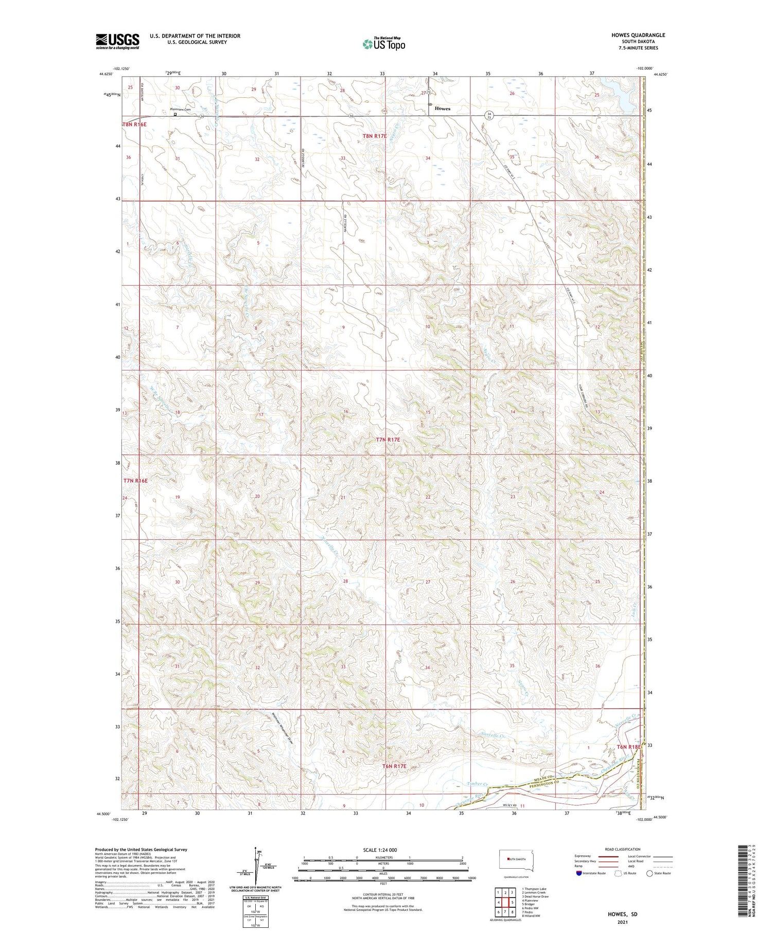
2021 topographic map quadrangle Howes in the state of South Dakota. Scale: 1:24000. Based on the newly updated USGS 7.5' US Topo map series, this map is in the following counties: Meade, Pennington, Ziebach, Haakon. The map contains contour data, water features, and other items you are used to seeing on USGS maps, but also has updated roads and other features. This is the next generation of topographic maps. Printed on high-quality waterproof paper with UV fade-resistant inks.
Quads adjacent to this one:
West: Plainview
Northwest: Thompson Lake
North: Lemmon Creek
Northeast: Dead Horse Draw
East: Bridger
Southeast: Hilland NW
South: Pedro
Southwest: Pedro NW
Contains the following named places: Ash Creek, East Branch Narcelle Creek, Howes, Howes Grazing Lake, Howes Post Office, Narcelle Creek, Negro Creek, Negro Creek School, Plainview Cemetery, Plainview Church, Road Dam Number 2, Timber Creek, West Branch Narcelle Creek, Whimmer Whammer Draw, ZIP Code: 57748


