MyTopo
Irish Butte South Dakota US Topo Map
Couldn't load pickup availability
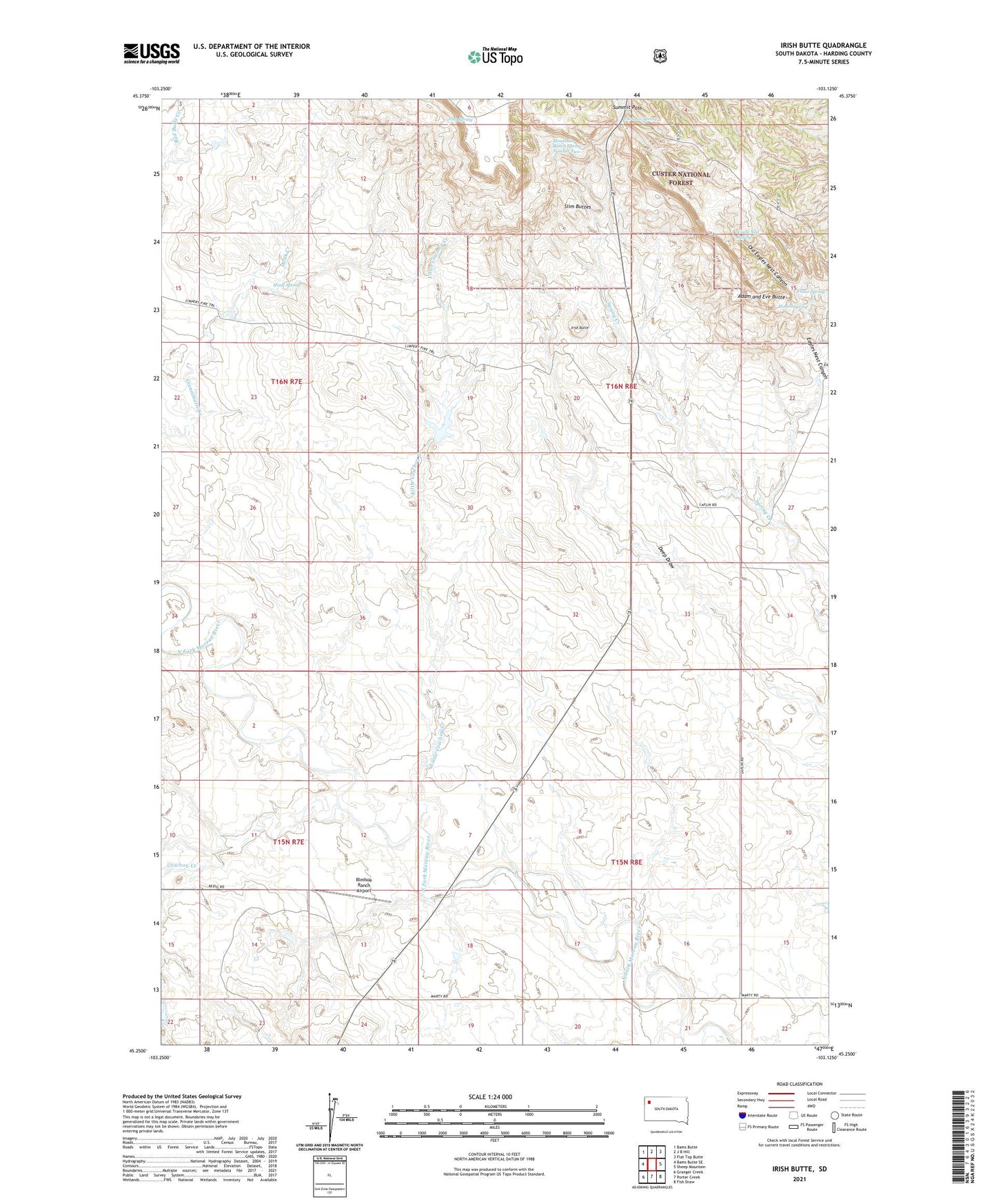
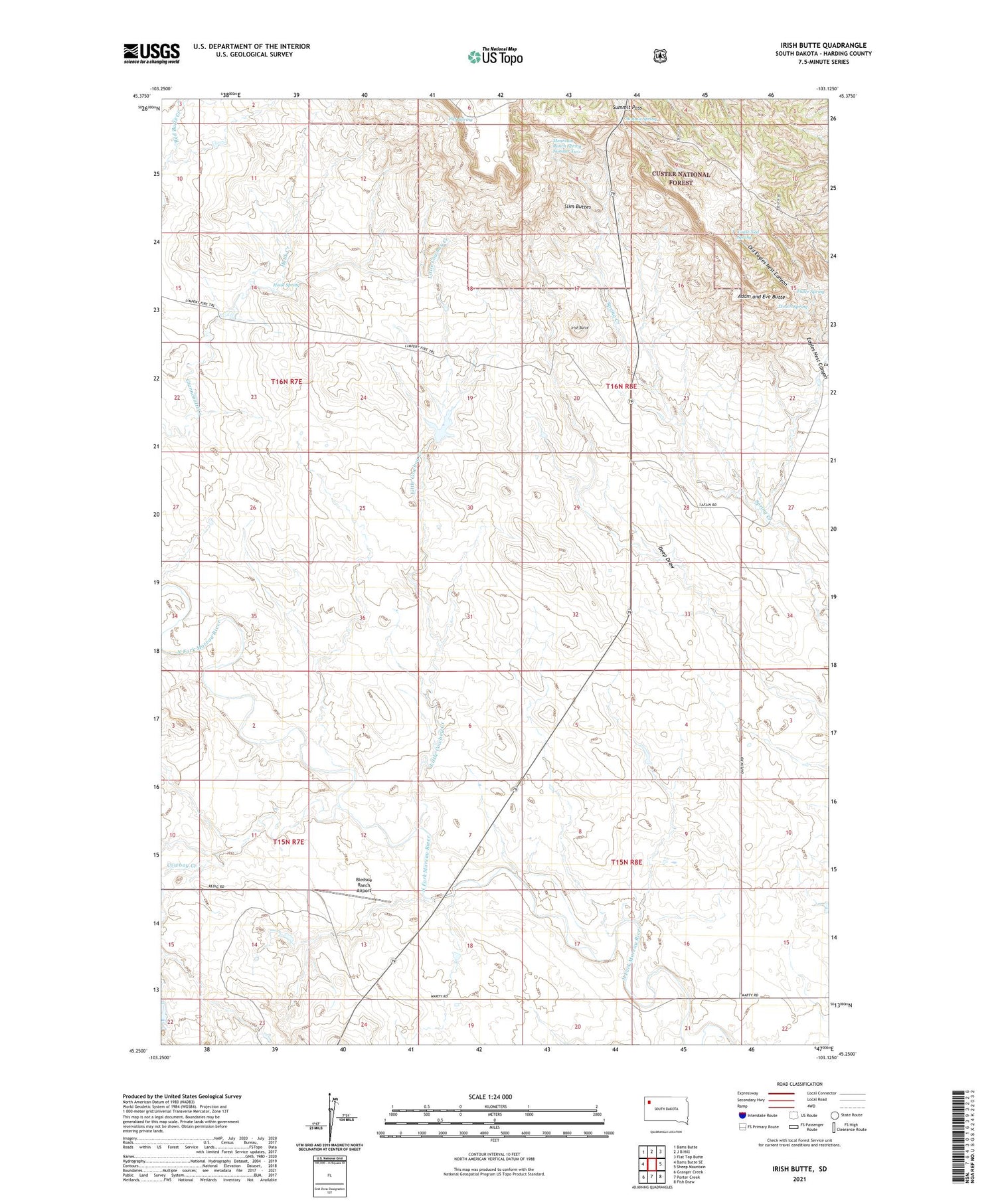
2021 topographic map quadrangle Irish Butte in the state of South Dakota. Scale: 1:24000. Based on the newly updated USGS 7.5' US Topo map series, this map is in the following counties: Harding. The map contains contour data, water features, and other items you are used to seeing on USGS maps, but also has updated roads and other features. This is the next generation of topographic maps. Printed on high-quality waterproof paper with UV fade-resistant inks.
Quads adjacent to this one:
West: Bams Butte SE
Northwest: Bams Butte
North: J B Hill
Northeast: Flat Top Butte
East: Sheep Mountain
Southeast: Fish Draw
South: Porter Creek
Southwest: Granger Creek
Contains the following named places: Adam and Eve Butte, Bledsoe Ranch Airport, Cowboy Creek, Deep Draw, Eagles Nest Canyon, Fish Spring, Gover, Govert School, Hoach Spring, Horton Ranch, Houk Creek, Houk Spring, Irish Butte, Laflin Ranch, Little Cowboy Creek, Mountain Ranch Spring Number Two, Old Eagles Nest Canyon, South Buttes Dam, Summit Pass, Summit Spring, Uncle Ned Spring