MyTopo
Sheep Mountain South Dakota US Topo Map
Couldn't load pickup availability
Also explore the Sheep Mountain Forest Service Topo of this same quad for updated USFS data
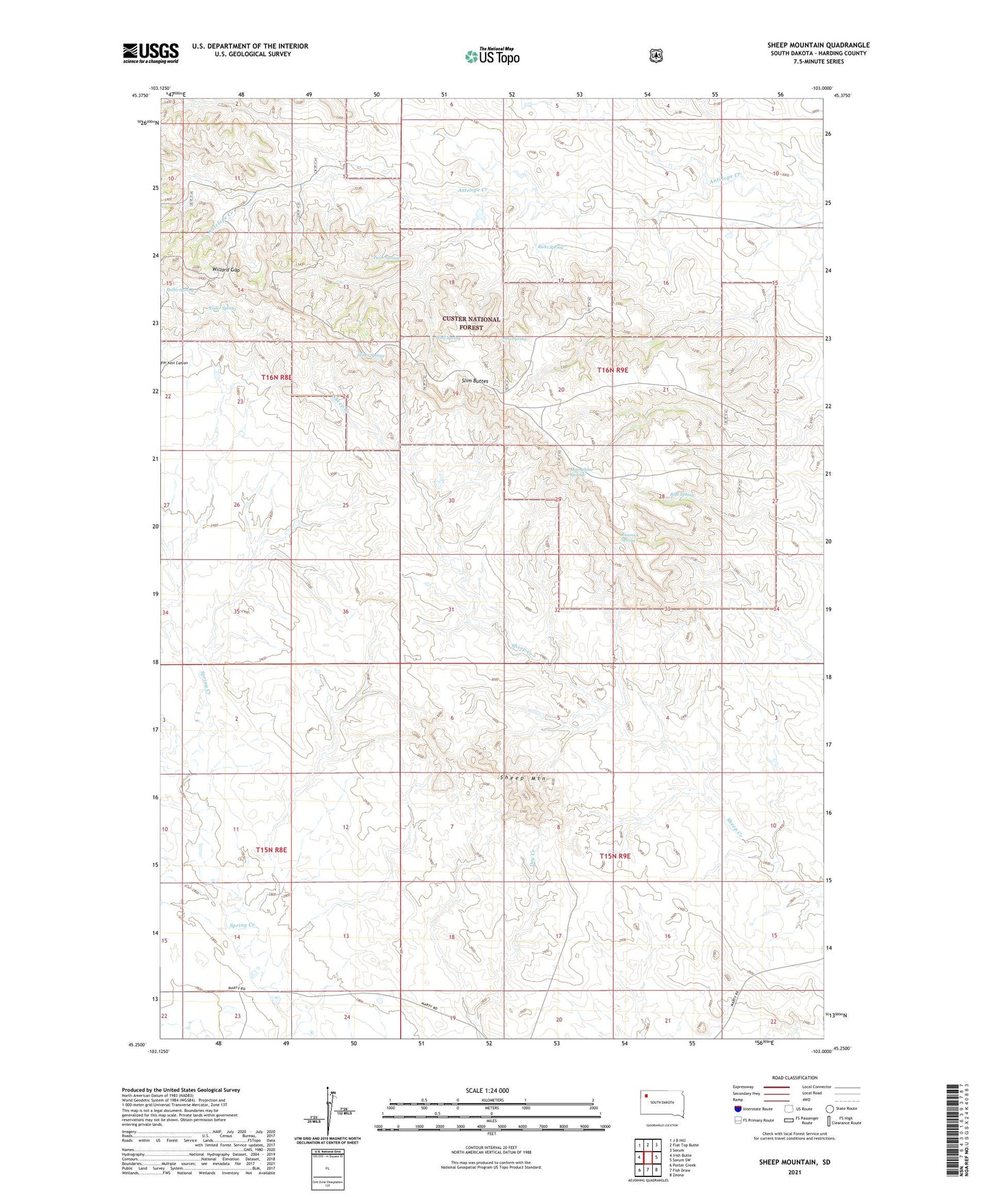
2021 topographic map quadrangle Sheep Mountain in the state of South Dakota. Scale: 1:24000. Based on the newly updated USGS 7.5' US Topo map series, this map is in the following counties: Harding. The map contains contour data, water features, and other items you are used to seeing on USGS maps, but also has updated roads and other features. This is the next generation of topographic maps. Printed on high-quality waterproof paper with UV fade-resistant inks.
Quads adjacent to this one:
West: Irish Butte
Northwest: J B Hill
North: Flat Top Butte
Northeast: Sorum
East: Sorum SW
Southeast: Zeona
South: Fish Draw
Southwest: Porter Creek
This map covers the same area as the classic USGS quad with code o45103c1.
Contains the following named places: Ana Spring, Batt Spring, Eisler Spring, Fuller Spring, Hines Spring, Moonshine Spring, North Marty Well, Ricki Spring, Rimrock Spring, Rimrock Trail, Rock Spring Trail, Sheep Mountain, South Mary Well, Twin Springs, Willard Gap, Wolf Spring