MyTopo
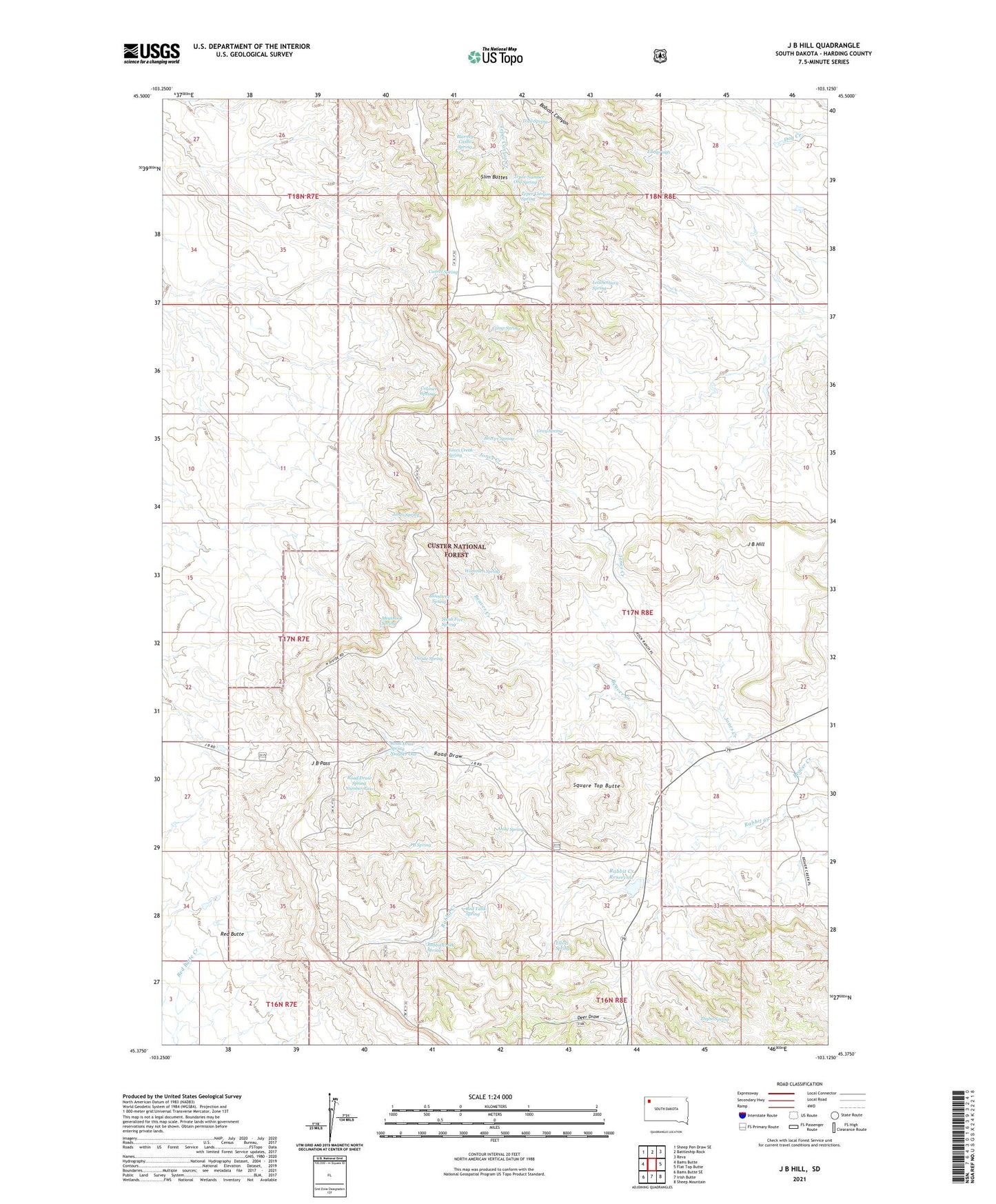
J B Hill South Dakota US Topo Map
Couldn't load pickup availability
Also explore the J B Hill Forest Service Topo of this same quad for updated USFS data
2021 topographic map quadrangle J B Hill in the state of South Dakota. Scale: 1:24000. Based on the newly updated USGS 7.5' US Topo map series, this map is in the following counties: Harding. The map contains contour data, water features, and other items you are used to seeing on USGS maps, but also has updated roads and other features. This is the next generation of topographic maps. Printed on high-quality waterproof paper with UV fade-resistant inks.
Quads adjacent to this one:
West: Bams Butte
Northwest: Sheep Pen Draw SE
North: Battleship Rock
Northeast: Reva
East: Flat Top Butte
Southeast: Sheep Mountain
South: Irish Butte
Southwest: Bams Butte SE
This map covers the same area as the classic USGS quad with code o45103d2.
Contains the following named places: Andy Spring, Beaver Spring, Blarney Castle Spring, Blomberg Spring, Camp Spring, Carrot Spring, Colonel Spring, Deer Draw, Divide Spring, Ell Springs, Elliott Spring, G Wammen Ranch, Gray Spring, H Hotchkiss Ranch, J B Hill, J B Pass, J B Spring, Jones Creek, Jones Creek Spring, Jones Spring, Leatherburg Spring, M Hamilton Ranch, Meathook Spring, Phillips Ranch, Rabbit Creek Dam, Rabbit Creek Reservoir, Rabbit Creek Spring, Red Butte, Red Tank Spring, Road Draw, Road Draw Spring Number One, Road Draw Spring Number Two, Rock Ranch, Rock Ranch School, Slash Five Spring, Slim Buttes, Square Top Butte, Tepee Canyon Spring, Tepee Number One Spring, Thybo Ranch, Thybo Spring, Township of Slim Buttes, Trail Spring, Wammen Spring, ZIP Code: 57651