MyTopo
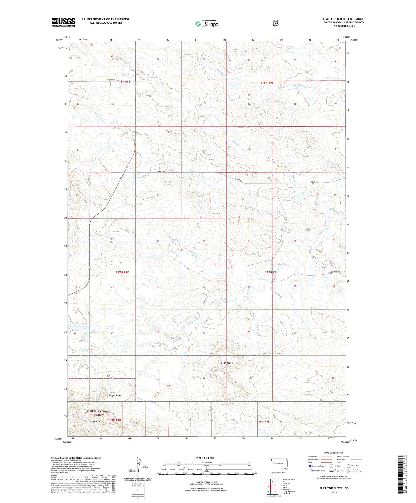
Flat Top Butte South Dakota US Topo Map
Couldn't load pickup availability
Also explore the Flat Top Butte Forest Service Topo of this same quad for updated USFS data
2021 topographic map quadrangle Flat Top Butte in the state of South Dakota. Scale: 1:24000. Based on the newly updated USGS 7.5' US Topo map series, this map is in the following counties: Harding. The map contains contour data, water features, and other items you are used to seeing on USGS maps, but also has updated roads and other features. This is the next generation of topographic maps. Printed on high-quality waterproof paper with UV fade-resistant inks.
Quads adjacent to this one:
West: J B Hill
Northwest: Battleship Rock
North: Reva
Northeast: White Hill
East: Sorum
Southeast: Sorum SW
South: Sheep Mountain
Southwest: Irish Butte
This map covers the same area as the classic USGS quad with code o45103d1.
Contains the following named places: Beaver Creek, Dog Creek, Finger Butte, Flat Top Butte, Gill, H Millett Ranch, Harold Millett Pond Number 1 Dam, Harold Millett Pond Number 2 Dam, Point Comfort, R Elling Ranch, Thybo Pond Dam