MyTopo
Iron Post Buttes South Dakota US Topo Map
Couldn't load pickup availability
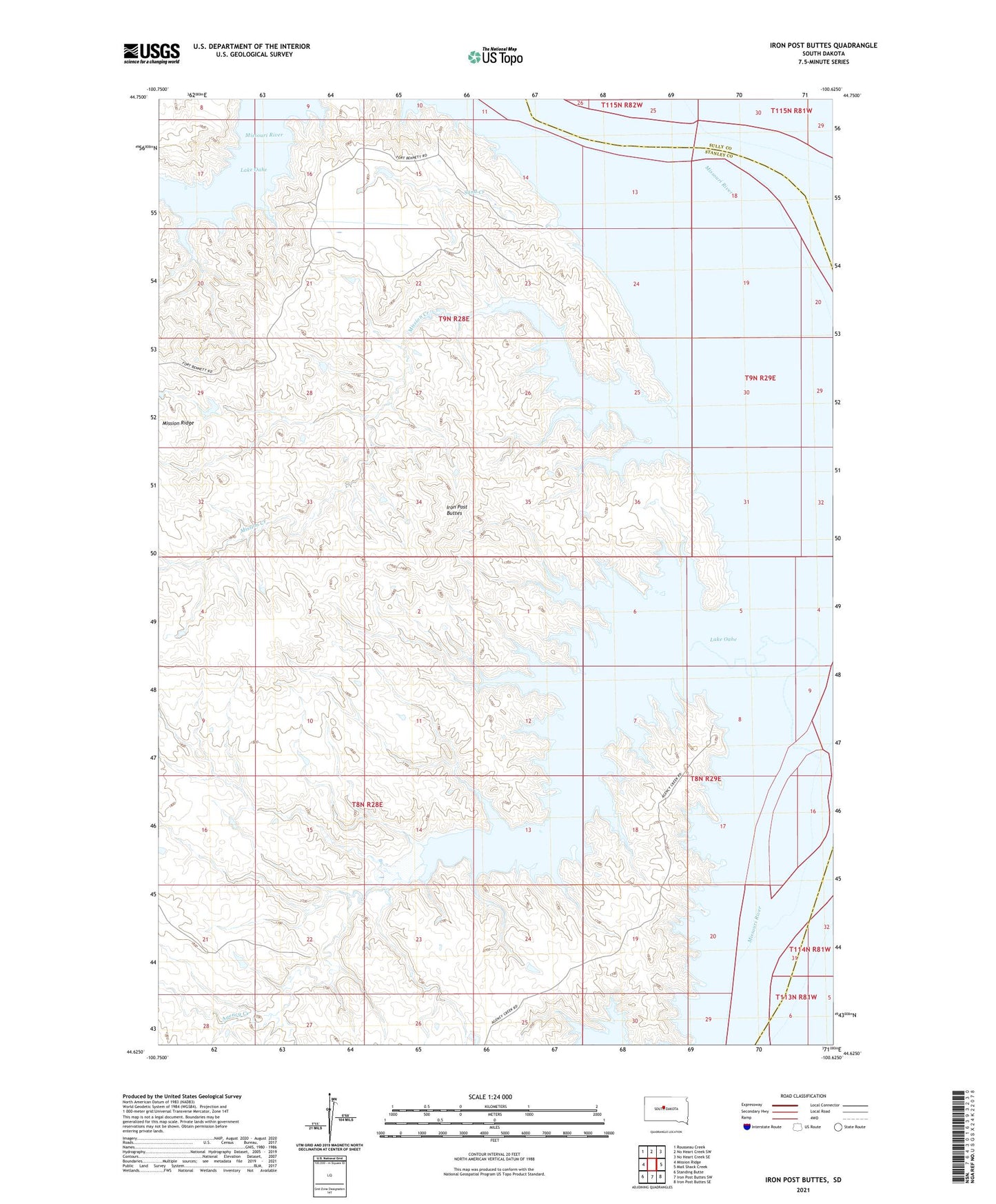
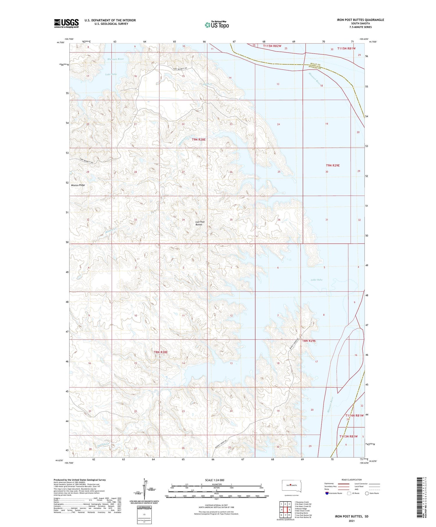
2021 topographic map quadrangle Iron Post Buttes in the state of South Dakota. Scale: 1:24000. Based on the newly updated USGS 7.5' US Topo map series, this map is in the following counties: Stanley, Sully. The map contains contour data, water features, and other items you are used to seeing on USGS maps, but also has updated roads and other features. This is the next generation of topographic maps. Printed on high-quality waterproof paper with UV fade-resistant inks.
Quads adjacent to this one:
West: Mission Ridge
Northwest: Rousseau Creek
North: No Heart Creek SW
Northeast: No Heart Creek SE
East: Mail Shack Creek
Southeast: Iron Post Buttes SE
South: Iron Post Buttes SW
Southwest: Standing Butte
Contains the following named places: Agency Creek, Cheyenne River Agencies I and II, Cheyenne River Post II, Cooper Ranch, Episcopal Boys School, Fort Bennett, Graham Ranch, Iron Post Buttes, J E Sheehan Estate Number 3 Dam, Little Bend, Mission Creek, Saint Johns Mission, Sand Creek, Walter Thompson Dam, Whiskey Island