MyTopo
Iron Post Buttes SE South Dakota US Topo Map
Couldn't load pickup availability
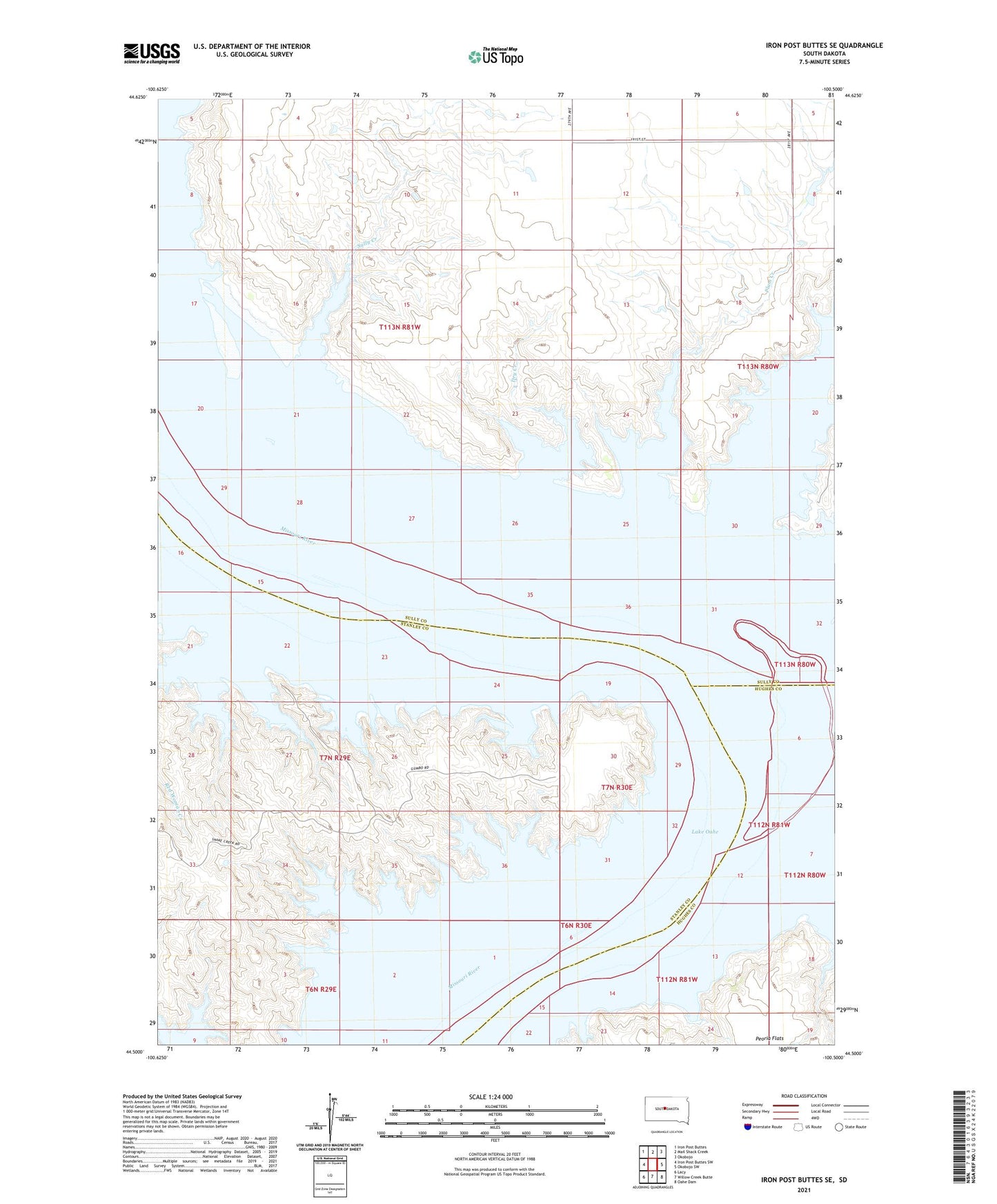
2021 topographic map quadrangle Iron Post Buttes SE in the state of South Dakota. Scale: 1:24000. Based on the newly updated USGS 7.5' US Topo map series, this map is in the following counties: Sully, Stanley, Hughes. The map contains contour data, water features, and other items you are used to seeing on USGS maps, but also has updated roads and other features. This is the next generation of topographic maps. Printed on high-quality waterproof paper with UV fade-resistant inks.
Quads adjacent to this one:
West: Iron Post Buttes SW
Northwest: Iron Post Buttes
North: Mail Shack Creek
Northeast: Okobojo
East: Okobojo SW
Southeast: Oahe Dam
South: Willow Creek Butte
Southwest: Lacy
This map covers the same area as the classic USGS quad with code o44100e5.
Contains the following named places: Dry Creek, Fielder Bottom, Fielder Post Office, Fort Sully, Koenig State Public Shooting Area, Lower Sully Landing, Oko Bojou Islands, Okobojo Creek, Okobojo Recreation Area, Plum Creek, River Bottom School Number 50, Sonnenschein Number 2 Dam, Sully Creek, Target Flat, Telegraph Flat, Township of Lewellyn Park, Zimmermans Ranch