MyTopo
Iroquois South Dakota US Topo Map
Couldn't load pickup availability
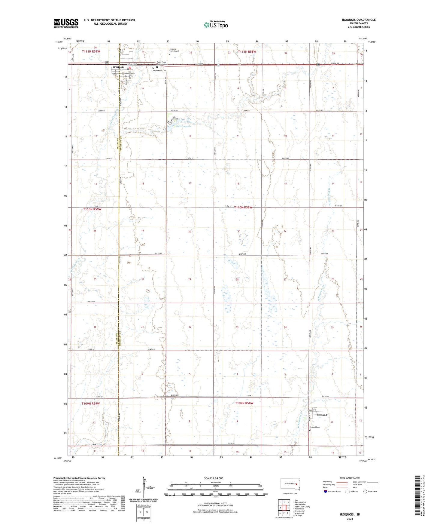
2021 topographic map quadrangle Iroquois in the state of South Dakota. Scale: 1:24000. Based on the newly updated USGS 7.5' US Topo map series, this map is in the following counties: Kingsbury, Beadle. The map contains contour data, water features, and other items you are used to seeing on USGS maps, but also has updated roads and other features. This is the next generation of topographic maps. Printed on high-quality waterproof paper with UV fade-resistant inks.
Quads adjacent to this one:
West: Pearl Creek Colony
Northwest: Yale
North: Bancroft West
Northeast: Bancroft East
East: Manchester
Southeast: Carthage
South: Artesian NE
Southwest: Artesian NW
Contains the following named places: City of Iroquois, Esmond, Esmond Cemetery, Esmond Creamery, Iroquois, Iroquois Cemetery Mound, Iroquois City Hall, Iroquois Elementary School, Iroquois Fire and Rescue District, Iroquois High School, Iroquois Middle School, Iroquois Post Office, Lake Iroquois, Maplewood Cemetery, Saint Paul's Catholic Cemetery, Sana Post Office, School Number 2, School Number 3, School Number 4, Township of Esmond, ZIP Code: 57353