MyTopo
Yale South Dakota US Topo Map
Couldn't load pickup availability
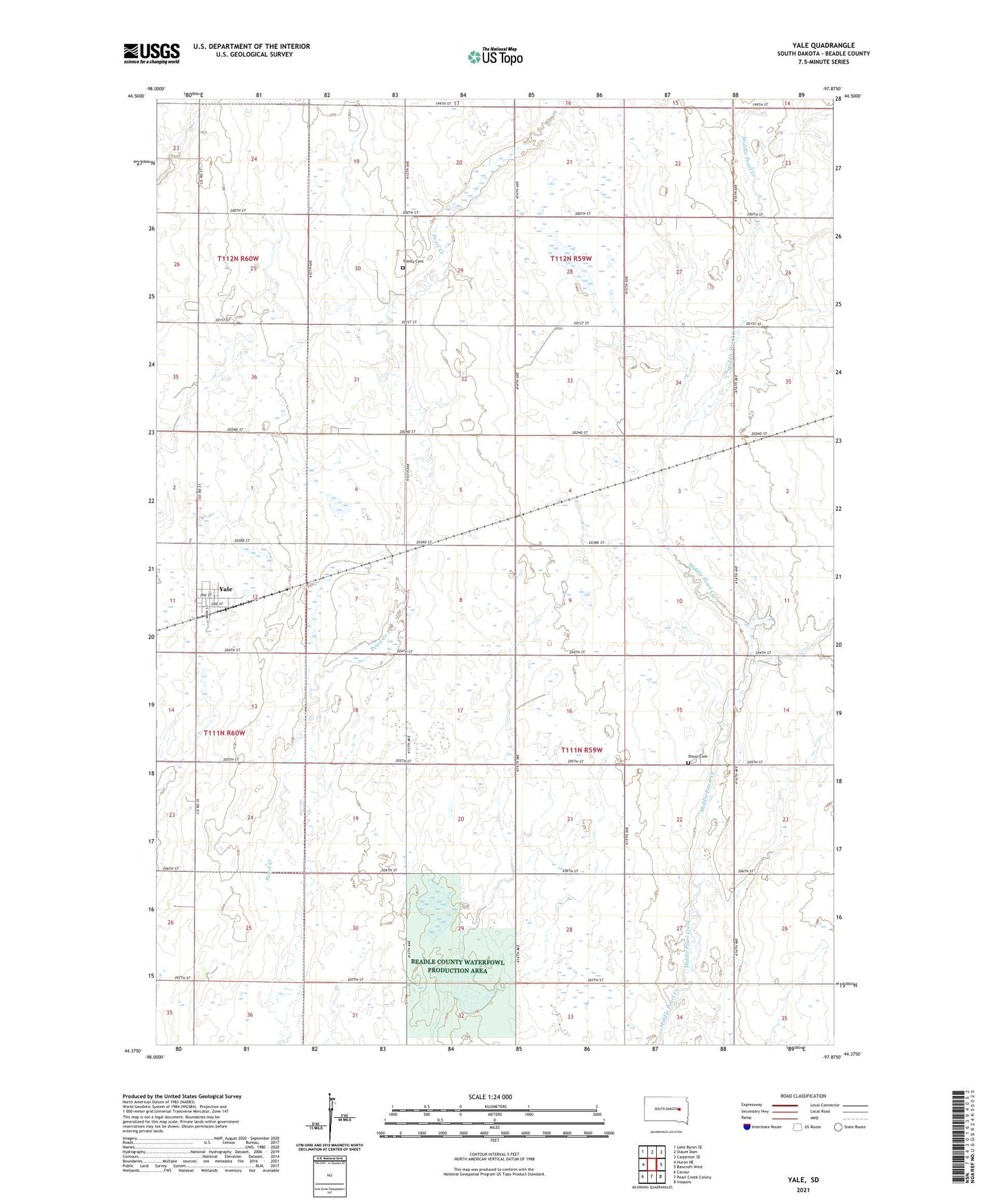
2021 topographic map quadrangle Yale in the state of South Dakota. Scale: 1:24000. Based on the newly updated USGS 7.5' US Topo map series, this map is in the following counties: Beadle. The map contains contour data, water features, and other items you are used to seeing on USGS maps, but also has updated roads and other features. This is the next generation of topographic maps. Printed on high-quality waterproof paper with UV fade-resistant inks.
Quads adjacent to this one:
West: Huron NE
Northwest: Lake Byron SE
North: Staum Dam
Northeast: Carpenter SE
East: Bancroft West
Southeast: Iroquois
South: Pearl Creek Colony
Southwest: Cavour
This map covers the same area as the classic USGS quad with code o44097d8.
Contains the following named places: Dixon Cemetery, Town of Yale, Township of Banner, Township of Foster, Trinity Cemetery, Yale, Yale Post Office